170.80.16.232 - IP Lookup: Free IP Address Lookup, Postal Code Lookup, IP Location Lookup, IP ASN, Public IP
Country:
 Nicaragua
Region:
City:
Location:
Time Zone:
Postal Code:
ISP:
ASN:
language:
User-Agent:
Proxy IP:
Blacklist:
IP information under different IP Channel
ip-api
Country
Region
City
ASN
Time Zone
ISP
Blacklist
Proxy
Latitude
Longitude
Postal
Route
db-ip
Country
Region
City
ASN
Time Zone
ISP
Blacklist
Proxy
Latitude
Longitude
Postal
Route
IPinfo
Country
Region
City
ASN
Time Zone
ISP
Blacklist
Proxy
Latitude
Longitude
Postal
Route
IP2Location
170.80.16.232Country
niRegion
masaya
City
la concepcion
Time Zone
ISP
Language
User-Agent
Latitude
Longitude
Postal
ipdata
Country
Region
City
ASN
Time Zone
ISP
Blacklist
Proxy
Latitude
Longitude
Postal
Route
Popular places and events near this IP address
Carazo Department
Department of Nicaragua
Distance: Approx. 9759 meters
Latitude and longitude: 11.85,-86.2
Carazo (Spanish pronunciation: [kaˈɾaso]) is a department in Nicaragua. It covers an area of 1,081 km2 (417 sq mi) and has a population of 198,395 (2021 estimate). The capital is Jinotepe.

Masaya Volcano
Active complex volcano in Nicaragua
Distance: Approx. 5921 meters
Latitude and longitude: 11.98277778,-86.16194444
Masaya (Spanish: Volcán Masaya) is a caldera located in Masaya, Nicaragua, 20 km (12 mi) south of the capital Managua. It is Nicaragua's first and largest national park, and one of 78 protected areas of Nicaragua. The complex volcano is composed of a nested set of calderas and craters, the largest of which is Las Sierras shield volcano and caldera.

Keiser University-Latin American Campus
Distance: Approx. 3723 meters
Latitude and longitude: 11.907,-86.2047
Keiser University - Latin American Campus (KU) is a branch campus of Keiser University in Florida, United States. It is located in the small town of San Marcos, Carazo, Nicaragua.
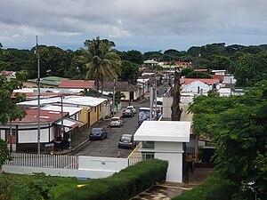
Jinotepe, Carazo
Municipality in Carazo Department, Nicaragua
Distance: Approx. 9759 meters
Latitude and longitude: 11.85,-86.2
Jinotepe (Spanish pronunciation: [xinoˈtepe]) is a city and municipality in the Carazo department of Nicaragua. The Indigenous inhabitants of Jinotepe are the Chorotegas and Nahuas. It borders with Managua, Masaya, Granada, and Rivas.
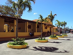
San Marcos, Carazo
Municipality in Carazo, Nicaragua
Distance: Approx. 2531 meters
Latitude and longitude: 11.91666667,-86.2
San Marcos is a town and a municipality in the Carazo Department of Nicaragua. It is located 45 km (28 mi) south of the capital Managua. The municipality has a population of 33,303 (2022 estimate).

Ticuantepe
Municipality in Managua, Nicaragua
Distance: Approx. 8927 meters
Latitude and longitude: 12.01666667,-86.2
Ticuantepe is a town and a municipality in the Managua department of Nicaragua with an estimated population of 39,012. The municipality is likely named after the Nahua chiefdom of Tekwantepek which was located in the Managua department. According to Spanish conquistador and historian Gonzalo Fernández de Oviedo y Valdés, Tekwantepek was a militarily strong chiefdom that was one of the last to fall to the conquistadors and their central-Mexican allies.

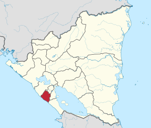
La Concepción, Nicaragua
Municipality in Masaya, Nicaragua
Distance: Approx. 820 meters
Latitude and longitude: 11.93333333,-86.18333333
La Concepción (Spanish pronunciation: [la konseβˈsjon]) is a town and a municipality in the Masaya department of Nicaragua.
Masatepe
Municipality in Masaya, Nicaragua
Distance: Approx. 4895 meters
Latitude and longitude: 11.91666667,-86.15
Masatepe (Spanish pronunciation: [masaˈtepe]) is one of the nine municipalities of the Department of Masaya in Nicaragua. It is located on the plateau of the villages 50 kilometers from Managua along the road to Masaya. It belongs to the tourist corridor of " Los Pueblos Blancos" on top of the coffee-producing Volcanic Plateau.
Nandasmo
Municipality in Masaya, Nicaragua
Distance: Approx. 7976 meters
Latitude and longitude: 11.93333333,-86.11666667
Nandasmo is a municipality in the Masaya department of Nicaragua.
Estadio Olímpico de San Marcos
Distance: Approx. 3910 meters
Latitude and longitude: 11.90638889,-86.20722222
Estadio Olimpico de San Marcos is a multi-use stadium in San Marcos, Nicaragua. It is currently used mostly for football matches and is the home stadium to FC San Marcos. The stadium has a seating capacity of 3,000 people.
Chocoyero-El Brujo Natural Reserve
Nature reserve in Nicaragua
Distance: Approx. 8930 meters
Latitude and longitude: 12.0167,-86.2
Chocoyero-El Brujo Natural Reserve (Spanish: Reserva Natural El Chocoyero-El Brujo) is located in the municipality of Ticuantepe in the Managua department of Nicaragua. Chocoyero-El Brujo is one of 78 protected areas in Nicaragua, and at just 455 acres (1.8 km2) this tropical forest is one of the smallest in size. Chocoyero-El Brujo was declared a natural reserve in 1993 is managed by the Ministry of the Environment and Natural Resources (MARENA).
Estadio Pedro Selva
Baseball stadium in Nicaragua
Distance: Approx. 9897 meters
Latitude and longitude: 11.84944444,-86.205
Estadio Pedro Selva is a professional baseball stadium, home of the "CAFETEROS DE CARAZO" the team that represents the city of Jinotepe and also the Carazo department in the German Pomares baseball league, and Professional Baseball League of Nicaragua. The stadium has also been used for soccer and was the home of the track and field teams "Xilotepel" and "Carazo". Its name is a tribute to one of the best baseball players Nicaragua has ever produced, Carazo's own Pedro Selva.
Weather in this IP's area
overcast clouds
20 Celsius
20 Celsius
20 Celsius
20 Celsius
1010 hPa
88 %
1010 hPa
962 hPa
10000 meters
5.15 m/s
13.06 m/s
66 degree
100 %