170.79.97.35 - IP Lookup: Free IP Address Lookup, Postal Code Lookup, IP Location Lookup, IP ASN, Public IP
Country:
Region:
City:
Location:
Time Zone:
Postal Code:
IP information under different IP Channel
ip-api
Country
Region
City
ASN
Time Zone
ISP
Blacklist
Proxy
Latitude
Longitude
Postal
Route
Luminati
Country
Region
rj
City
riobonito
ASN
Time Zone
America/Sao_Paulo
ISP
Conect Provedor de Acesso a Internet Ltda Me
Latitude
Longitude
Postal
IPinfo
Country
Region
City
ASN
Time Zone
ISP
Blacklist
Proxy
Latitude
Longitude
Postal
Route
IP2Location
170.79.97.35Country
Region
rio de janeiro
City
tangua
Time Zone
America/Sao_Paulo
ISP
Language
User-Agent
Latitude
Longitude
Postal
db-ip
Country
Region
City
ASN
Time Zone
ISP
Blacklist
Proxy
Latitude
Longitude
Postal
Route
ipdata
Country
Region
City
ASN
Time Zone
ISP
Blacklist
Proxy
Latitude
Longitude
Postal
Route
Popular places and events near this IP address

Rio Bonito, Rio de Janeiro
Municipality in Southeast, Brazil
Distance: Approx. 9414 meters
Latitude and longitude: -22.70777778,-42.62583333
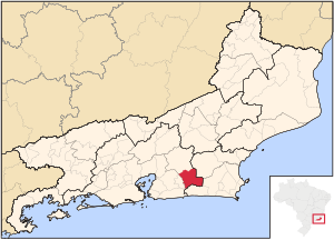
Rio Bonito (Portuguese pronunciation: [ˈʁi.u buˈnitu], [ˈʁi.u boˈnitu]) is a municipality located in the Brazilian state of Rio de Janeiro. Its population was 60,573 (2020) and its area is 462 km2. The municipality contains part of the Central Rio de Janeiro Atlantic Forest Mosaic of conservation units, created in 2006.

Tanguá
Municipality in Southeast, Brazil
Distance: Approx. 46 meters
Latitude and longitude: -22.73,-42.71388889
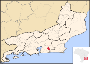
Tanguá (Portuguese pronunciation: [tɐ̃ˈgwa]) is a municipality located in the Brazilian state of Rio de Janeiro. It covers an area of 145,5 km². Its population is relatively stable, with 29,481 in 2005 and 30,732 in 2010, most of them urban.
Bonito River (Caceribu River tributary)
River in Rio de Janeiro state, Brazil
Distance: Approx. 1539 meters
Latitude and longitude: -22.71666667,-42.71666667
The Bonito River is a river of Rio de Janeiro state in southeastern Brazil. It is a tributary of the Caceribu River.
Do Gado River
River in Rio de Janeiro, Brazil
Distance: Approx. 8940 meters
Latitude and longitude: -22.71666667,-42.8
The Do Gado River is a river of Rio de Janeiro state in southeastern Brazil.
Dos Duques River
River in Brazil
Distance: Approx. 3691 meters
Latitude and longitude: -22.73333333,-42.75
The Dos Duques River is a river of Rio de Janeiro state in southeastern Brazil.

Serra do Barbosão Municipal Nature Park
Distance: Approx. 3226 meters
Latitude and longitude: -22.717409,-42.742335
The Serra do Barbosão Municipal Nature Park is a municipal nature park in the state of Rio de Janeiro, Brazil. It protects an area of Atlantic Forest.
Weather in this IP's area
overcast clouds
25 Celsius
25 Celsius
25 Celsius
25 Celsius
1013 hPa
92 %
1013 hPa
1000 hPa
10000 meters
0.54 m/s
0.68 m/s
250 degree
100 %