170.78.95.0 - IP Lookup: Free IP Address Lookup, Postal Code Lookup, IP Location Lookup, IP ASN, Public IP
Country:
Region:
City:
Location:
Time Zone:
Postal Code:
IP information under different IP Channel
ip-api
Country
Region
City
ASN
Time Zone
ISP
Blacklist
Proxy
Latitude
Longitude
Postal
Route
Luminati
Country
Region
pa
City
portodemoz
ASN
Time Zone
America/Manaus
ISP
ALMEIRIM TELECOM LTDA - ME
Latitude
Longitude
Postal
IPinfo
Country
Region
City
ASN
Time Zone
ISP
Blacklist
Proxy
Latitude
Longitude
Postal
Route
IP2Location
170.78.95.0Country
Region
para
City
almeirim
Time Zone
America/Santarem
ISP
Language
User-Agent
Latitude
Longitude
Postal
db-ip
Country
Region
City
ASN
Time Zone
ISP
Blacklist
Proxy
Latitude
Longitude
Postal
Route
ipdata
Country
Region
City
ASN
Time Zone
ISP
Blacklist
Proxy
Latitude
Longitude
Postal
Route
Popular places and events near this IP address

Almeirim, Pará
Place in Norte, Brazil
Distance: Approx. 64 meters
Latitude and longitude: -1.52277778,-52.58194444
Almeirim is a city on the Amazon and the northernmost municipality in the Brazilian state of Pará. It is also the fourth largest municipality in that state and the eighth largest in Brazil (by area). The municipality is crossed by the Equator.
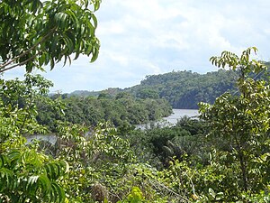
Paru River
River in Pará, Brazil
Distance: Approx. 5853 meters
Latitude and longitude: -1.53333333,-52.63333333
The Paru River is a northern tributary of the lower Amazon in Pará state in north-central Brazil. The river flows through the Uatuma-Trombetas moist forests ecoregion. Part of the river's basin is in the Maicuru Biological Reserve.
Almeirim Airport
Airport
Distance: Approx. 4930 meters
Latitude and longitude: -1.47916667,-52.57805556
Almeirim Airport (IATA: GGF, ICAO: SNYA) is the airport serving Almeirim, located in the Pará state of Brazil.
Weather in this IP's area
overcast clouds
23 Celsius
24 Celsius
23 Celsius
23 Celsius
1011 hPa
95 %
1011 hPa
1009 hPa
10000 meters
1.39 m/s
7.51 m/s
30 degree
100 %
