170.7.254.114 - IP Lookup: Free IP Address Lookup, Postal Code Lookup, IP Location Lookup, IP ASN, Public IP
Country:
Region:
City:
Location:
Time Zone:
Postal Code:
ISP:
ASN:
language:
User-Agent:
Proxy IP:
Blacklist:
IP information under different IP Channel
ip-api
Country
Region
City
ASN
Time Zone
ISP
Blacklist
Proxy
Latitude
Longitude
Postal
Route
db-ip
Country
Region
City
ASN
Time Zone
ISP
Blacklist
Proxy
Latitude
Longitude
Postal
Route
IPinfo
Country
Region
City
ASN
Time Zone
ISP
Blacklist
Proxy
Latitude
Longitude
Postal
Route
IP2Location
170.7.254.114Country
Region
texas
City
temple
Time Zone
America/Chicago
ISP
Language
User-Agent
Latitude
Longitude
Postal
ipdata
Country
Region
City
ASN
Time Zone
ISP
Blacklist
Proxy
Latitude
Longitude
Postal
Route
Popular places and events near this IP address
Morgan's Point Resort, Texas
City in Texas, United States
Distance: Approx. 1627 meters
Latitude and longitude: 31.15138889,-97.45861111
Morgan's Point Resort is a General Law city in Bell County, Texas, United States. Morgan's Point Resort was incorporated 1970. As of the 2020 census, the population was 4,636.

Temple, Texas
City in Texas, United States
Distance: Approx. 5841 meters
Latitude and longitude: 31.10555556,-97.42083333
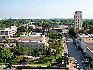
Temple is a city in Bell County, Texas, United States. As of 2020, the city has a population of 82,073 according to the U.S. census. Temple lies in the region referred to as Central Texas and is a principal city in the Killeen–Temple–Fort Hood metropolitan area, (Fort Hood was redesignated "Fort Cavazos" in 2023) which as of the 2020 Census had a population of 475,367.

Belton Lake
Flood control reservoir in northwest of Belton, Texas
Distance: Approx. 5906 meters
Latitude and longitude: 31.10861111,-97.4725
Belton Lake is a U.S. Army Corps of Engineers reservoir on the Leon River in the Brazos River basin, 5 miles (8 km) northwest of Belton, Texas, United States. The lake extends into both Bell County and Coryell County. Belton Dam and the lake are both managed by the Fort Worth District of the U.S. Army Corps of Engineers.
Holy Trinity Catholic High School (Texas)
Private, coeducational school in Temple, , Texas, United States
Distance: Approx. 4927 meters
Latitude and longitude: 31.119095,-97.411437
Holy Trinity Catholic High School or HTCHS is a private high school in Temple, Texas. Holy Trinity Catholic High School is a private, co-educational college-preparatory school. It is located in the Roman Catholic Diocese of Austin.
Belton High School (Texas)
High school in Belton, Bell County, Texas, United States
Distance: Approx. 8008 meters
Latitude and longitude: 31.0871,-97.4704
Belton High School (BHS) is a public high school that serves the city of Belton, Texas, United States, parts of Bell County and classified as a 5A school by the University Interscholastic League (UIL). It is a part of the Belton Independent School District located in south central Bell County. During 2022–2023, Slocum High School had an enrollment of 1,941 students and a student to teacher ratio of 12.35.

Draughon–Miller Central Texas Regional Airport
Airport
Distance: Approx. 3276 meters
Latitude and longitude: 31.15194444,-97.40777778
Draughon–Miller Central Texas Regional Airport (IATA: TPL, ICAO: KTPL, FAA LID: TPL) is six miles northwest of Temple, in Bell County, Texas. The National Plan of Integrated Airport Systems for 2011–2015 categorized it as a general aviation facility.
Red Murff Field
Baseball venue in Belton, Texas, US
Distance: Approx. 9169 meters
Latitude and longitude: 31.07632,-97.47119
Red Murff Field is a baseball venue located in Belton, Texas, and home to the Mary Hardin-Baylor Crusaders baseball program of the American Southwest Conference. The field is named after Red Murff, who initiated the UMHB baseball program. The ballpark holds a capacity of 700.
Temple High School (Texas)
High school in Temple, Bell County, Texas, United States
Distance: Approx. 9975 meters
Latitude and longitude: 31.10698,-97.35347
Temple High School is a public high school located in Temple, Texas. As of the 2024–2026 biennial realignment, it is classified as a 6A school by the University Interscholastic League. It is part of the Temple Independent School District located in central Bell County.
Moffat, Texas
Unincorporated community in Texas, United States
Distance: Approx. 5622 meters
Latitude and longitude: 31.2,-97.46833333
Moffat is a small unincorporated community in Bell County, Texas, United States. It is part of the Killeen–Temple–Fort Hood Metropolitan Statistical Area.

V. R. Means House
Historic house in Texas, United States
Distance: Approx. 9814 meters
Latitude and longitude: 31.06694444,-97.45055556
The V. R. Means House on E. 14th Street in Belton, Texas was built in 1913. It was listed on the National Register of Historic Places in 1990. It was built by the New Lumber Co.
White Hall, Texas
Unincorporated community in Texas, United States
Distance: Approx. 7291 meters
Latitude and longitude: 31.21944444,-97.42972222
White Hall is an unincorporated community in Bell County, in the U.S. state of Texas. According to the Handbook of Texas, the community had a population of 45 in 2000. It is located within the Killeen-Temple-Fort Hood metropolitan area.
Bland, Texas
Ghost town in Texas, United States
Distance: Approx. 9469 meters
Latitude and longitude: 31.21305556,-97.51444444
Bland is a ghost town in Bell County, in the U.S. state of Texas. It is located within the Killeen-Temple-Fort Hood metropolitan area.
Weather in this IP's area
overcast clouds
12 Celsius
10 Celsius
12 Celsius
12 Celsius
1015 hPa
53 %
1015 hPa
990 hPa
10000 meters
6.77 m/s
13.77 m/s
183 degree
100 %