170.55.88.149 - IP Lookup: Free IP Address Lookup, Postal Code Lookup, IP Location Lookup, IP ASN, Public IP
Country:
Region:
City:
Location:
Time Zone:
Postal Code:
IP information under different IP Channel
ip-api
Country
Region
City
ASN
Time Zone
ISP
Blacklist
Proxy
Latitude
Longitude
Postal
Route
Luminati
Country
Region
fl
City
miami
ASN
Time Zone
America/New_York
ISP
CROWNCASTLE-AS33132
Latitude
Longitude
Postal
IPinfo
Country
Region
City
ASN
Time Zone
ISP
Blacklist
Proxy
Latitude
Longitude
Postal
Route
IP2Location
170.55.88.149Country
Region
florida
City
fort myers
Time Zone
America/New_York
ISP
Language
User-Agent
Latitude
Longitude
Postal
db-ip
Country
Region
City
ASN
Time Zone
ISP
Blacklist
Proxy
Latitude
Longitude
Postal
Route
ipdata
Country
Region
City
ASN
Time Zone
ISP
Blacklist
Proxy
Latitude
Longitude
Postal
Route
Popular places and events near this IP address

McGregor, Florida
Census-designated place in Florida, United States
Distance: Approx. 2177 meters
Latitude and longitude: 26.56361111,-81.90972222
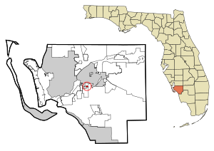
McGregor is a census-designated place (CDP) in Lee County, Florida, United States. The population was 7,976 at the 2020 census, up from 7,406 at the 2010 census. It is part of the Cape Coral-Fort Myers, Florida Metropolitan Statistical Area.

Page Park, Florida
Census-designated place in Florida, United States
Distance: Approx. 3048 meters
Latitude and longitude: 26.57805556,-81.86111111
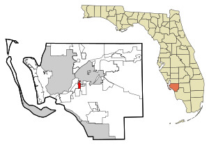
Page Park is a census-designated place (CDP) in Lee County, Florida, United States. The population was 747 at the 2020 census, up from 514 at the 2010 census. It is part of the Cape Coral-Fort Myers, Florida Metropolitan Statistical Area.

Pine Manor, Florida
Census-designated place in Florida, United States
Distance: Approx. 1284 meters
Latitude and longitude: 26.57194444,-81.87777778
Pine Manor is a census-designated place (CDP) located off U.S. Route 41 (South Cleveland Ave) and Summerlin Road in Lee County, Florida, United States. The population was 4,122 at the 2020 census, up from 3,428 at the 2010 census. It is part of the Cape Coral-Fort Myers, Florida Metropolitan Statistical Area.

Villas, Florida
Census-designated place in Florida, United States
Distance: Approx. 2161 meters
Latitude and longitude: 26.555,-81.86916667
Villas, Florida is an unincorporated community and census-designated place (CDP) in Lee County, Florida, United States. The population was 12,687 at the 2020 census, up from 11,569 at the 2010 census. It is part of the Cape Coral-Fort Myers, Florida Metropolitan Statistical Area.

Whiskey Creek, Florida
Census-designated place in Florida, United States
Distance: Approx. 1425 meters
Latitude and longitude: 26.5775,-81.88972222
Whiskey Creek is a census-designated place (CDP) in Lee County, Florida, United States. The population was 4,842 at the 2020 census, up from 4,655 at the 2010 census. It is part of the Cape Coral-Fort Myers, Florida Metropolitan Statistical Area.
Florida SouthWestern State College
Public college in Fort Myers, Florida, US
Distance: Approx. 1504 meters
Latitude and longitude: 26.5513,-81.8872
Florida SouthWestern State College (FSW) is a public college in Fort Myers, Florida. It is a member of the Florida College System.
Cypress Lake High School
Public high school in Cypress Lake, Florida
Distance: Approx. 2901 meters
Latitude and longitude: 26.542,-81.902
Cypress Lake High School Center for the Arts is a secondary school located in Cypress Lake, Florida. Cypress Lake High School is a high school in the South Zone specializing in five arts programs: Music, Dance, Media, Theatre, and Visual arts. Cypress Lake has AP programs and an extensive ESOL program.
Bishop Verot High School
Private, coeducational school in Fort Myers, Florida
Distance: Approx. 2661 meters
Latitude and longitude: 26.58861111,-81.88555556
Bishop Verot High School is a private, Roman Catholic high school in Fort Myers, Florida. It is located in the Diocese of Venice, Florida.
Evangelical Christian School (Fort Myers, Florida)
School in Fort Myers, Florida, United States
Distance: Approx. 2875 meters
Latitude and longitude: 26.57444444,-81.86111111
Evangelical Christian School (ECS) is a private, college preparatory, non-denominational Christian school in Fort Myers, Florida.

John Yarbrough Linear Park
Linear park trail in Fort Myers, Florida, U.S.
Distance: Approx. 3270 meters
Latitude and longitude: 26.56897,-81.85539
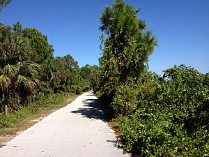
The John Yarbrough Linear Park (originally the Ten Mile Canal Linear Park) is a 6-mile linear park trail located in Fort Myers, Florida. The trail parallels the Ten Mile Canal and the Seminole Gulf Railway, and is owned and operated by Lee County Parks and Recreation. It is part of Lee County's Tour de Parks route along with Lakes Regional Park and other locations.
Tanglewood, Florida
Former CDP in Florida, United States
Distance: Approx. 1640 meters
Latitude and longitude: 26.57694444,-81.89722222
Tanglewood was a Census-designated place in Lee County, Florida during the 1980 United States Census. The population in 1980 was 8,229. The census area was partially annexed by neighboring Fort Myers while the remainder of the area was reassigned to the newly designated CDPs of Whiskey Creek & McGregor.
Suncoast Credit Union Arena
Multipurpose arena within Florida SouthWestern State College
Distance: Approx. 1895 meters
Latitude and longitude: 26.5478,-81.8869
Suncoast Credit Union Arena is a 75,000 sq ft (7,000 m2) multipurpose arena on the campus of Florida SouthWestern State College (FSW) in Fort Myers, Florida. It is the home of the FSW Buccaneers men's and women's basketball and volleyball teams. It holds 3,500 people in basketball configuration.
Weather in this IP's area
clear sky
15 Celsius
14 Celsius
13 Celsius
16 Celsius
1021 hPa
63 %
1021 hPa
1020 hPa
10000 meters
4.63 m/s
7.2 m/s
20 degree
