170.40.164.194 - IP Lookup: Free IP Address Lookup, Postal Code Lookup, IP Location Lookup, IP ASN, Public IP
Country:
Region:
City:
Location:
Time Zone:
Postal Code:
IP information under different IP Channel
ip-api
Country
Region
City
ASN
Time Zone
ISP
Blacklist
Proxy
Latitude
Longitude
Postal
Route
Luminati
Country
Region
mo
City
kansascity
ASN
Time Zone
America/Chicago
ISP
DST-ASN
Latitude
Longitude
Postal
IPinfo
Country
Region
City
ASN
Time Zone
ISP
Blacklist
Proxy
Latitude
Longitude
Postal
Route
IP2Location
170.40.164.194Country
Region
missouri
City
kansas city
Time Zone
America/Chicago
ISP
Language
User-Agent
Latitude
Longitude
Postal
db-ip
Country
Region
City
ASN
Time Zone
ISP
Blacklist
Proxy
Latitude
Longitude
Postal
Route
ipdata
Country
Region
City
ASN
Time Zone
ISP
Blacklist
Proxy
Latitude
Longitude
Postal
Route
Popular places and events near this IP address
Raytown, Missouri
City in Missouri, United States
Distance: Approx. 3007 meters
Latitude and longitude: 38.995,-94.46555556
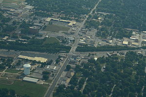
Raytown is a city in Jackson County, Missouri, United States, and is a suburb of Kansas City. The population was at 30,012 in 2020 census. The current mayor of Raytown is Michael McDonough.

Arrowhead Stadium
NFL football stadium in Missouri, United States
Distance: Approx. 3431 meters
Latitude and longitude: 39.04888889,-94.48388889
Arrowhead Stadium is an American football stadium in Kansas City, Missouri, United States. It primarily serves as the home venue of the Kansas City Chiefs of the National Football League (NFL). It was built at the same time as neighboring Kauffman Stadium, home of Major League Baseball's Kansas City Royals, which together form the Truman Sports Complex.

Kauffman Stadium
Baseball stadium in Kansas City, Missouri
Distance: Approx. 3554 meters
Latitude and longitude: 39.05138889,-94.48055556
Kauffman Stadium () (nicknamed "The K") is a baseball stadium located in Kansas City, Missouri. It is the home ballpark of Major League Baseball's Kansas City Royals. It is next door to Arrowhead Stadium, home of National Football League's Kansas City Chiefs.
Truman Sports Complex
Sports and entertainment facility located in Kansas City, Missouri
Distance: Approx. 3473 meters
Latitude and longitude: 39.05,-94.48222222
The Truman Sports Complex is a sports and entertainment facility in Kansas City, Missouri. It includes two major league sports venues: GEHA Field at Arrowhead Stadium, which is home to the National Football League's Kansas City Chiefs, and Kauffman Stadium, which hosts Major League Baseball's Kansas City Royals. The complex also hosts various other events during the rest of the year.
Raytown Senior High School
Public school
Distance: Approx. 1086 meters
Latitude and longitude: 39.01279,-94.46036
Raytown Senior High School is a high school located in Raytown, Missouri. The school was established in 1914. The enrollment of Raytown High School currently stands at 1503 students.
Richards Field
Distance: Approx. 3420 meters
Latitude and longitude: 38.993772,-94.4801
Richards Field was the first airport in the Kansas City metropolitan area. The field was established in 1922 near the border between Kansas City, Missouri, and Raytown, Missouri, at the southeast corner of Blue Ridge Boulevard and Gregory Boulevard. It was named for John Francisco Richards II, a Kansas City aviator killed in World War I. The airport was visited by Charles Lindbergh.
Two Rivers Psychiatric Hospital
Hospital in Missouri, United States
Distance: Approx. 911 meters
Latitude and longitude: 39.02981,-94.46766
Two Rivers Behavioral Health System was a 105-bed psychiatric hospital located in Kansas City, Missouri. Opened in October 1986, the facility was operated as a private, for-profit, behavioral health hospital and was owned by Universal Health Services. Two Rivers Behavioral Health System had a broad range of in-patient, partial hospitalization, and intensive outpatient services comprising the following units or programs: The National Center for Trauma-Based Disorders Dual Diagnosis and Addictions Spectrum Adult Services Renaissance Older Adult Program Child and Adolescent Program The National Center for Trauma-Based Disorders had both trauma stabilization and trauma treatment programs as well as a program for those with trauma and co-occurring eating disorders and addictions.
1995 Kansas City Royals season
Major League Baseball team season
Distance: Approx. 3577 meters
Latitude and longitude: 39.05169444,-94.48030556
The 1995 Kansas City Royals season was the 27th season for the franchise, and their 23rd at Kauffman Stadium. During this season, the Royals finished second in the American League Central, with a record of 70 wins and 74 losses. This was the first of 17 losing seasons the Royals would suffer through 2012.

Blue Ridge Crossing
Shopping mall in Kansas City, Missouri
Distance: Approx. 3126 meters
Latitude and longitude: 39.0455,-94.4447
Blue Ridge Crossing is a shopping center located in Kansas City, Missouri and Independence, Missouri at the intersections of I-70, US 40 Highway at Exit 11 & Sterling Avenue at Exit 10.
Rice-Tremonti House
Historic house in Missouri, United States
Distance: Approx. 2504 meters
Latitude and longitude: 39.00388889,-94.48166667
The Rice-Tremonti House in Raytown, Missouri, was built in 1844 and listed on the National Register of Historic Places in 1979. The house was built by Archibald and Sally Rice, who had moved to Missouri from North Carolina and started a forced-labor farm worked by enslaved people. They built a log house in this location around 1836.
Brooking Township, Jackson County, Missouri
Inactive township in the US state of Missouri
Distance: Approx. 3664 meters
Latitude and longitude: 38.99,-94.4744
Brooking Township is an inactive township in Jackson County, in the U.S. state of Missouri. Brooking Township was established in 1872, taking its name from Alvin Brooking, a state legislator. The township includes Raytown and environs, including a northwestern portion of Unity Village.
Wildwood Lake (Jackson County, Missouri)
Reservoir in Missouri, United States
Distance: Approx. 3022 meters
Latitude and longitude: 38.99666667,-94.45194444
Wildwood Lake is a reservoir in Jackson County, in the U.S. state of Missouri. It is located one mile southeast of Raytown.
Weather in this IP's area
overcast clouds
1 Celsius
-2 Celsius
1 Celsius
1 Celsius
1025 hPa
62 %
1025 hPa
990 hPa
10000 meters
3.39 m/s
8.41 m/s
203 degree
100 %

