170.39.48.103 - IP Lookup: Free IP Address Lookup, Postal Code Lookup, IP Location Lookup, IP ASN, Public IP
Country:
Region:
City:
Location:
Time Zone:
Postal Code:
IP information under different IP Channel
ip-api
Country
Region
City
ASN
Time Zone
ISP
Blacklist
Proxy
Latitude
Longitude
Postal
Route
Luminati
Country
ASN
Time Zone
America/Toronto
ISP
RACK-AND-DATA
Latitude
Longitude
Postal
IPinfo
Country
Region
City
ASN
Time Zone
ISP
Blacklist
Proxy
Latitude
Longitude
Postal
Route
IP2Location
170.39.48.103Country
Region
ontario
City
kitchener
Time Zone
America/Toronto
ISP
Language
User-Agent
Latitude
Longitude
Postal
db-ip
Country
Region
City
ASN
Time Zone
ISP
Blacklist
Proxy
Latitude
Longitude
Postal
Route
ipdata
Country
Region
City
ASN
Time Zone
ISP
Blacklist
Proxy
Latitude
Longitude
Postal
Route
Popular places and events near this IP address

Kitchener, Ontario
City in Ontario, Canada
Distance: Approx. 2045 meters
Latitude and longitude: 43.41861111,-80.47277778
Kitchener is a city in the Canadian province of Ontario, about 100 km (62 mi) west of Toronto. It is one of three cities that make up the Regional Municipality of Waterloo and is the regional seat. Kitchener was known as Berlin until a 1916 referendum changed its name.
St. Mary's High School (Kitchener)
High school in Kitchener, Ontario, Canada
Distance: Approx. 2213 meters
Latitude and longitude: 43.420036,-80.467431
St. Mary's High School is a Catholic secondary school in Kitchener, Ontario, Canada. It serves most of Kitchener's Catholic students, with others attending Resurrection Catholic Secondary School.
Eastwood Collegiate Institute
Public high school in Kitchener, Ontario
Distance: Approx. 4485 meters
Latitude and longitude: 43.43961389,-80.45854444
Eastwood Collegiate Institute is a public high school in Kitchener, Ontario, Canada. It was established in 1956. The school teams are known as the "Lions".

Fairview Park Mall
Shopping mall in Kitchener, Ontario
Distance: Approx. 3771 meters
Latitude and longitude: 43.42487,-80.43859
CF Fairview Park (commonly known as Fairview Park Mall) is a large shopping mall of 120 stores in Kitchener, Ontario, Canada, owned and managed by Westcliff Management Ltd. Anchor stores are Hudson's Bay and Walmart, with one large anchor space, last occupied by Sears, divided into multiple stores including Winners, Sport Chek, Mark's, and a RBC branch which opened in 2021, with the rest of vacant space planned for redevelopment in the future. Kingsway Drive bounds CF Fairview Park to the north, Wilson Avenue to the west, Fairway Road to the south, and Highway 8 to the east.

Rockway Mennonite Collegiate
Private school in Kitchener, Ontario, Canada
Distance: Approx. 3978 meters
Latitude and longitude: 43.4357,-80.46397
Rockway Mennonite Collegiate (RMC) is an independent Mennonite high school located in Kitchener, Ontario, Canada. It offers academic programs for grade 7–12 students, various cross-cultural exchanges, as well as arts, athletics and tech programs. Approximately 40% of its 300-student population are Mennonite, coming from the modern Canadian Mennonite church, rather than Old Order Mennonites.

Doon Heritage Village
History and living history museum in Ontario, Canada
Distance: Approx. 2652 meters
Latitude and longitude: 43.402,-80.438
Doon Heritage Village, located at the Ken Seiling Waterloo Region Museum, is a picturesque 60 acre living history village that shows visitors what life was like in the Waterloo Region in the year 1914. It is located in the former Doon village, now part of Kitchener, Ontario, Canada, next to Homer Watson Park. The Doon Heritage Village is open seasonally from May to December.
Grand Valley Institution for Women
Women's prison
Distance: Approx. 2323 meters
Latitude and longitude: 43.401,-80.442
Grand Valley Institution for Women (GVI; French: Établissement pour femmes Grand Valley) is a women's prison in Kitchener, Ontario, operated by the Correctional Service of Canada (CSC). In Canada, all offenders sentenced to prison terms of greater than two years serve their time in a federal institution operated by the CSC. The Grand Valley Institution, which had a reported capacity of approximately 130 women as of April 2010, is the only federal women's prison in Ontario.

Doon, Ontario
Suburban community in Kitchener, Ontario, Canada
Distance: Approx. 4651 meters
Latitude and longitude: 43.392173,-80.414304
Doon is a suburban community and former village which is now a part of the city of Kitchener, Ontario, Canada. Doon was settled around 1800 by German Mennonites from Pennsylvania, and after 1830 by Scottish immigrants. The area is located at the confluence of Schneider Creek and the Grand River.

Mill station
Light rail station in Kitchener, Ontario
Distance: Approx. 3797 meters
Latitude and longitude: 43.43395,-80.47839
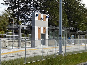
Mill is a stop on the Region of Waterloo's Ion rapid transit system. It is located southeast of the intersection of Ottawa and Mill Streets in Kitchener, alongside the CN Huron Subdivision. It opened on June 21, 2019.

Block Line station
Light rail station in Kitchener, Ontario
Distance: Approx. 2567 meters
Latitude and longitude: 43.4226,-80.46263
Block Line is a stop on the Region of Waterloo's Ion rapid transit system. It is located alongside Courtland Avenue in Kitchener, just north of Block Line Road. It opened on June 21, 2019.

Waterloo Pioneer Memorial Tower
Memorial tower in Ontario, Canada
Distance: Approx. 4406 meters
Latitude and longitude: 43.400142,-80.41622
The Waterloo Pioneer Memorial Tower was built in 1926 in Kitchener to commemorate the arrival of the Pennsylvania Dutch to Southwestern Ontario. It was conceived by William Henry Breithaupt, who wanted to heal wounds of nationalism fomented in the city during World War I. This led to increasing anti-German sentiment and an eventual change in the name of the city from Berlin to Kitchener. The tower overlooks the Grand River on a site once cleared by the first pioneers to settle the area.
Sunrise Centre
Bus terminal in Kitchener, Ontario
Distance: Approx. 4113 meters
Latitude and longitude: 43.415324,-80.517165
The Sunrise Centre Station is a bus station and terminal in Kitchener, Ontario, Canada. The station is a single platform with bus bays on each side. The platform has a heated shelter with seats inside, LED real-time displays and map boards.
Weather in this IP's area
overcast clouds
2 Celsius
-3 Celsius
1 Celsius
2 Celsius
1022 hPa
88 %
1022 hPa
983 hPa
10000 meters
5.66 m/s
8.23 m/s
90 degree
100 %