170.39.116.47 - IP Lookup: Free IP Address Lookup, Postal Code Lookup, IP Location Lookup, IP ASN, Public IP
Country:
Region:
City:
Location:
Time Zone:
Postal Code:
IP information under different IP Channel
ip-api
Country
Region
City
ASN
Time Zone
ISP
Blacklist
Proxy
Latitude
Longitude
Postal
Route
Luminati
Country
Region
va
City
ashburn
ASN
Time Zone
America/New_York
ISP
RACKDOG-LLC
Latitude
Longitude
Postal
IPinfo
Country
Region
City
ASN
Time Zone
ISP
Blacklist
Proxy
Latitude
Longitude
Postal
Route
IP2Location
170.39.116.47Country
Region
maryland
City
potomac
Time Zone
America/New_York
ISP
Language
User-Agent
Latitude
Longitude
Postal
db-ip
Country
Region
City
ASN
Time Zone
ISP
Blacklist
Proxy
Latitude
Longitude
Postal
Route
ipdata
Country
Region
City
ASN
Time Zone
ISP
Blacklist
Proxy
Latitude
Longitude
Postal
Route
Popular places and events near this IP address

Travilah, Maryland
Census-designated place in Maryland
Distance: Approx. 3629 meters
Latitude and longitude: 39.0575,-77.26055556
Travilah is a United States census-designated place and an unincorporated area in Montgomery County, Maryland. It is 17.28 square miles (44.8 km2) located along the north side of the Potomac River, and surrounded by the communities of Potomac, North Potomac, and Darnestown—all census-designated places. It had a population of 11,985 as of the 2020 census.
Bullis School
Private preparatory school in Potomac, Maryland, United States
Distance: Approx. 3537 meters
Latitude and longitude: 39.02833333,-77.2
Bullis School is a private, co-educational college preparatory day school for grades K-12.

Great Falls Park
National Park Service unit in Virginia, United States
Distance: Approx. 3681 meters
Latitude and longitude: 38.9975,-77.255
Great Falls Park is a small National Park Service (NPS) site in Virginia, United States. Situated on 800 acres (3.2 km2) along the banks of the Potomac River in northern Fairfax County, the park is a disconnected but integral part of the George Washington Memorial Parkway. The Great Falls of the Potomac River are near the northern boundary of the park, as are the remains of the Patowmack Canal, the first canal in the United States that used locks to raise and lower boats.
Great Falls (Potomac River)
Waterfalls on the Potomac River in Maryland and Virginia
Distance: Approx. 3615 meters
Latitude and longitude: 38.9975,-77.2525
Great Falls is a series of rapids and waterfalls on the Potomac River, 14 miles (23 km) upstream from Washington, D.C., on the border of Montgomery County, Maryland and Fairfax County, Virginia. The Potomac and the falls themselves are legally entirely within Maryland, since the state's border follows the south bank of the river. Great Falls Park, managed as part of George Washington Memorial Parkway, is on the southern banks in Virginia, and Chesapeake and Ohio Canal National Historical Park parkland is along the northern banks of the river in Maryland.

Olmsted Island
Island in the Potomac River, US
Distance: Approx. 3474 meters
Latitude and longitude: 38.9983,-77.25
Olmsted Island is a small island in the middle of the Potomac River in the U.S. state of Maryland, near Great Falls which is a part of C & O Canal National Historical Park, located across the river from Great Falls Park. It is a part of Potomac, Maryland. Named for Frederick Law Olmsted Jr., the landscape architect and preservationist whose famous father designed New York's Central Park, the small island is a bedrock terrace forest that supports rare, threatened and endangered plant species.
WCTN
Radio station in Maryland, United States
Distance: Approx. 3437 meters
Latitude and longitude: 39.03666667,-77.2025
WCTN is a Spanish hits radio station broadcasting on 950 kHz in the medium-wave AM band from Potomac, Maryland.

Billy Goat Trail
Hiking Trail in Montgomery County, Maryland, US
Distance: Approx. 3908 meters
Latitude and longitude: 38.9938,-77.2458
The Billy Goat Trail is a 4.7-mile (7.6 km) hiking trail that follows a path between the C&O Canal and the Potomac River within the Chesapeake and Ohio Canal National Historical Park near the Great Falls in Montgomery County, Maryland.
Watts Branch (Potomac River tributary)
Tributary stream of the Potomac River in Montgomery County, Maryland, United States
Distance: Approx. 2063 meters
Latitude and longitude: 39.0398312,-77.2599817
Watts Branch is a tributary stream of the Potomac River in Montgomery County, Maryland.

Edward Beale House
Historic house in Maryland, United States
Distance: Approx. 2702 meters
Latitude and longitude: 39.04972222,-77.22527778
The Edward Beale House is a historic home located at Potomac, Montgomery County, Maryland. It is a Colonial Revival residence built in 1938, and designed to look like a Pennsylvania farmhouse that has evolved over centuries. The 2+1⁄2-story house has a modified telescope form composed of stone and frame sections covered with side-gable slate shingle roofs.

Glen Store and Post Office
Distance: Approx. 2771 meters
Latitude and longitude: 39.04530556,-77.21702778
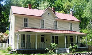
The Glen Store and Post Office is a late 19th-century home located in Potomac, Maryland.
Matildaville, Virginia
Ghost town in Virginia, United States
Distance: Approx. 3982 meters
Latitude and longitude: 38.99722222,-77.26277778
Matildaville is a ghost town located along the Patowmack Canal near present day Great Falls, Virginia, United States. It was named for the wife of Light Horse Harry Lee, on 40 acres of land owned at the time by Bryan Fairfax, 8th Lord Fairfax of Cameron, and served as headquarters for the Patowmack Company from 1785 until 1799. Now, all that remains of the town are a series of ruins on the grounds of Great Falls Park.

Glenstone
Art museum in Maryland, United States
Distance: Approx. 3810 meters
Latitude and longitude: 39.061703,-77.252595
Glenstone is a private contemporary art museum in Potomac, Maryland, founded in 2006 by American billionaire Mitchell Rales and his wife, Emily Wei Rales. The museum's exhibitions are drawn from a collection of about 1,300 works from post-World War II artists around the world. It is the largest private contemporary art museum in the United States, holding more than $4.6 billion in net assets, and is noted for its setting in a broad natural landscape.
Weather in this IP's area
clear sky
7 Celsius
7 Celsius
6 Celsius
8 Celsius
1026 hPa
61 %
1026 hPa
1013 hPa
10000 meters
0.45 m/s
4.47 m/s
331 degree
9 %

