170.39.116.32 - IP Lookup: Free IP Address Lookup, Postal Code Lookup, IP Location Lookup, IP ASN, Public IP
Country:
Region:
City:
Location:
Time Zone:
Postal Code:
IP information under different IP Channel
ip-api
Country
Region
City
ASN
Time Zone
ISP
Blacklist
Proxy
Latitude
Longitude
Postal
Route
Luminati
Country
Region
va
City
ashburn
ASN
Time Zone
America/New_York
ISP
RACKDOG-LLC
Latitude
Longitude
Postal
IPinfo
Country
Region
City
ASN
Time Zone
ISP
Blacklist
Proxy
Latitude
Longitude
Postal
Route
IP2Location
170.39.116.32Country
Region
illinois
City
mount prospect
Time Zone
America/Chicago
ISP
Language
User-Agent
Latitude
Longitude
Postal
db-ip
Country
Region
City
ASN
Time Zone
ISP
Blacklist
Proxy
Latitude
Longitude
Postal
Route
ipdata
Country
Region
City
ASN
Time Zone
ISP
Blacklist
Proxy
Latitude
Longitude
Postal
Route
Popular places and events near this IP address

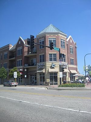
Mount Prospect, Illinois
Village in Illinois, United States
Distance: Approx. 216 meters
Latitude and longitude: 42.06555556,-87.93611111
Mount Prospect is a village in Cook County, Illinois, United States. It is part of Elk Grove and Wheeling townships, about 20 miles (32 km) northwest of downtown Chicago and approximately 4 miles (6.4 km) north of O'Hare International Airport. As of the 2020 census, the village had a total population of 56,852.
Randhurst Ice Arena
Distance: Approx. 1772 meters
Latitude and longitude: 42.08127778,-87.93194444
Randhurst Ice Arena was an indoor arena located in Mount Prospect, Illinois. The arena, which sat about 2,000 people, was the part-time home of the Chicago Cougars of the World Hockey Association from 1974 to 1975. During the 1974 Avco Cup playoffs, the Cougars' regular home, the International Amphitheatre was being used for other events.
Mount Prospect School District 57
School district in Illinois, United States
Distance: Approx. 1384 meters
Latitude and longitude: 42.07333333,-87.94638889
Mount Prospect Public School District 57 is a community public school district that serves over 2,000 pre-kindergarten through eighth grade students in Mount Prospect, Illinois, United States, a suburb of Chicago covering an area of 4.3 square miles (11 km2).

Prospect Heights station
Commuter rail station in Prospect Heights, Illinois
Distance: Approx. 3661 meters
Latitude and longitude: 42.0923,-87.908
Prospect Heights is a station on Metra's North Central Service in Prospect Heights, Illinois. The station is 26.6 miles (42.8 km) away from Union Station, the southern terminus of the line. In Metra's zone-based fare system, Prospect Heights is in zone 3.

Cumberland station (Metra)
Railroad station in Des Plaines, Illinois, US
Distance: Approx. 2279 meters
Latitude and longitude: 42.0524,-87.9122
Cumberland station is one of two commuter railroad stations on Metra's Union Pacific Northwest Line in the city of Des Plaines, Illinois. It is officially located at 475 East Northwest Highway (US 14), and lies 18.2 miles (29.3 km) from Ogilvie Transportation Center in Chicago. In Metra's zone-based fare system, Cumberland is in zone 3.

Randhurst Village
Shopping mall in Illinois, United States
Distance: Approx. 2106 meters
Latitude and longitude: 42.08431667,-87.93329722
Randhurst Village (previously known as Randhurst Mall and Randhurst Center or simply known as Randhurst) is a shopping center located at the corner of Rand Road (U.S. Route 12) and Elmhurst Road (Illinois Route 83) in Mount Prospect, Illinois. The shopping center took its name from combining the names of these two roads into a portmanteau. The original owner of the shopping center was the Randhurst Corporation (a joint venture of Carson Pirie Scott, Wieboldt's, and Montgomery Ward).
Mount Prospect Public Library
Library in Illinois, United States
Distance: Approx. 208 meters
Latitude and longitude: 42.0656,-87.936
The Mount Prospect Public Library is a public library located in Mount Prospect, Illinois, United States, a suburb of Chicago. A staff of 171 full and part-time employees work at the Library, in more than a dozen areas throughout the 101,000-square-foot facility. Currently more than 61,000 patrons are registered cardholders.

Mount Prospect station
Railway station in Illinois
Distance: Approx. 334 meters
Latitude and longitude: 42.0631,-87.9361
Mount Prospect is a station on Metra's Union Pacific Northwest Line located in Mount Prospect, Illinois. The station is located at 13 E. Northwest Highway near its intersection with Main St. (Illinois Route 83).
Rainbow Hospice
American non-profit hospice and palliative care provider
Distance: Approx. 2318 meters
Latitude and longitude: 42.079103,-87.912372
Rainbow Hospice and Palliative Care, founded in 1981, is one of the oldest and largest non-profit hospice and palliative care providers in Illinois. With main offices at 1550 Bishop Court in Mt. Prospect and additional offices in Elgin and Urbana, Rainbow serves patients in seven counties throughout Illinois: Cook, DuPage, Kane, Kendall, Lake, McHenry and Will counties.

Maryville Academy
Distance: Approx. 2980 meters
Latitude and longitude: 42.0669,-87.8975
Maryville Academy is a child care organization rooted in Catholic teaching. Located in Des Plaines, Illinois, Maryville was founded in 1883.

All Saints Cemetery
Distance: Approx. 3361 meters
Latitude and longitude: 42.062222,-87.893056
All Saints Cemetery is a cemetery of the Roman Catholic Archdiocese of Chicago, and is located at 700 North River Road, in Des Plaines, Illinois. The original 1923 East cemetery was expanded in 1954 to include All Saints West. The cemetery includes a three-story community mausoleum containing space for thousands of above-ground interments.
Rolling Green Country Club
Distance: Approx. 3417 meters
Latitude and longitude: 42.09222222,-87.95361111
Rolling Green Country Club is a private country club in Arlington Heights, Illinois, with over 350 full golf members and 105 acres that contain a 71.5 rated golf course, swimming facilities, restaurant, bar, fitness center and skeet shooting range. Rolling Green is the only location in Arlington Heights, IL where firing a gun is legal.
Weather in this IP's area
overcast clouds
-1 Celsius
-7 Celsius
-2 Celsius
0 Celsius
1024 hPa
66 %
1024 hPa
997 hPa
10000 meters
7.15 m/s
10.28 m/s
153 degree
100 %