170.254.229.46 - IP Lookup: Free IP Address Lookup, Postal Code Lookup, IP Location Lookup, IP ASN, Public IP
Country:
Region:
City:
Location:
Time Zone:
Postal Code:
IP information under different IP Channel
ip-api
Country
Region
City
ASN
Time Zone
ISP
Blacklist
Proxy
Latitude
Longitude
Postal
Route
Luminati
Country
Region
dc
City
bogota
ASN
Time Zone
America/Bogota
ISP
Media Commerce Partners S.A
Latitude
Longitude
Postal
IPinfo
Country
Region
City
ASN
Time Zone
ISP
Blacklist
Proxy
Latitude
Longitude
Postal
Route
IP2Location
170.254.229.46Country
Region
risaralda
City
pereira
Time Zone
America/Bogota
ISP
Language
User-Agent
Latitude
Longitude
Postal
db-ip
Country
Region
City
ASN
Time Zone
ISP
Blacklist
Proxy
Latitude
Longitude
Postal
Route
ipdata
Country
Region
City
ASN
Time Zone
ISP
Blacklist
Proxy
Latitude
Longitude
Postal
Route
Popular places and events near this IP address

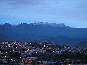
Risaralda Department
Department of Colombia
Distance: Approx. 572 meters
Latitude and longitude: 4.81666667,-75.7
Risaralda (Spanish pronunciation: [risaˈɾalda]) is a department of Colombia. It is located in the western central of the country, in the Andean region, It is part of the Coffee axis with Caldas and Quindío. Its capital is Pereira.

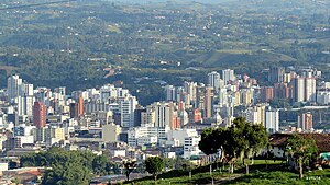
Pereira, Colombia
City in Risaralda, Colombia
Distance: Approx. 203 meters
Latitude and longitude: 4.81427778,-75.69455833
Pereira (Spanish pronunciation: [peˈɾejɾa]) is the capital city of the Colombian department of Risaralda. It's located in the foothills of the Andes in a coffee-producing area of Colombia officially known as the "Coffee Axis". Pereira, alongside the rest of the Coffee Axis, form part of UNESCO World Heritage Site known as the "Coffee Cultural Landscape of Colombia".

Dosquebradas
Municipality and town in Risaralda Department, Colombia
Distance: Approx. 2642 meters
Latitude and longitude: 4.83333333,-75.68333333
Dosquebradas (Spanish pronunciation: [doskeˈβɾaðas]) is the second largest city and a municipality in the Risaralda Department, Colombia. As of 2023, with a population of approximately 225,540 inhabitants. The city is connected by the César Gaviria Trujillo Viaduct to Pereira, the capital of the department.

César Gaviria Trujillo Viaduct
Cable-stayed bridge
Distance: Approx. 1199 meters
Latitude and longitude: 4.81755556,-75.68616667
The César Gaviria Trujillo Viaduct (Spanish: Viaducto César Gaviria Trujillo) is a cable-stayed bridge connecting the neighbouring cities of Pereira and Dosquebradas in Risaralda, Colombia. It is one of the longest cable-stayed bridges in South America and, at the time of its completion in 1997, ranked 20th in the world.[1] The bridge has a total length of 440 metres, including a central span of 211 metres. There are four traffic lanes and two sidewalks, giving a total width of 26 metres.
Estadio Hernán Ramírez Villegas
Distance: Approx. 6293 meters
Latitude and longitude: 4.804804,-75.75219
Estadio Hernán Ramírez Villegas is a multi-purpose stadium in Pereira, Colombia. It is currently used mostly for football matches. It is also the home of Deportivo Pereira.

Technological University of Pereira
Public research university in Pereira, Colombia
Distance: Approx. 2200 meters
Latitude and longitude: 4.795,-75.68861111
The Technological University of Pereira (Spanish: Universidad Tecnológica de Pereira) is a national public research university in Pereira, Risaralda, Colombia. The university is located in the southeast of the city. The university offers studies in engineering (Industrial engineering, Engineering physics, Systems engineering and Computer science, Electrical engineering, Mechanical engineering); Science and Technology (Veterinary medicine, Medicine, Chemical technology, Industrial chemistry, Environmental management); Liberal arts (English, Spanish language and Literature, philosophy, Communication and Computer Education); Child pedagogy; and Sports science and recreation.

Our Lady of Poverty Cathedral, Pereira
Church in Pereira, Colombia
Distance: Approx. 171 meters
Latitude and longitude: 4.81465,-75.69536
The Our Lady of Poverty Cathedral (Spanish: Catedral de Nuestra Señora de la Pobreza), also called Pereira Cathedral, is the cathedral church of Catholic worship in the city of Pereira, capital of Risaralda department in the South American country of Colombia. The cathedral is dedicated to the Virgin Mary under the title of Our Lady of Poverty (Nuestra Señora de la Pobreza). It is the main church of the Diocese of Pereira and was elevated to cathedral on December 18, 1952, by a bull of Pope Pius XII. It is located on the western side of the Plaza de Bolivar, between Calles 20 and 21 south of Carrera 7, in the center of the city.

Cauca Valley montane forests
Ecoregion in western Colombia
Distance: Approx. 7767 meters
Latitude and longitude: 4.839,-75.631
The Cauca Valley montane forests (NT0109) is an ecoregion in western Colombia. It covers the sides of the Cauca Valley, which runs from south to north between the Central and Western Ranges (cordilleras) of the Colombian Andes. The ecoregion is home to very diverse fauna and flora, due in part to its varied elevations and climates, in part to its position near the isthmus of Panama, the route along which North American species invaded South America and then diversified as they moved to the upper parts of the Andes.
Weather in this IP's area
few clouds
23 Celsius
23 Celsius
22 Celsius
23 Celsius
1013 hPa
73 %
1013 hPa
850 hPa
10000 meters
2.57 m/s
310 degree
20 %
