Country:
 USA
USARegion:
City:
Latitude and Longitude:
Time Zone:
Postal Code:
IP information under different IP Channel
ip-api
Country
Region
City
ASN
Time Zone
ISP
Blacklist
Proxy
Latitude
Longitude
Postal
Route
IPinfo
Country
Region
City
ASN
Time Zone
ISP
Blacklist
Proxy
Latitude
Longitude
Postal
Route
MaxMind
Country
Region
City
ASN
Time Zone
ISP
Blacklist
Proxy
Latitude
Longitude
Postal
Route
Luminati
Country
USRegion
al
City
bayminette
ASN
Time Zone
America/Chicago
ISP
BALDWIN
Latitude
Longitude
Postal
db-ip
Country
Region
City
ASN
Time Zone
ISP
Blacklist
Proxy
Latitude
Longitude
Postal
Route
ipdata
Country
Region
City
ASN
Time Zone
ISP
Blacklist
Proxy
Latitude
Longitude
Postal
Route
Popular places and events near this IP address

Bay Minette, Alabama
City in and county seat of Baldwin County, Alabama
Distance: Approx. 2868 meters
Latitude and longitude: 30.883446,-87.777183
Bay Minette is a city in and the county seat of Baldwin County, Alabama, United States. As of the 2010 census, the population of the city was 8,044.
Pine Grove, Alabama
Unincorporated community in Alabama, United States
Distance: Approx. 3700 meters
Latitude and longitude: 30.83361111,-87.74111111
Pine Grove is an unincorporated community in Baldwin County, Alabama, United States. It is located south of Bay Minette. The community is part of the Daphne–Fairhope–Foley Micropolitan Statistical Area.
Baldwin County High School
Public high school in Bay Minette, Baldwin County, Alabama, United States
Distance: Approx. 4679 meters
Latitude and longitude: 30.8936,-87.79408
Baldwin County High School is a public high school that serves grades 9-12 in Bay Minette, Baldwin County, Alabama, United States. It is part of the Baldwin County Public Schools. The school's mascot is the tiger.
Coastal Alabama Community College
Public college in southern Alabama, US
Distance: Approx. 1860 meters
Latitude and longitude: 30.85,-87.78
Coastal Alabama Community College (also known as Coastal Alabama Community College – South) is a public community college with campuses in southern Alabama. Coastal Alabama was formed through the consolidation of Alabama Southern Community College, Faulkner State Community College, and Jefferson Davis Community College.
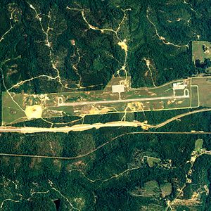
Bay Minette Municipal Airport
Airport
Distance: Approx. 5371 meters
Latitude and longitude: 30.87027778,-87.81944444
Bay Minette Municipal Airport (FAA LID: 1R8) is a city government-owned public-use airport located 3 nautical miles (6 km) southwest of the central business district of Bay Minette, a city in Baldwin County, Alabama, United States.
Carpenter's Station, Alabama
Unincorporated community in Alabama, US
Distance: Approx. 9715 meters
Latitude and longitude: 30.85722222,-87.86611111
Carpenter's Station is a community located in Baldwin County, Alabama. It appears as "Carpenter" on the Bay Minette South U.S. Geological Survey Map.
Baldwin County Board of Education
School district in Alabama
Distance: Approx. 4020 meters
Latitude and longitude: 30.89139722,-87.78548333
The Baldwin County Board of Education oversees most public schools in Baldwin County, Alabama, and is based in Bay Minette, Alabama. The Board serves the entire county. Over 30,000 students are within the supervision of the Board.

First Baptist Church (Bay Minette, Alabama)
Historic church in Alabama, United States
Distance: Approx. 2977 meters
Latitude and longitude: 30.88472222,-87.77666667
First Baptist Church is a historic Southern Baptist church on D'Olive Street in Bay Minette, Alabama, United States. It was built in 1914 and added to the National Register of Historic Places in 1988. The Bay Minette Public Library currently occupies the building.
Crossroads, Alabama
Unincorporated community in Alabama, United States
Distance: Approx. 9647 meters
Latitude and longitude: 30.835,-87.86111111
Crossroads is an unincorporated community in Baldwin County, Alabama, United States. Crossroads is located on Alabama State Route 225, 5.5 miles (8.9 km) southwest of Bay Minette.
Deep Run (Godbolt Creek tributary)
River in Alabama, United States
Distance: Approx. 9046 meters
Latitude and longitude: 30.9375,-87.79333333
Deep Run is a tributary of Godbolt Creek in Baldwin County, Alabama in the United States. The GNIS I.D. number is 117191.
Weather in this IP's area
clear sky
9 Celsius
8 Celsius
8 Celsius
11 Celsius
1028 hPa
63 %
1028 hPa
1018 hPa
10000 meters
2.62 m/s
9.43 m/s
76 degree
06:55:50
18:16:02