Country:
Region:
City:
Latitude and Longitude:
Time Zone:
Postal Code:
IP information under different IP Channel
ip-api
Country
Region
City
ASN
Time Zone
ISP
Blacklist
Proxy
Latitude
Longitude
Postal
Route
Luminati
Country
Region
go
City
anapolis
ASN
Time Zone
America/Sao_Paulo
ISP
HC TELECOM PROVEDOR DE INTERNET EIRELI-ME
Latitude
Longitude
Postal
IPinfo
Country
Region
City
ASN
Time Zone
ISP
Blacklist
Proxy
Latitude
Longitude
Postal
Route
db-ip
Country
Region
City
ASN
Time Zone
ISP
Blacklist
Proxy
Latitude
Longitude
Postal
Route
ipdata
Country
Region
City
ASN
Time Zone
ISP
Blacklist
Proxy
Latitude
Longitude
Postal
Route
Popular places and events near this IP address

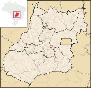
Anápolis
Municipality in Central-West, Brazil
Distance: Approx. 7829 meters
Latitude and longitude: -16.33388889,-48.95194444
Anápolis (, Portuguese: [ɐˈnapolis]) is a Brazilian city in the state of Goiás. It is located between two capitals, the federal capital Brasília and state capital Goiânia. It is the third most populous city in the state, with 398,869 inhabitants according to the Brazilian Institute of Geographic and Statistics in 2022.

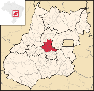
Microregion of Anápolis
Microregion in Goiás, Brazil
Distance: Approx. 7284 meters
Latitude and longitude: -16.32694444,-48.95277778
The Anápolis Microregion is a microregion of central Goiás state, Brazil. More than sixty percent of the population is concentrated in Anápolis, the regional center. The land is fertile and well-watered.

Campo Limpo de Goiás
Municipality in Central-West, Brazil
Distance: Approx. 8217 meters
Latitude and longitude: -16.295,-49.08472222
Campo Limpo de Goiás is a municipality in central Goiás state, Brazil. It separated from the municipality of Anápolis in 1997. The distance to the state capital, Goiânia, is 75 km and connections are made by BR-153, passing through Anápolis, and then taking GO-330.
Estádio Jonas Duarte
Multi-use stadium in Anápolis, Brazil
Distance: Approx. 8512 meters
Latitude and longitude: -16.34634722,-48.95576111
Estádio Jonas Duarte is a multi-use stadium located in Anápolis, Brazil. It is used mostly for football matches and hosts the home matches of Associação Atlética Anapolina, Anápolis Futebol Clube, Grêmio Esportivo Anápolis and Grêmio Esportivo Inhumense. The stadium has a maximum capacity of 20,000 people and was built in 1965.

Roman Catholic Diocese of Anápolis
Catholic ecclesiastical territory
Distance: Approx. 7012 meters
Latitude and longitude: -16.3287,-48.9574
The Roman Catholic Diocese of Anápolis (Latin: Dioecesis Anapolitanus) is a diocese located in the city of Anápolis in the ecclesiastical province of Goiânia in Brazil.

Anápolis Air Force Base
Air base of the Brazilian Air Force
Distance: Approx. 6767 meters
Latitude and longitude: -16.23861111,-48.97222222
Anápolis Air Force Base – ALA2 (ICAO: SBAN) is a base of the Brazilian Air Force, located in Anápolis, Brazil.
Weather in this IP's area
overcast clouds
25 Celsius
26 Celsius
25 Celsius
25 Celsius
1013 hPa
72 %
1013 hPa
907 hPa
10000 meters
1.77 m/s
1.96 m/s
22 degree
100 %
05:34:07
18:29:15