170.231.114.31 - IP Lookup: Free IP Address Lookup, Postal Code Lookup, IP Location Lookup, IP ASN, Public IP
Country:
Region:
City:
Location:
Time Zone:
Postal Code:
ISP:
ASN:
language:
User-Agent:
Proxy IP:
Blacklist:
IP information under different IP Channel
ip-api
Country
Region
City
ASN
Time Zone
ISP
Blacklist
Proxy
Latitude
Longitude
Postal
Route
db-ip
Country
Region
City
ASN
Time Zone
ISP
Blacklist
Proxy
Latitude
Longitude
Postal
Route
IPinfo
Country
Region
City
ASN
Time Zone
ISP
Blacklist
Proxy
Latitude
Longitude
Postal
Route
IP2Location
170.231.114.31Country
Region
rio de janeiro
City
cabo frio
Time Zone
America/Sao_Paulo
ISP
Language
User-Agent
Latitude
Longitude
Postal
ipdata
Country
Region
City
ASN
Time Zone
ISP
Blacklist
Proxy
Latitude
Longitude
Postal
Route
Popular places and events near this IP address

São Pedro da Aldeia
Municipality in Southeast, Brazil
Distance: Approx. 9721 meters
Latitude and longitude: -22.83888889,-42.10277778
São Pedro da Aldeia (Portuguese pronunciation: [sɐ̃w ˈpedɾu dɐwˈdejɐ]) is a municipality in Brazil. Its population was 106,049 (2020) and its area is 340 km2.

Cabo Frio
Municipality in Southeast, Brazil
Distance: Approx. 32 meters
Latitude and longitude: -22.87888889,-42.01888889
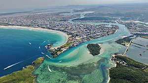
Cabo Frio (Portuguese pronunciation: [ˈkabu ˈfɾi.u], Cold Cape) is a tourist destination located in the state of Rio de Janeiro. The Brazilian coast runs east from Rio de Janeiro to Cabo Frio where it turns sharply north. North of Cabo Frio is Cabo de São Tomé.
Correão
Distance: Approx. 2503 meters
Latitude and longitude: -22.88980833,-42.04000556
Correão, also known Estádio Alair Corrêa, is a multi-use stadium located in Cabo Frio, Brazil. It is used mostly for football matches and hosts the home matches of Associação Desportiva Cabofriense. The stadium has a maximum capacity of 12,000 people.

Arraial do Cabo
Municipality in Southeast, Brazil
Distance: Approx. 9712 meters
Latitude and longitude: -22.96583333,-42.02777778
Arraial do Cabo (Portuguese pronunciation: [ɐʁɐjˈaw du ˈkabu]) is a municipality located in the Brazilian state of Rio de Janeiro. Its population was 30,593 as of 2020 census and its total area is 160 square kilometres (62 sq mi). It was founded in 1503 by the conqueror Amerigo Vespucci.

Cabo Frio International Airport
Airport serving Cabo Frio, Brazil
Distance: Approx. 7141 meters
Latitude and longitude: -22.92083333,-42.07138889
Cabo Frio International Airport (IATA: CFB, ICAO: SBCB) is the airport serving Cabo Frio, Brazil. The airport is operated by Aeropart.

Igreja Matriz de Nossa Senhora da Assunção, Cabo Frio
Church in Cabo Frio, Brazil
Distance: Approx. 137 meters
Latitude and longitude: -22.8787,-42.0199
The Church Mother of Our Lady of Assumption (Portuguese: Igreja Matriz de Nossa Senhora da Assunção) is the name given to a religious building that is part of the Catholic Church and is located in the city of Cabo Frio in the state of Rio de Janeiro in the southern part of the South American country of Brazil. The current church was built in 1663 and in 1724 it was extensively restored with approbation of John V of Portugal. The interior of the church was restored in 1960 under the direction of Adail Bento Costa.
Weather in this IP's area
broken clouds
24 Celsius
25 Celsius
24 Celsius
24 Celsius
1013 hPa
97 %
1013 hPa
1012 hPa
10000 meters
4.99 m/s
8.39 m/s
36 degree
54 %