170.231.11.30 - IP Lookup: Free IP Address Lookup, Postal Code Lookup, IP Location Lookup, IP ASN, Public IP
Country:
Region:
City:
Location:
Time Zone:
Postal Code:
IP information under different IP Channel
ip-api
Country
Region
City
ASN
Time Zone
ISP
Blacklist
Proxy
Latitude
Longitude
Postal
Route
Luminati
Country
Region
rn
City
ares
ASN
Time Zone
America/Fortaleza
ISP
PROXXIMA TELECOMUNICACOES SA
Latitude
Longitude
Postal
IPinfo
Country
Region
City
ASN
Time Zone
ISP
Blacklist
Proxy
Latitude
Longitude
Postal
Route
IP2Location
170.231.11.30Country
Region
paraiba
City
campina grande
Time Zone
America/Fortaleza
ISP
Language
User-Agent
Latitude
Longitude
Postal
db-ip
Country
Region
City
ASN
Time Zone
ISP
Blacklist
Proxy
Latitude
Longitude
Postal
Route
ipdata
Country
Region
City
ASN
Time Zone
ISP
Blacklist
Proxy
Latitude
Longitude
Postal
Route
Popular places and events near this IP address

Campina Grande
City in Paraíba, Brazil
Distance: Approx. 6 meters
Latitude and longitude: -7.23055556,-35.88111111
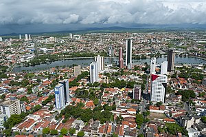
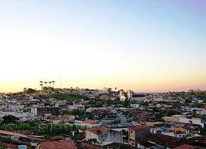
Campina Grande is the second most populous Brazilian city in the State of Paraíba after João Pessoa, the capital. It is considered to be the most important city of the Northeastern Brazilian subregion called agreste. It is considered one of the main industrial, technological and educational centers in the northeastern region of Brazil.

Amigão
Football stadium
Distance: Approx. 2604 meters
Latitude and longitude: -7.25388889,-35.88083333
Estádio Governador Ernani Sátyro, usually known by its nickname Amigão (sometimes called O Amigão), is a multi-purpose stadium in Campina Grande, Brazil. It is currently used mostly for football matches. The stadium holds 35,000.
Estádio Presidente Vargas (Paraíba)
Distance: Approx. 1535 meters
Latitude and longitude: -7.22777778,-35.89472222
Estádio Presidente Vargas is a multi-use stadium located in Campina Grande, Brazil. It is used mostly for football matches and hosts the home matches of Treze Futebol Clube. The stadium has a maximum capacity of 12,000 people and was built in 1940.

Federal University of Campina Grande
Academic publisher
Distance: Approx. 3589 meters
Latitude and longitude: -7.21688889,-35.91055556
The Federal University of Campina Grande (Portuguese: Universidade Federal de Campina Grande, UFCG) is a public university whose main campus is located in the city of Campina Grande, Paraíba, Brazil. Together with the Federal University of Paraíba, it is the main university of the state of Paraíba, Brazil. Established after splitting from UFPB in 2002, it is one of the leading technological and scientific production institutes of northeastern Brazil, being mentioned in a 2001 edition of the Newsweek magazine as a technopole - among 9 other around the world - that represents a new vision for technology.

Historical and Geographic Museum of Campina Grande
Distance: Approx. 1331 meters
Latitude and longitude: -7.21861231,-35.88240339
Historical and Geographic Museum of Campina Grande is a Brazilian museum, and is located in the Floriano Peixoto Avenue, in Campina Grande, Paraíba. The heap of the museum is dedicated to the historical, social and cultural development of the city. It possesses photographs, articles, maps, furniture, weapons, vehicles, jewels, dolls and organized tools to relate the history of the city.

Roman Catholic Diocese of Campina Grande
Catholic ecclesiastical territory
Distance: Approx. 1325 meters
Latitude and longitude: -7.2186,-35.8812
The Roman Catholic Diocese of Campina Grande (Latin: Dioecesis Campinae Grandis) is a suffragan Latin diocese in the ecclesiastical province of Paraíba, in northeastern Brazil. Its cathedral episcopal see is Catedral Nossa Senhora da Conceição, dedicated to the Immaculate Conception, in the city of Campina Grande. It is vacant.

Lagoa Seca
Municipality in South, Brazil
Distance: Approx. 7290 meters
Latitude and longitude: -7.17083,-35.8539
Lagoa Seca is a municipality in the state of Paraíba in the Northeast Region of Brazil.

Campina Grande Airport
Airport in Brazil
Distance: Approx. 4570 meters
Latitude and longitude: -7.26916667,-35.895
Presidente João Suassuna Airport (IATA: CPV, ICAO: SBKG) is the airport serving Campina Grande, Brazil. Since August 2, 1960 it has been named after João Urbano Pessoa de Vasconcelos Suassuna (1886-1930), President of the State of Paraíba (at the time State Governors had the title of President) from 1924 to 1928.

Museum of Popular Arts of Paraíba
Distance: Approx. 742 meters
Latitude and longitude: -7.2242,-35.8789
The Museum of Popular Arts of Paraíba (MAPP) (Portuguese: Museu de Arte Popular da Paraíba), also known as "Three Pandeiros Museum", due to its circular shape, is based in the city of Campina Grande, state of Paraíba, Brazil. It was designed by the architect Oscar Niemeyer, being his last project, and is part of the State University of Paraíba. It was inaugurated December 13, 2012, but officially opened to public visitation in 2014.
TV Borborema
Television station in Paraíba, Brazil
Distance: Approx. 1544 meters
Latitude and longitude: -7.21725,-35.88522222
TV Borborema (channel 8) is a Brazilian television station based in Campina Grande, Paraíba. serving as an affiliate of the SBT television network. It was founded in 1966, being the first television station in the state, and is owned-and-operated by the Fortaleza, Ceará-based Sistema Opinião de Comunicação.
Weather in this IP's area
broken clouds
24 Celsius
24 Celsius
24 Celsius
24 Celsius
1013 hPa
78 %
1013 hPa
955 hPa
10000 meters
4.12 m/s
130 degree
75 %