Country:
Region:
City:
Latitude and Longitude:
Time Zone:
Postal Code:
IP information under different IP Channel
ip-api
Country
Region
City
ASN
Time Zone
ISP
Blacklist
Proxy
Latitude
Longitude
Postal
Route
Luminati
Country
Region
mi
City
southfield
ASN
Time Zone
America/Detroit
ISP
COMERICA-INC
Latitude
Longitude
Postal
IPinfo
Country
Region
City
ASN
Time Zone
ISP
Blacklist
Proxy
Latitude
Longitude
Postal
Route
db-ip
Country
Region
City
ASN
Time Zone
ISP
Blacklist
Proxy
Latitude
Longitude
Postal
Route
ipdata
Country
Region
City
ASN
Time Zone
ISP
Blacklist
Proxy
Latitude
Longitude
Postal
Route
Popular places and events near this IP address

Bingham Farms, Michigan
Village in Michigan, United States
Distance: Approx. 2189 meters
Latitude and longitude: 42.5175,-83.27777778
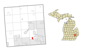
Bingham Farms is a village in Oakland County in the U.S. state of Michigan. A northern suburb of Detroit, Bingham Farms is located within Southfield Township, roughly 20 miles (32.2 km) northwest of downtown Detroit. As of the 2020 census, the village had a population of 1,124.

Franklin, Michigan
Village in Michigan, United States
Distance: Approx. 2446 meters
Latitude and longitude: 42.52,-83.30388889
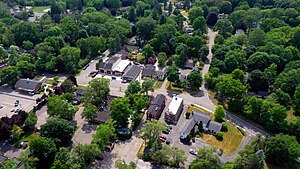
Franklin is a village in Oakland County in the U.S. state of Michigan. A northern suburb of Detroit, Franklin is located within Southfield Township, roughly 20 miles (32.2 km) northwest of downtown Detroit. As of the 2020 census, the village had a population of 3,139.

Detroit Country Day School
Private, day, college preparatory school in Beverly Hills, Michigan, United States
Distance: Approx. 2650 meters
Latitude and longitude: 42.51422222,-83.2645
Detroit Country Day School (also known as DCD, DCDS, or Country Day) is a private, secular school located in three campuses in Oakland County, in the U.S. state of Michigan, north of Detroit. The administrative offices, facility services, safety and security services, and the upper school (Grades 9-12) are situated in a campus in Beverly Hills. The middle school (Grades 4-8) is also located in Beverly Hills, seamlessly connected to the upper school.
Farber Hebrew Day School – Yeshivat Akiva
Religious school in Michigan, United States
Distance: Approx. 3114 meters
Latitude and longitude: 42.50233333,-83.25286111
Yeshivat Akiva is an N-12 Modern Orthodox Religious Zionist day school in Southfield, Michigan, serving Southeast Michigan. It opened in 1964 as an elementary school and shortly thereafter added a middle school (in 1967) and high school (starting in 1971, with a 10th grade). From the start the school has had a strong connection to Israel and for the first two decades the school's 12th grade took place in Israel.
WPXD-TV
Ion Television station in Ann Arbor, Michigan
Distance: Approx. 2564 meters
Latitude and longitude: 42.48361111,-83.31222222
WPXD-TV (channel 31) is a television station licensed to Ann Arbor, Michigan, United States, serving as the Ion Television affiliate for the Detroit area. Owned by Inyo Broadcast Holdings, the station broadcasts from a transmitter on West 11 Mile Road in Southfield, Michigan. Channel 31 in Ann Arbor was inserted in 1973 at the request of Gershom Morningstar, a local resident.
Birmingham Temple
Humanistic Jewish synagogue in Detroit, Michigan, United States
Distance: Approx. 3261 meters
Latitude and longitude: 42.4991,-83.3304
The Birmingham Temple, officially the Congregation for Humanistic Judaism of Metro Detroit, is a Humanistic Jewish congregation and synagogue, located at 8611 West Twelve Mile Road, Farmington Hills, Detroit, Michigan, in the United States. The synagogue was founded in 1963 as the Birmingham Temple in Birmingham, a suburb of Detroit.

American Center
Office/retail in Southfield-Detroit, United States
Distance: Approx. 1329 meters
Latitude and longitude: 42.49,-83.29888889
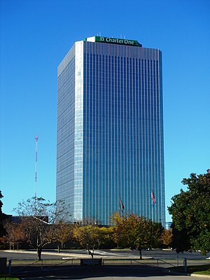
The American Center is a high-rise tower in the Metro Detroit suburb of Southfield, Michigan, built in 1975 as the corporate headquarters for the automaker American Motors Corporation (AMC), which was subsequently acquired by Chrysler Corporation in 1987. The building is located adjacent to Interstate 696, M-10, and US 24 interchange. Upgraded in 2001, the office tower has 27 floors, including a basement, and has been owned and managed since 2017 by Redico, a Southfield-based real estate developer.
Southfield Christian School
Private christian school in Southfield, Michigan, United States
Distance: Approx. 2459 meters
Latitude and longitude: 42.49934,-83.26077
Southfield Christian School (SCS) is a private, college-preparatory Christian school in Southfield, Michigan. It is a ministry of Highland Park Baptist Church for grades PK–12.
Park West Gallery
Commercial art gallery in Michigan, United States
Distance: Approx. 2057 meters
Latitude and longitude: 42.50378,-83.31532
Park West Gallery is a commercial art gallery based in Southfield, Michigan, United States. Park West Gallery claims to be the largest private art gallery in the world, but that is largely disputed, and that it has sold hundreds of works of art for thousands of dollars. It exhibits work from historic artists such as Renoir, Picasso, Rembrandt, and Durer as well as contemporary artists such as Peter Max, Michael Godard and Mark Kostabi.
Tel-Twelve Mall
Shopping mall in Michigan, United States
Distance: Approx. 648 meters
Latitude and longitude: 42.499,-83.283
Tel-Twelve Mall is a shopping mall located in Southfield, Michigan, a suburb of Detroit, Michigan, United States. Developed as an enclosed mall in 1968, it was demolished and rebuilt in 2001 as a power center composed of big box tenants. Its anchor stores include Best Buy, DSW, Lowe's, Meijer, Michaels, Office Depot and PetSmart.
Holy Sepulchre Cemetery (Southfield, Michigan)
Cemetery in Oakland County, Michigan
Distance: Approx. 3281 meters
Latitude and longitude: 42.471569,-83.29963
Holy Sepulchre Cemetery in Southfield, Michigan, is an American cemetery operated by the Roman Catholic Archdiocese of Detroit.

Mother of God Cathedral (Southfield, Michigan)
Church in Michigan, United States
Distance: Approx. 2825 meters
Latitude and longitude: 42.47620556,-83.27987778
Mother of God Cathedral also called Our Lady of Chaldeans is a Chaldean Catholic cathedral located in Southfield, Michigan, United States. It is the seat for the Eparchy of St. Thomas the Apostle of Detroit.
Weather in this IP's area
clear sky
8 Celsius
6 Celsius
6 Celsius
10 Celsius
1020 hPa
81 %
1020 hPa
995 hPa
10000 meters
3.09 m/s
230 degree
07:16:11
17:17:47