170.2.130.234 - IP Lookup: Free IP Address Lookup, Postal Code Lookup, IP Location Lookup, IP ASN, Public IP
Country:
Region:
City:
Location:
Time Zone:
Postal Code:
IP information under different IP Channel
ip-api
Country
Region
City
ASN
Time Zone
ISP
Blacklist
Proxy
Latitude
Longitude
Postal
Route
Luminati
Country
ASN
Time Zone
America/Chicago
ISP
Daimler Truck AG
Latitude
Longitude
Postal
IPinfo
Country
Region
City
ASN
Time Zone
ISP
Blacklist
Proxy
Latitude
Longitude
Postal
Route
IP2Location
170.2.130.234Country
Region
oregon
City
portland
Time Zone
America/Los_Angeles
ISP
Language
User-Agent
Latitude
Longitude
Postal
db-ip
Country
Region
City
ASN
Time Zone
ISP
Blacklist
Proxy
Latitude
Longitude
Postal
Route
ipdata
Country
Region
City
ASN
Time Zone
ISP
Blacklist
Proxy
Latitude
Longitude
Postal
Route
Popular places and events near this IP address
Rosa Parks station (TriMet)
Light rail station in Portland, Oregon, U.S.
Distance: Approx. 626 meters
Latitude and longitude: 45.57,-122.68222222
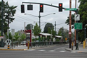
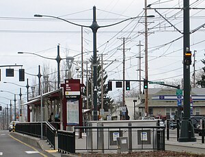
Rosa Parks is a light rail station on the MAX Yellow Line in the Arbor Lodge neighborhood of Portland, Oregon. It is the 6th stop northbound on the Interstate MAX extension. It was originally named North Portland Boulevard, but following the city's decision in fall 2006 to rename Portland Blvd.

North Lombard Transit Center
Distance: Approx. 354 meters
Latitude and longitude: 45.57722222,-122.68222222
North Lombard Transit Center is a light rail station on the MAX Yellow Line in Portland, Oregon. It is the 7th stop northbound on the Interstate MAX extension. The station is located in the median of Interstate Avenue near the intersection with N Lombard Street.

Arbor Lodge, Portland, Oregon
Neighborhood in Portland, Oregon, U.S.
Distance: Approx. 563 meters
Latitude and longitude: 45.57354,-122.69247
Arbor Lodge is a neighborhood in the North section of Portland, Oregon. Interstate 5 forms the eastern boundary of the neighborhood. The south boundary is formed by Ainsworth Street, the west boundary is formed by a combination of Willamette Boulevard and Chataqua Boulevard, and the north boundary is formed by Lombard Street.

Kenton Library
Library in Oregon
Distance: Approx. 863 meters
Latitude and longitude: 45.582813,-122.686719
The Kenton Library is a branch of the Multnomah County Library (MCL), in the Kenton neighborhood of Portland in the U.S. state of Oregon. Preceded by reading rooms in North Portland and later by the Lombard Branch Library, the Kenton Library opened in 2010 in a storefront on North Denver Avenue. The branch offers the MCL catalog of two million books, periodicals and other materials.
Trinity Academy (Portland, Oregon)
Classical christian school in Portland, Oregon, United States
Distance: Approx. 769 meters
Latitude and longitude: 45.576773,-122.676023
Trinity Academy is a private classical Christian middle and high school located in north central Portland, Oregon The school was founded by Roman Catholic and Protestant Christians, though non-Christian students are welcome. Trinity Schools licenses the Trinity School Curriculum to Trinity Academy.

Eagle Portland
Gay bar in Portland, Oregon, U.S.
Distance: Approx. 825 meters
Latitude and longitude: 45.57742,-122.67554
Eagle Portland is a gay bar catering to bears and leather enthusiasts, located in north Portland, Oregon, United States.

Arbor Lodge Park
Public park in Portland, Oregon, U.S.
Distance: Approx. 688 meters
Latitude and longitude: 45.5728,-122.6938
Arbor Lodge Park is a public park in north Portland, Oregon's Arbor Lodge neighborhood, in the United States. The 8.69-acre (3.52 ha) park was acquired in 1940.

Gammans Park
Public park in Portland, Oregon, U.S.
Distance: Approx. 657 meters
Latitude and longitude: 45.575363,-122.694028
Gammans Park is a public park in north Portland, Oregon's Arbor Lodge neighborhood, in the United States. The 1.64-acre (0.66 ha) park was acquired in 1910 when the wife of lawyer George G. Gammans gave the city six lots for a park that would memorialize him.

Kenton Commercial Historic District
Historic district in Portland, Oregon, U.S.
Distance: Approx. 819 meters
Latitude and longitude: 45.5824,-122.6869
The Kenton Commercial Historic District is a historic district in north Portland, Oregon's Kenton neighborhood, in the United States. The district is listed on the National Register of Historic Places.

World Famous Kenton Club
Bar and music venue in Portland, Oregon, U.S.
Distance: Approx. 844 meters
Latitude and longitude: 45.582561,-122.687537
The World Famous Kenton Club, or simply Kenton Club, is a bar and music venue in north Portland, Oregon, United States. The venue was established as the Kenton Club in 1947, and became a biker bar. The "world famous" tagline was acquired after appearing in the film Kansas City Bomber (1972); the venue became known as World Famous Kenton Club, and memorabilia related to the film and its star Raquel Welch are displayed throughout the interior.

Nite Hawk Cafe and Lounge
Restaurant in Portland, Oregon, U.S.
Distance: Approx. 664 meters
Latitude and longitude: 45.56952778,-122.68255556
The Nite Hawk Cafe and Lounge is a restaurant in Portland, Oregon.
Casa Zoraya
Latin American restaurant in Portland, Oregon, U.S.
Distance: Approx. 809 meters
Latitude and longitude: 45.5773,-122.6757
Casa Zoraya is a family-operated Latin American and Peruvian restaurant in Portland, Oregon, United States. It opened in north Portland's Piedmont neighborhood in 2018 and has garnered a positive reception, especially for its ceviches.
Weather in this IP's area
few clouds
10 Celsius
9 Celsius
8 Celsius
12 Celsius
1017 hPa
79 %
1017 hPa
1008 hPa
10000 meters
4.63 m/s
110 degree
20 %
