170.185.101.33 - IP Lookup: Free IP Address Lookup, Postal Code Lookup, IP Location Lookup, IP ASN, Public IP
Country:
Region:
City:
Location:
Time Zone:
Postal Code:
IP information under different IP Channel
ip-api
Country
Region
City
ASN
Time Zone
ISP
Blacklist
Proxy
Latitude
Longitude
Postal
Route
Luminati
Country
Region
ky
City
leitchfield
ASN
Time Zone
America/Chicago
ISP
ENA
Latitude
Longitude
Postal
IPinfo
Country
Region
City
ASN
Time Zone
ISP
Blacklist
Proxy
Latitude
Longitude
Postal
Route
IP2Location
170.185.101.33Country
Region
kentucky
City
leitchfield
Time Zone
America/Chicago
ISP
Language
User-Agent
Latitude
Longitude
Postal
db-ip
Country
Region
City
ASN
Time Zone
ISP
Blacklist
Proxy
Latitude
Longitude
Postal
Route
ipdata
Country
Region
City
ASN
Time Zone
ISP
Blacklist
Proxy
Latitude
Longitude
Postal
Route
Popular places and events near this IP address

Grayson County, Kentucky
County in Kentucky, United States
Distance: Approx. 5434 meters
Latitude and longitude: 37.46,-86.35
Grayson County is a county located in the U.S. state of Kentucky. As of the 2020 census, the population was 26,420. Its county seat is Leitchfield.

Clarkson, Kentucky
City in Kentucky, United States
Distance: Approx. 6493 meters
Latitude and longitude: 37.49472222,-86.22277778
Clarkson is a home rule-class city in Grayson County, Kentucky, United States. The population was 933 at the 2020 census, up from 875 at the 2010 census, Once called "Grayson Springs Depot" after a nearby resort, the name was changed in 1882 to honor the resort's owner, Manoah Clarkson. Clarkson is known for its Honeyfest and is home to The Walter T. Kelley Company, a manufacturer of beekeeping equipment.

Leitchfield, Kentucky
City in Kentucky, United States
Distance: Approx. 402 meters
Latitude and longitude: 37.48361111,-86.29388889
Leitchfield is the county seat of Grayson County, Kentucky, United States. Leitchfield is a home rule-class city with a population of 6,404 as of the 2020 census.
Grayson County High School (Kentucky)
High school in Leitchfield, Kentucky, United States
Distance: Approx. 4276 meters
Latitude and longitude: 37.46333333,-86.3375
Grayson County High School is the only major high school located in Leitchfield, Kentucky, United States. The school is home to approximately 1300 students with a lightly fluctuating population throughout the year. Grayson County High School is home to several accomplished sports teams, including cheerleading, baseball, softball, football, soccer, volleyball, tennis, golf, track, cross country and basketball teams.

St. Augustine Catholic Church (Grayson Springs, Kentucky)
Historic church in Kentucky, United States
Distance: Approx. 6354 meters
Latitude and longitude: 37.45027778,-86.2325
St. Augustine Catholic Church is a parish of the Roman Catholic Church near Clarkson, Kentucky, in the Eastern Deanery of the Diocese of Owensboro. It is noted for its historic parish church at 30 St Augustine Church Road in Grayson Springs.
WKHG
Radio station in Leitchfield, Kentucky
Distance: Approx. 3509 meters
Latitude and longitude: 37.51111111,-86.2875
WKHG (104.9 FM) is a radio station broadcasting a hot adult contemporary format. Licensed to Leitchfield, Kentucky, United States, the station is currently owned by Heritage Media of Kentucky, Inc., and features programming from Fox News Radio and Fox Sports Radio.
WMTL
Radio station in Leitchfield, Kentucky
Distance: Approx. 3509 meters
Latitude and longitude: 37.51111111,-86.2875
WMTL (870 AM) is a radio station broadcasting a country music format. Licensed to Leitchfield, Kentucky, United States, the station is owned by Heritage Media of Kentucky, Inc. It features programming from Fox News Radio and Fox Sports Radio.

Hunter House (Leitchfield, Kentucky)
Historic house in Kentucky, United States
Distance: Approx. 183 meters
Latitude and longitude: 37.48138889,-86.295
The Hunter House, located at 118 W. Walnut St. in Leitchfield, Kentucky, was built in c.1886. It was listed on the National Register of Historic Places in 1985.

Grayson Springs (resort)
United States historic place
Distance: Approx. 6494 meters
Latitude and longitude: 37.46027778,-86.22472222
Grayson Springs, or Grayson Springs Inn and Resort, in Grayson County, Kentucky south of Clarkson, dates from 1825. It was listed on the National Register of Historic Places in 1978. The listing included one contributing site and one contributing building.

The Cedars (Leitchfield, Kentucky)
United States historic place
Distance: Approx. 3299 meters
Latitude and longitude: 37.47444444,-86.25722222
The Cedars, on Grayson Springs Road in Grayson County, Kentucky east of Leitchfield, was built in c.1789 and 1847. It was listed on the National Register of Historic Places in 1976. The main block of the brick house, Greek Revival in style, was built by Benjamin Lone Rogers in 1847.

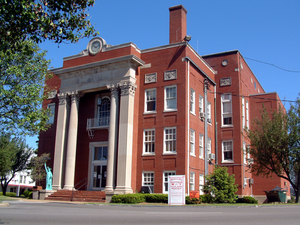
Court Square Historic District, Leitchfield
Historic district in Kentucky, United States
Distance: Approx. 1 meters
Latitude and longitude: 37.48,-86.29388889
The Court Square Historic District in Leitchfield, Kentucky was listed on the National Register of Historic Places in 1984. The initial listing included 29 contributing buildings, including the 1935 Grayson County Courthouse, on 10 acres (4.0 ha). The listing was expanded in 1988 to add two more contributing buildings and two contributing objects.
Jack Thomas House
United States historic place
Distance: Approx. 124 meters
Latitude and longitude: 37.48,-86.2925
The Jack Thomas House, at 108 E. Main St. in Leitchfield, Kentucky was built in 1810. It was listed on the National Register of Historic Places in 1976.
Weather in this IP's area
overcast clouds
1 Celsius
-1 Celsius
1 Celsius
1 Celsius
1016 hPa
84 %
1016 hPa
990 hPa
7075 meters
1.34 m/s
3.58 m/s
265 degree
89 %

