170.178.138.228 - IP Lookup: Free IP Address Lookup, Postal Code Lookup, IP Location Lookup, IP ASN, Public IP
Country:
Region:
City:
Location:
Time Zone:
Postal Code:
IP information under different IP Channel
ip-api
Country
Region
City
ASN
Time Zone
ISP
Blacklist
Proxy
Latitude
Longitude
Postal
Route
Luminati
Country
Region
tn
City
lynchburg
ASN
Time Zone
America/Chicago
ISP
MOTLOW
Latitude
Longitude
Postal
IPinfo
Country
Region
City
ASN
Time Zone
ISP
Blacklist
Proxy
Latitude
Longitude
Postal
Route
IP2Location
170.178.138.228Country
Region
tennessee
City
tullahoma
Time Zone
America/Chicago
ISP
Language
User-Agent
Latitude
Longitude
Postal
db-ip
Country
Region
City
ASN
Time Zone
ISP
Blacklist
Proxy
Latitude
Longitude
Postal
Route
ipdata
Country
Region
City
ASN
Time Zone
ISP
Blacklist
Proxy
Latitude
Longitude
Postal
Route
Popular places and events near this IP address

Tullahoma, Tennessee
City in Tennessee, United States
Distance: Approx. 248 meters
Latitude and longitude: 35.36861111,-86.21333333
Tullahoma is a city in Coffee and Franklin counties in southern Middle Tennessee, United States. The population was 20,339 at the 2020 census. In 2019, the population was estimated to be 19,555.
George Dickel
Brand of whisky produced in the State of Tennessee
Distance: Approx. 8163 meters
Latitude and longitude: 35.43861111,-86.24472222
George Dickel is a brand of Tennessee whisky produced in Tullahoma, in Coffee County, Tennessee. Today owned by Diageo, the modern brand was introduced in 1964, though the distillery has a longer history. Whisky production and aging takes place at the Cascade Hollow Distillery, which offers tours to the public and is part of the American Whiskey Trail.

Tullahoma campaign
Military campaign of the American Civil War
Distance: Approx. 924 meters
Latitude and longitude: 35.3621,-86.2117
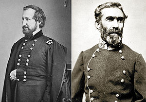
The Tullahoma campaign (or Middle Tennessee campaign) was a military operation conducted from June 24 to July 3, 1863, by the Union Army of the Cumberland under Maj. Gen. William Rosecrans, and is regarded as one of the most brilliant maneuvers of the American Civil War.
Motlow State Community College
Multi-campus sollege in middle Tennessee, US
Distance: Approx. 8023 meters
Latitude and longitude: 35.3658,-86.2999
Motlow State Community College is a public community college with multiple locations in southern Middle Tennessee. The main campus opened its facilities in 1969 and is located in Moore County on 187 acres of land donated by the late Senator Reagor Motlow and family. Motlow College also has learning centers in Fayetteville, McMinnville and Smyrna, a teaching site in Sparta and a partnership in Shelbyville at the Middle Tennessee Education Center.
Tullahoma Regional Airport
Airport
Distance: Approx. 3349 meters
Latitude and longitude: 35.38,-86.24666667
Tullahoma Regional Airport (IATA: THA, ICAO: KTHA, FAA LID: THA), also known as William Northern Field and Soesbe-Martin Field, is a public use airport in Coffee County, Tennessee, United States. It is owned by the City of Tullahoma and located two nautical miles (4 km) northwest of its central business district. This airport is included in the National Plan of Integrated Airport Systems for 2011–2015, which categorized it as a general aviation facility.
Tullahoma High School
Public high school in Tullahoma, Coffee, Tennessee, United States
Distance: Approx. 886 meters
Latitude and longitude: 35.3715,-86.22137
Tullahoma High School is a public high school located in Tullahoma, Coffee County, Tennessee. It is operated by the Tullahoma City Schools.
WFTZ
Radio station in Manchester, Tennessee
Distance: Approx. 6831 meters
Latitude and longitude: 35.3975,-86.14416667
WFTZ (101.5 FM "Rooster 101.5") is a radio station broadcasting a hot adult contemporary format. Licensed to Manchester, Tennessee, United States, it serves Coffee County and surrounding counties. It first began broadcasting in 1992.
WHMT
Radio station in Tullahoma, Tennessee
Distance: Approx. 3195 meters
Latitude and longitude: 35.34333333,-86.2
WHMT (740 AM, "Whiskey Country") is a radio station broadcasting a country music format. Licensed to Tullahoma, Tennessee, United States, the station is currently owned by Peter Bowman, through licensee Bowman Broadcasting, LLC. The station is named for its close proximity to prominent whiskey Distilleries in the area.
WKTH
Radio station in Tullahoma, Tennessee
Distance: Approx. 4155 meters
Latitude and longitude: 35.34058333,-86.18416667
WKTH (88.5 FM) is a K-Love affiliated radio station licensed to the city of Tullahoma, Tennessee. It is owned by Educational Media Foundation. The station broadcasts at 88.5 FM with an effective radiated power output of 1,900 watts as authorized by the Federal Communications Commission.

L.D. Hickerson House
United States historic place
Distance: Approx. 561 meters
Latitude and longitude: 35.36555556,-86.21
The L.D. Hickerson House is a historic house in Tullahoma, Tennessee. It was built in 1895 for Lytle David Hickerson, the founding president of the McMinnville & Manchester Railroad and the First National Bank. It was designed in the Stick-Eastlake style.
Beechcraft Heritage Museum
Aviation museum in Tullahoma, Tennessee
Distance: Approx. 2990 meters
Latitude and longitude: 35.37218,-86.244569
The Beechcraft Heritage Museum is an aviation museum at the Tullahoma Regional Airport in Tullahoma, Tennessee. It is focused on the history of the Beech Aircraft Corporation.
Weather in this IP's area
broken clouds
9 Celsius
8 Celsius
8 Celsius
10 Celsius
1012 hPa
93 %
1012 hPa
973 hPa
10000 meters
2.57 m/s
230 degree
75 %
