170.167.255.183 - IP Lookup: Free IP Address Lookup, Postal Code Lookup, IP Location Lookup, IP ASN, Public IP
Country:
Region:
City:
Location:
Time Zone:
Postal Code:
ISP:
ASN:
language:
User-Agent:
Proxy IP:
Blacklist:
IP information under different IP Channel
ip-api
Country
Region
City
ASN
Time Zone
ISP
Blacklist
Proxy
Latitude
Longitude
Postal
Route
db-ip
Country
Region
City
ASN
Time Zone
ISP
Blacklist
Proxy
Latitude
Longitude
Postal
Route
IPinfo
Country
Region
City
ASN
Time Zone
ISP
Blacklist
Proxy
Latitude
Longitude
Postal
Route
IP2Location
170.167.255.183Country
Region
washington
City
issaquah
Time Zone
America/Los_Angeles
ISP
Language
User-Agent
Latitude
Longitude
Postal
ipdata
Country
Region
City
ASN
Time Zone
ISP
Blacklist
Proxy
Latitude
Longitude
Postal
Route
Popular places and events near this IP address

Issaquah, Washington
City in Washington, United States
Distance: Approx. 1912 meters
Latitude and longitude: 47.53555556,-122.04333333
Issaquah ( ISS-ə-kwah) is a city in King County, Washington, United States. The population was 40,051 at the 2020 census. Located in a valley and bisected by Interstate 90, the city is bordered by the Sammamish Plateau to the north and the "Issaquah Alps" to the south.

KNHC
Radio station in Seattle, Washington
Distance: Approx. 3222 meters
Latitude and longitude: 47.54305556,-122.10694444
KNHC (89.5 FM) is a Class C1 high school radio station based in Seattle, Washington. It is the world's oldest, still remaining, dance music station. C89.5 offers a hybrid of current-based EDM product and Rhythmic Top 40 remixes, as well as new dance songs that are potential future hits – all of which are presented in a Top 40-like direction.

Issaquah High School
Public four-year educational institution in Washington, United States
Distance: Approx. 3098 meters
Latitude and longitude: 47.5223,-122.0288
Issaquah High School (also known as IHS or Issaquah) is a four-year public secondary school in Issaquah, Washington, United States, a suburb east of Seattle. It is one of three high schools in the Issaquah School District and serves students in grades 9–12 from the central portion of the district. Issaquah High serves the cities of Issaquah, Sammamish, and Bellevue.
Cougar Mountain Regional Wildland Park
Park in King County, Washington, US
Distance: Approx. 2103 meters
Latitude and longitude: 47.52083333,-122.09138889
Cougar Mountain Regional Wildland Park is a regional park in King County, Washington, near the towns of Bellevue and Issaquah. The park was established in June 1983 to protect the central core of Cougar Mountain, the park covers 3,115 acres (12.61 km2) with 38 miles (61 km) of hiking trails and 12 miles (19 km) of equestrian trails.
Issaquah School District
School district in Washington state
Distance: Approx. 3039 meters
Latitude and longitude: 47.55444444,-122.04694444
Issaquah School District No. 411 is a public school district in King County, Washington. It is headquartered in Issaquah, Washington.

Issaquah Valley Trolley
Distance: Approx. 2431 meters
Latitude and longitude: 47.53111111,-122.03555556
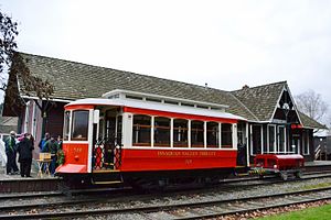
The Issaquah Valley Trolley (IVT) was a heritage streetcar line in Issaquah, Washington, United States. It was a project of the Issaquah History Museums (formerly known as the Issaquah Historical Society). The IVT operated from the Issaquah Depot Museum building located at 78 First Ave, NE. The service operated on a trial basis in 2001–02 and then on a regular basis, seasonally, from 2012 to 2020.
Attack on Squak Valley Chinese laborers, 1885
Distance: Approx. 2093 meters
Latitude and longitude: 47.53636667,-122.04116944
The Attack on Squak Valley Chinese laborers took place on September 7, 1885, in Squak Valley (now called Issaquah), Washington Territory, when a group of men fired their guns into several tents where a group of Chinese hop pickers were sleeping. The gunfire resulted in the death of three Chinese men and the wounding of three others. The attackers were later identified and brought to trial, but all were acquitted.

Cougar Mountain Zoo
Zoo in Washington, U.S.
Distance: Approx. 2619 meters
Latitude and longitude: 47.55299,-122.08069
Cougar Mountain Zoo is an 11-acre (4.5 ha) non-profit zoological park located in Issaquah, Washington, on the north slope of Cougar Mountain about 15 miles (24 km) east of Seattle. It is located near the border of the Cougar Mountain Regional Wildland Park. The zoo focuses on endangered species including lemurs from Madagascar, Bengal tigers, and endangered birds from various parts of the world.
Cougar Mountain
Mountain in Washington, United States
Distance: Approx. 2260 meters
Latitude and longitude: 47.52027778,-122.09333333
Cougar Mountain is a peak in the Issaquah Alps in King County, Washington. It is part of the highlands in the Eastside suburbs of Seattle, and at 1,614 feet (492 m) it is the lowest and westernmost of the Alps. About two-thirds of Cougar Mountain has experienced residential development, and is home to many neighborhood communities such as Lakemont.

Issaquah station
United States historic place
Distance: Approx. 2442 meters
Latitude and longitude: 47.53105556,-122.03541667
Issaquah station, also known as Issaquah Depot or the Seattle, Lake Shore and Eastern Railway Depot, is a former railway station located in Issaquah, Washington, listed on the National Register of Historic Places. It was built in 1889 as a passenger station and freight warehouse for the Seattle, Lake Shore and Eastern Railway (SLS&E), serving what was then known as Gilman, Washington (and as Squak Valley until 1888). The town was renamed Issaquah around the turn of the century.

Pickering Farm
Historic barn and farm in Issaquah, Washington, U.S.
Distance: Approx. 2531 meters
Latitude and longitude: 47.55,-122.04916667
Pickering Farm is a former farm located in Issaquah, Washington listed on the National Register of Historic Places. It has been the site for a farmer's market since the late 1990s. Pickering Barn is available for rental.
Gibson Ek High School
Distance: Approx. 2573 meters
Latitude and longitude: 47.5267,-122.0343
Gibson Ek High School is a four-year public secondary school in Issaquah, Washington, United States, a suburb east of Seattle. It is one of five high schools in the Issaquah School District. It opened in the fall of 2016 at the previous location of Issaquah Middle School.
Weather in this IP's area
clear sky
8 Celsius
7 Celsius
6 Celsius
10 Celsius
1020 hPa
60 %
1020 hPa
1001 hPa
10000 meters
2.57 m/s
330 degree
