170.150.98.78 - IP Lookup: Free IP Address Lookup, Postal Code Lookup, IP Location Lookup, IP ASN, Public IP
Country:
Region:
City:
Location:
Time Zone:
Postal Code:
ISP:
ASN:
language:
User-Agent:
Proxy IP:
Blacklist:
IP information under different IP Channel
ip-api
Country
Region
City
ASN
Time Zone
ISP
Blacklist
Proxy
Latitude
Longitude
Postal
Route
db-ip
Country
Region
City
ASN
Time Zone
ISP
Blacklist
Proxy
Latitude
Longitude
Postal
Route
IPinfo
Country
Region
City
ASN
Time Zone
ISP
Blacklist
Proxy
Latitude
Longitude
Postal
Route
IP2Location
170.150.98.78Country
Region
rio de janeiro
City
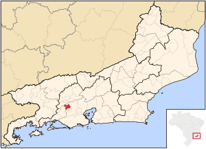
engenheiro nicanor pereira
Time Zone
America/Sao_Paulo
ISP
Language
User-Agent
Latitude
Longitude
Postal
ipdata
Country
Region
City
ASN
Time Zone
ISP
Blacklist
Proxy
Latitude
Longitude
Postal
Route
Popular places and events near this IP address

Engenheiro Paulo de Frontin, Rio de Janeiro
Municipality in Southeast, Brazil
Distance: Approx. 8731 meters
Latitude and longitude: -22.55,-43.67777778
Engenheiro Paulo de Frontin (Portuguese pronunciation: [ẽʒẽˈɲe(j)ɾu ˈpawlu dʒi fɾõˈtʃĩ]) is a municipality located in the Brazilian state of Rio de Janeiro. Its population was 14,071 (2020) and its area is 139 km².

Japeri
Municipality in Southeast, Brazil
Distance: Approx. 5737 meters
Latitude and longitude: -22.64305556,-43.65333333
Japeri (Portuguese pronunciation: [ʒapeˈɾi]) is a municipality in the state of Rio de Janeiro, southeast region of Brazil. This city was founded on June 30, 1991. Is very known to be located next to the last station of the largest branch of the railroad of Brazil (Central do Brasil), whose image has been stamps in Brazil.

Paracambi
Municipality in Southeast, Brazil
Distance: Approx. 1533 meters
Latitude and longitude: -22.61083333,-43.70888889
Paracambi (Portuguese pronunciation: [paɾakɐ̃ˈbi]) is a municipality located in the Brazilian state of Rio de Janeiro. Its population was 52,683 (2020) and its area is 179 km2.
Ribeirão das Lajes
River in Brazil
Distance: Approx. 2923 meters
Latitude and longitude: -22.65,-43.7
The Ribeirão das Lajes is a river of Rio de Janeiro state in southeastern Brazil.
Santana River (Rio de Janeiro)
River in Brazil
Distance: Approx. 2923 meters
Latitude and longitude: -22.65,-43.7
The Santana River is a river of Rio de Janeiro state in southeastern Brazil.
São Pedro River (Guandu River tributary)
River in Brazil
Distance: Approx. 8430 meters
Latitude and longitude: -22.660264,-43.633154
The São Pedro River is a river of Rio de Janeiro state in southeastern Brazil. It is a tributary of the Guandu River. The 2,353 hectares (5,810 acres) Jaceruba Environmental Protection Area in the municipality of Nova Iguaçu was created in 2002 with objectives that included protection and preservation of the forests, springs and headwaters of the São Pedro River basin.
Weather in this IP's area
broken clouds
37 Celsius
39 Celsius
37 Celsius
37 Celsius
1011 hPa
34 %
1011 hPa
975 hPa
10000 meters
3.59 m/s
4.19 m/s
11 degree
58 %