170.150.222.133 - IP Lookup: Free IP Address Lookup, Postal Code Lookup, IP Location Lookup, IP ASN, Public IP
Country:
Region:
City:
Location:
Time Zone:
Postal Code:
IP information under different IP Channel
ip-api
Country
Region
City
ASN
Time Zone
ISP
Blacklist
Proxy
Latitude
Longitude
Postal
Route
Luminati
Country
Region
pa
City
tucuma
ASN
Time Zone
America/Belem
ISP
S.O.S. TELECOM LTDA
Latitude
Longitude
Postal
IPinfo
Country
Region
City
ASN
Time Zone
ISP
Blacklist
Proxy
Latitude
Longitude
Postal
Route
IP2Location
170.150.222.133Country
Region
para
City
sao felix do xingu
Time Zone
America/Belem
ISP
Language
User-Agent
Latitude
Longitude
Postal
db-ip
Country
Region
City
ASN
Time Zone
ISP
Blacklist
Proxy
Latitude
Longitude
Postal
Route
ipdata
Country
Region
City
ASN
Time Zone
ISP
Blacklist
Proxy
Latitude
Longitude
Postal
Route
Popular places and events near this IP address

Fresco River
River in Pará, Brazil
Distance: Approx. 845 meters
Latitude and longitude: -6.645151,-52.002631
The Fresco River is a river of Pará state in north-central Brazil. It is a right tributary of Xingu River, which it joins at São Félix do Xingu. The Fresco River is a blackwater river.

São Félix do Xingu
Municipality in Northern, Brazil
Distance: Approx. 1807 meters
Latitude and longitude: -6.63333333,-51.98333333
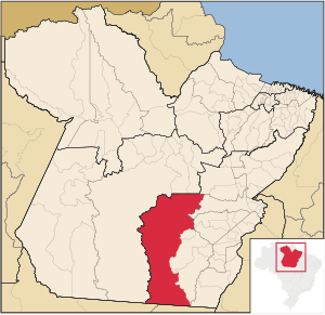
São Félix do Xingu is a municipality in the state of Pará in the Northern region of Brazil. The city is served by São Félix do Xingu Airport. With an area of 84,212.932 km2 (32,514.795 sq mi), it is the third largest municipality in Pará and the sixth largest in Brazil.
São Félix do Xingu Airport
Airport
Distance: Approx. 4744 meters
Latitude and longitude: -6.64138889,-51.95222222
São Félix do Xingu Airport (IATA: SXX, ICAO: SNFX) is the airport serving São Félix do Xingu, Brazil.
Weather in this IP's area
broken clouds
24 Celsius
25 Celsius
24 Celsius
24 Celsius
1011 hPa
91 %
1011 hPa
980 hPa
10000 meters
0.39 m/s
0.1 m/s
148 degree
66 %