170.0.82.251 - IP Lookup: Free IP Address Lookup, Postal Code Lookup, IP Location Lookup, IP ASN, Public IP
Country:
Region:
City:
Location:
Time Zone:
Postal Code:
IP information under different IP Channel
ip-api
Country
Region
City
ASN
Time Zone
ISP
Blacklist
Proxy
Latitude
Longitude
Postal
Route
Luminati
Country
Region
lim
City
limaregion
ASN
Time Zone
America/Lima
ISP
GTD PERU S.A
Latitude
Longitude
Postal
IPinfo
Country
Region
City
ASN
Time Zone
ISP
Blacklist
Proxy
Latitude
Longitude
Postal
Route
IP2Location
170.0.82.251Country
Region
ancash
City
chimbote
Time Zone
America/Lima
ISP
Language
User-Agent
Latitude
Longitude
Postal
db-ip
Country
Region
City
ASN
Time Zone
ISP
Blacklist
Proxy
Latitude
Longitude
Postal
Route
ipdata
Country
Region
City
ASN
Time Zone
ISP
Blacklist
Proxy
Latitude
Longitude
Postal
Route
Popular places and events near this IP address

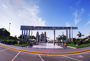
Chimbote
Place in Ancash, Peru
Distance: Approx. 2062 meters
Latitude and longitude: -9.07454444,-78.59357222
Chimbote [tʃimˈbote] ; Quechua: Chimputi) is the largest city in the Ancash Region and the 10th largest city in Peru. With a population of 425,367, it is the capital of both Santa Province and Chimbote District. The city is located on the coast in Ferrol Bay, 130 km south of Trujillo and 420 kilometers (260 mi) north of Lima on the North Pan-American highway.
Tnte. FAP Jaime Montreuil Morales Airport
Airport in Peru
Distance: Approx. 9381 meters
Latitude and longitude: -9.15,-78.52361111
Teniente FAP Jaime Montreuil Morales Airport (IATA: CHM, ICAO: SPEO) is an airport serving Chimbote, in the Ancash Region of Peru. It is operated by the civil government and handles many government planes.
Estadio Manuel Gómez Arellano
Distance: Approx. 2639 meters
Latitude and longitude: -9.06444444,-78.58972222
Estadio Manuel Gómez Arellano was a multi-use stadium in Chimbote (Ancash, Peru). It is no longer used by football team José Gálvez FBC. The stadium held 15,000 people. It was replaced by Estadio Olímpico Municipal in 2007.

Santa province
Province in Ancash, Peru
Distance: Approx. 2398 meters
Latitude and longitude: -9.08305556,-78.6
Santa is one of twenty provinces of the Ancash Region in Peru. The province of Santa was created on February 12, 1821. Its capital, Chimbote, that long time ago became the first fishing port of the world, is the most important city of the coastal zone of Ancash.

Isla Blanca (Santa)
Distance: Approx. 5247 meters
Latitude and longitude: -9.105,-78.62166667
Isla Blanca or Blanca Island is a volcanic island located at the mouth of Chimbote Bay, near Chimbote, Peru. Administratively it is in Chimbote District, Santa Province, Ancash Region. The island is approximately 3200 m long and 920 m wide.

Chimbote District
District in Ancash, Peru
Distance: Approx. 2398 meters
Latitude and longitude: -9.08305556,-78.6
Chimbote District is one of nine districts of the Santa Province in Peru.
Estadio Manuel Rivera Sánchez
Distance: Approx. 2576 meters
Latitude and longitude: -9.10001,-78.560207
Estadio Municipal Centenario Manuel Rivera Sánchez is a multi-purpose stadium in Chimbote, Peru. It was inaugurated on June 30, 2007 with a friendly game between the Peru U-17 national football team and the Colombia U-17 national football team. Peru lost 4–2.

Coishco District
District in Ancash, Peru
Distance: Approx. 8049 meters
Latitude and longitude: -9.02305556,-78.61555556
Coishco District is one of nine districts of the Santa Province in Peru.
Nuevo Chimbote District
District in Ancash, Peru
Distance: Approx. 6585 meters
Latitude and longitude: -9.12138889,-78.53083333
The district of Nuevo Chimbote is one of the nine that make up the province of Santa, located in the department of Ancash in Peru.
Catholic University Los Angeles of Chimbote
Distance: Approx. 1696 meters
Latitude and longitude: -9.0771,-78.5913
Catholic University Los Angeles of Chimbote (Universidad Católica Los Ángeles de Chimbote; Uladech Católica or Uladech) is a Catholic university in Chimbote, Peru. The university's rector as of 2013 is Ing. Dr.
Weather in this IP's area
overcast clouds
24 Celsius
25 Celsius
24 Celsius
24 Celsius
1013 hPa
70 %
1013 hPa
1012 hPa
10000 meters
3.79 m/s
3.08 m/s
205 degree
100 %
