Country:
Region:
City:
Latitude and Longitude:
Time Zone:
Postal Code:
IP information under different IP Channel
ip-api
Country
Region
City
ASN
Time Zone
ISP
Blacklist
Proxy
Latitude
Longitude
Postal
Route
Luminati
Country
Region
mex
City
ciudadnicolasromero
ASN
Time Zone
America/Mexico_City
ISP
Tu Casa Inalambrica de Mexico
Latitude
Longitude
Postal
IPinfo
Country
Region
City
ASN
Time Zone
ISP
Blacklist
Proxy
Latitude
Longitude
Postal
Route
db-ip
Country
Region
City
ASN
Time Zone
ISP
Blacklist
Proxy
Latitude
Longitude
Postal
Route
ipdata
Country
Region
City
ASN
Time Zone
ISP
Blacklist
Proxy
Latitude
Longitude
Postal
Route
Popular places and events near this IP address

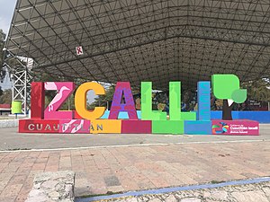
Cuautitlán Izcalli
City & Municipality in State of Mexico, Mexico
Distance: Approx. 8073 meters
Latitude and longitude: 19.65,-99.25
Cuautitlán Izcalli (Spanish pronunciation: [kwawtiˈtlan isˈkaʎi]) is a city and one of the 125 municipalities that make up the State of Mexico. Its municipal seat is Cuautitlán Izcalli. It is located in the Valley of Mexico area, and is part of the Metropolitan area of Mexico City.

Atizapán de Zaragoza
Municipality in State of Mexico, Mexico
Distance: Approx. 6618 meters
Latitude and longitude: 19.56111111,-99.24694444
Atizapán de Zaragoza is a municipality, in State of Mexico in Mexico. The municipality covers an area of 91.07 km2. In 2010, the municipality had a total population of 489,937.
Ciudad López Mateos
City in State of Mexico, Mexico
Distance: Approx. 5208 meters
Latitude and longitude: 19.55,-99.28333333
Ciudad López Mateos (most commonly called "Atizapán") is a city in the State of Mexico, Mexico, and the municipal seat of the municipality called Atizapán de Zaragoza. The city was previously named San Francisco Atizapán, but the official name was changed after president Adolfo López Mateos, who was born in that town. However, the city is still commonly known as Atizapán.

Ciudad Nicolás Romero
City and municipality in State of Mexico, Mexico
Distance: Approx. 7170 meters
Latitude and longitude: 19.58333333,-99.36666667
Ciudad Nicolás Romero is the largest city and municipal seat of the municipality of Nicolás Romero in the State of Mexico, Mexico. It is located 58 km from the city of Toluca, the state capital and lies in the north-central part of the state, just northwest of the Federal District (Mexico City). The seat/municipality's current name is to honor Nicolás Romero, who fought for Benito Juárez during the Reform War and the French intervention in Mexico.

Colegio Alemán Alexander von Humboldt (Mexico City)
Distance: Approx. 9612 meters
Latitude and longitude: 19.51444444,-99.26444444
Colegio Alemán Alexander von Humboldt, A. C. (German: Deutsche Schule Mexiko-Stadt) is a network of German-language primary and secondary schools based in Greater Mexico City. There are three campuses under a single school board, with each campus acting autonomously. As of 2010, the institution together is the largest German school outside of Germany.
Instituto Tecnológico de Estudios Superiores de Monterrey (Campus Estado de México)
Distance: Approx. 7364 meters
Latitude and longitude: 19.5959,-99.2291
“Instituto Tecnológico de Estudios Superiores Monterrey, Campus Estado de Mexico (known also as Tec CEM) is one of the campus of the “Instituto Tecnológico y de Estudios Superiores Monterrey”. It is located in the Atizapán de Zaragoza Municipality, in Mexico State. There are about 10,000 students between high school, college, and postgraduate studies.
Weather in this IP's area
overcast clouds
14 Celsius
13 Celsius
7 Celsius
14 Celsius
1012 hPa
68 %
1012 hPa
768 hPa
10000 meters
1.3 m/s
1.53 m/s
235 degree
95 %
06:47:40
17:57:37
