Country:
Region:
City:
Latitude and Longitude:
Time Zone:
Postal Code:
IP information under different IP Channel
ip-api
Country
Region
City
ASN
Time Zone
ISP
Blacklist
Proxy
Latitude
Longitude
Postal
Route
Luminati
Country
ASN
Time Zone
Africa/Johannesburg
ISP
Desktop-Network-Solutions
Latitude
Longitude
Postal
IPinfo
Country
Region
City
ASN
Time Zone
ISP
Blacklist
Proxy
Latitude
Longitude
Postal
Route
db-ip
Country
Region
City
ASN
Time Zone
ISP
Blacklist
Proxy
Latitude
Longitude
Postal
Route
ipdata
Country
Region
City
ASN
Time Zone
ISP
Blacklist
Proxy
Latitude
Longitude
Postal
Route
Popular places and events near this IP address
Greenstone Hill
Place in Gauteng, South Africa
Distance: Approx. 3140 meters
Latitude and longitude: -26.118,28.156
Greenstone Hill is a suburb on the East Rand in the City of Johannesburg Metropolitan Municipality in the Gauteng province of South Africa. It is in-between Edenvale to the south and Modderfontein to the north.

Kelvin Power Station
Power plant in South Africa
Distance: Approx. 4085 meters
Latitude and longitude: -26.11611111,28.19388889
Kelvin Power Station is a coal-fired power station, located in Gauteng near OR Tambo International Airport. Kelvin is one of only a few power stations in South Africa not owned by Eskom. Until 2001 the power station was the property of the City of Johannesburg, but it has since been privatised, resold a number of times, and is currently owned by Investec and Nedbank Capital.
Cresslawn
Place in Gauteng, South Africa
Distance: Approx. 4637 meters
Latitude and longitude: -26.11166667,28.20444444
Cresslawn is a suburb of Kempton Park, in Gauteng province, South Africa. The suburb has a primary school named Cresslawn Primary School, that was established in 1980.

Marlboro (Gautrain station)
Railway station near Johannesburg, South Africa
Distance: Approx. 5349 meters
Latitude and longitude: -26.0836,28.1114
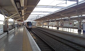
Marlboro is a metro station on the Gautrain rapid transit system in Marlboro, Gauteng. It opened on 8 June 2010 with service to OR Tambo International Airport.
Edleen
Place in Gauteng, South Africa
Distance: Approx. 4176 meters
Latitude and longitude: -26.093,28.206
Edleen is a suburb in western Kempton Park, in Gauteng province, South Africa.
Esther Park
Place in Gauteng, South Africa
Distance: Approx. 2766 meters
Latitude and longitude: -26.1,28.19
Esther Park, also spelt Estherpark, is a suburb of Kempton Park, in Gauteng province, South Africa. It is west of the city centre.
Modderfontein Stadium
Sports venue in South Africa
Distance: Approx. 994 meters
Latitude and longitude: -26.099357,28.167143
Modderfontein Stadium is a multi-use stadium situated in Modderfontein, which is a part of the Johannesburg Municipality, in the Gauteng province in South Africa. Currently, it is mostly used to host football matches.
Modderfontein (East Rand)
Place in Gauteng, South Africa
Distance: Approx. 748 meters
Latitude and longitude: -26.0845,28.1669
Modderfontein is a small town on the East Rand of Gauteng, South Africa. It began as a mining town adjacent to the Mud River, hence its name which is Afrikaans for "mud spring" or "fountain". It is located in the City of Johannesburg Metropolitan Municipality, adjacent to Kempton Park in the neighbouring City of Ekurhuleni Metropolitan Municipality.
Lombardy East
Residential suburb of eastern Johannesburg, South Africa
Distance: Approx. 5075 meters
Latitude and longitude: -26.1146,28.121
Lombardy East is a residential suburb of eastern Johannesburg, South Africa. It is located in Region E of the City of Johannesburg Metropolitan Municipality.
Lakeside, Johannesburg
Place in Gauteng, South Africa
Distance: Approx. 2268 meters
Latitude and longitude: -26.09916667,28.14361111
Lakeside is a suburb of Johannesburg, South Africa. It is located adjacent to Modderfontein in the City of Johannesburg Metropolitan Municipality.
Kempton Park West
Place in Gauteng, South Africa
Distance: Approx. 2327 meters
Latitude and longitude: -26.0858,28.1869
Kempton Park West is a suburb of Kempton Park, in Gauteng province, South Africa.
Terenure, Kempton Park
Place in Gauteng, South Africa
Distance: Approx. 3314 meters
Latitude and longitude: -26.08333333,28.19638889
Terenure is a suburb of Kempton Park, in Gauteng province, South Africa. According to the 2011 census, Terenure and Terenure Extension had a population of 4,144 and 6,579 respectively.
Weather in this IP's area
scattered clouds
18 Celsius
18 Celsius
17 Celsius
19 Celsius
1017 hPa
80 %
1017 hPa
845 hPa
10000 meters
3.5 m/s
9.19 m/s
26 degree
39 %
05:13:30
18:28:46