Country:
 Democratic Republic of the Congo
Region:
City:
Latitude and Longitude:
Time Zone:
Postal Code:
IP information under different IP Channel
ip-api
Country
Region
City
ASN
Time Zone
ISP
Blacklist
Proxy
Latitude
Longitude
Postal
Route
IPinfo
Country
Region
City
ASN
Time Zone
ISP
Blacklist
Proxy
Latitude
Longitude
Postal
Route
MaxMind
Country
Region
City
ASN
Time Zone
ISP
Blacklist
Proxy
Latitude
Longitude
Postal
Route
Luminati
Country
CDRegion
hk
City
lubumbashi
ASN
Time Zone
Africa/Lubumbashi
ISP
ORANGE-RDC
Latitude
Longitude
Postal
db-ip
Country
Region
City
ASN
Time Zone
ISP
Blacklist
Proxy
Latitude
Longitude
Postal
Route
ipdata
Country
Region
City
ASN
Time Zone
ISP
Blacklist
Proxy
Latitude
Longitude
Postal
Route
Popular places and events near this IP address

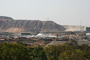
Lubumbashi
Second-largest city in the Democratic Republic of the Congo
Distance: Approx. 881 meters
Latitude and longitude: -11.66416667,27.48277778
Lubumbashi (former names: Élisabethville (French); (Dutch)) is the second-largest city in the Democratic Republic of the Congo, located in the country's southeasternmost part, along the border with Zambia. The capital and principal city of the Haut-Katanga Province, Lubumbashi is the center of mining in the region, acting as a hub for many of the country's largest mining companies. No definite population figures are available, but the population of the city's urban area is estimated to be around 2,584,000 in 2021.

Haut-Katanga Province
Province in DR Congo
Distance: Approx. 909 meters
Latitude and longitude: -11.66666667,27.48333333
Haut-Katanga (French for "Upper Katanga") is one of the 21 provinces of the Democratic Republic of the Congo created in the 2015 repartitioning. Haut-Katanga, Haut-Lomami, Lualaba, and Tanganyika provinces are the result of the dismemberment of the former Katanga province. Haut-Katanga was formed from the Haut-Katanga district and the independently administered cities of Likasi and Lubumbashi.
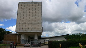
Roman Catholic Archdiocese of Lubumbashi
Roman Catholic archdiocese in the Democratic Republic of the Congo
Distance: Approx. 528 meters
Latitude and longitude: -11.6657,27.4798
The Roman Catholic Archdiocese of Lubumbashi (Latin: Lubumbashien(sis)) is the Metropolitan See for the ecclesiastical province of Lubumbashi in the Democratic Republic of the Congo.
Stade TP Mazembe
Distance: Approx. 2053 meters
Latitude and longitude: -11.678373,27.489241
Stade TP Mazembe is a multi-use stadium located in the Kamalondo suburb of Lubumbashi, Democratic Republic of the Congo. Since its completion in 2012, it has mostly been used for football matches and is the home venue of TP Mazembe and CS Don Bosco. The stadium has 18,000 seats.

Haut-Katanga District
Distance: Approx. 909 meters
Latitude and longitude: -11.66666667,27.46666667
Haut-Katanga District (Upper Katanga District) is a former district located in the former Katanga Province of the Democratic Republic of the Congo. The copper mining centers of Lubumbashi and Likasi were surrounded by the district but were administratively separate.
Lubumbashi (commune)
Commune in the Democratic Republic of the Congo
Distance: Approx. 515 meters
Latitude and longitude: -11.66472222,27.47944444
Lubumbashi is a commune of the city of Lubumbashi in the Democratic Republic of the Congo.
Lufilian Arc
Distance: Approx. 909 meters
Latitude and longitude: -11.666667,27.466667
The Lufilian Arc (or Lufilian Belt) is part of a system of orogenic belts in southern Africa formed during the Pan-African orogeny, a stage in the formation of the Gondwana supercontinent. It extends across eastern Angola, the Katanga Province of the southern Democratic Republic of the Congo and the northwest of Zambia. The arc is about 800 kilometres (500 mi) long.
Stade Kashala Bonzola
Distance: Approx. 2053 meters
Latitude and longitude: -11.678373,27.489241
Stade Kashala Bonzola is a multi-use stadium in the Kanshi suburb of Mbuji-Mayi, Democratic Republic of the Congo. The stadium was completed in 2016 and is mostly used for football matches. It serves as the new home venue of SM Sanga Balende.

Sts. Peter and Paul Cathedral, Lubumbashi
Church in Haut-Katanga Province, Congo
Distance: Approx. 517 meters
Latitude and longitude: -11.6657,27.4797
Cathedral of Saints Peter and Paul in Lubumbashi (French: Cathédrale Saints Pierre et Paul de Lubumbashi) or simply Lubumbashi Cathedral , in the city of Lubumbashi, Haut-Katanga Province in the Democratic Republic of the Congo, is a parish of the Roman Catholic Church and the seat of the Metropolitan Archdiocese of Lubumbashi (Archidioecesis Lubumbashiensis). The cathedral church is located between Kapenda and Kasa-Vubu avenues. The Convent of St.
National Museum of Lubumbashi
Museum in Lubumbashi, DRC
Distance: Approx. 1867 meters
Latitude and longitude: -11.64965,27.47707
The National Museum of Lubumbashi (French: Musée national de Lubumbashi) is a museum with core collections in archaeology and ethnography in Lubumbashi, Haut-Katanga Province in the Democratic Republic of the Congo. It was founded in 1946.
Haut-Luapula District
District in Katanga, Belgian Congo
Distance: Approx. 909 meters
Latitude and longitude: -11.666667,27.483333
Haut-Luapula District (French: District du Haut-Luapula, Dutch: District Boven Luapula) was a district of the Belgian Congo from 1912 to 1933, when it was dissolved. It roughly corresponded to the southern part of the present Haut-Katanga Province.
Luapula-Moero District
District in Katanga, Belgian Congo
Distance: Approx. 909 meters
Latitude and longitude: -11.666667,27.483333
Luapula-Moero District was a district of the pre-2015 Katanga Province in the Belgian Congo and Democratic Republic of the Congo. It roughly corresponded in area to the present Haut-Katanga Province.
Weather in this IP's area
overcast clouds
31 Celsius
30 Celsius
31 Celsius
31 Celsius
1008 hPa
31 %
1008 hPa
879 hPa
10000 meters
1.63 m/s
1.7 m/s
143 degree
88 %
05:43:58
18:06:29