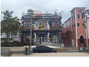
Country:
Region:
City:
Latitude and Longitude:
Time Zone:
Postal Code:
IP information under different IP Channel
ip-api
Country
Region
City
ASN
Time Zone
ISP
Blacklist
Proxy
Latitude
Longitude
Postal
Route
Luminati
Country
ASN
Time Zone
America/Puerto_Rico
ISP
UBINET-WIRELESS
Latitude
Longitude
Postal
IPinfo
Country
Region
City
ASN
Time Zone
ISP
Blacklist
Proxy
Latitude
Longitude
Postal
Route
db-ip
Country
Region
City
ASN
Time Zone
ISP
Blacklist
Proxy
Latitude
Longitude
Postal
Route
ipdata
Country
Region
City
ASN
Time Zone
ISP
Blacklist
Proxy
Latitude
Longitude
Postal
Route
Popular places and events near this IP address

San Sebastián, Puerto Rico
Town and municipality in Puerto Rico
Distance: Approx. 1790 meters
Latitude and longitude: 18.33722222,-66.99055556
San Sebastián (Spanish pronunciation: [san seβasˈtjan] , locally [ˌsaŋ seβaʔˈtjaŋ]) is a town and municipality of Puerto Rico located in the northwestern region of the island, south of Isabela, Quebradillas and Camuy; north of Las Marías; east of Moca and Añasco; and west of Lares. San Sebastián is spread over twenty-four barrios and San Sebastián Pueblo (the downtown area and the administrative center of the city). It is a principal city of the Aguadilla-Isabela-San Sebastián Metropolitan Statistical Area.
WCMA (AM)
Puerto Rican radio station
Distance: Approx. 1909 meters
Latitude and longitude: 18.36055556,-66.99166667
WCMA (1600 AM, "Cima 103.7") is a radio station broadcasting a Spanish Tropical format. Licensed to Bayamón, Puerto Rico, it serves all of Puerto Rico. The station is currently owned by Aurio A. Matos Barreto.

Iglesia San Sebastián Mártir
Historic church in San Sebastián, Puerto Rico
Distance: Approx. 1832 meters
Latitude and longitude: 18.336777,-66.990445
The Iglesia San Sebastián Mártir (English: Church of Saint Sebastian the Martyr) in the plaza in San Sebastián, Puerto Rico was completed in 1897. It was listed on the U.S. National Register of Historic Places in 1984, and on the Puerto Rico Register of Historic Sites and Zones in 2001. It is one of five churches designed by state architect Pedro Cobreros during 1890 to 1896 and completed in 1897 and is "austere, yet noble".

Guatemala River
River of Puerto Rico
Distance: Approx. 1259 meters
Latitude and longitude: 18.3363387,-67.0046229
The Guatemala River (Río Guatemala) is a river of San Sebastián, Puerto Rico.
Sonador River
River of Puerto Rico
Distance: Approx. 2029 meters
Latitude and longitude: 18.3443938,-67.022401
The Sonador River is a river of Puerto Rico.

Pozas, San Sebastián, Puerto Rico
Barrio of Puerto Rico
Distance: Approx. 2296 meters
Latitude and longitude: 18.332641,-67.018456
Pozas is a barrio in the municipality of San Sebastián, Puerto Rico. Its population in 2010 was 3,515.

Bahomamey
Barrio of San Sebastián, Puerto Rico
Distance: Approx. 1249 meters
Latitude and longitude: 18.340531,-66.994319
Bahomamey is a barrio in the municipality of San Sebastián, Puerto Rico. Its population in 2010 was 2,218.

Guatemala, San Sebastián, Puerto Rico
Barrio of Puerto Rico
Distance: Approx. 657 meters
Latitude and longitude: 18.352668,-67.006689
Guatemala is a barrio in the municipality of San Sebastián, Puerto Rico. Its population in 2010 was 2,512. The Guatemala River is located in Guatemala barrio.

San Sebastián barrio-pueblo
Historical and administrative center (seat) of San Sebastián, Puerto Rico
Distance: Approx. 1863 meters
Latitude and longitude: 18.336802,-66.990029
San Sebastián barrio-pueblo is a barrio and the administrative center (seat) of San Sebastián, a municipality of Puerto Rico. Its population in 2010 was 1,424. As was customary in Spain, in Puerto Rico, the municipality has a barrio called pueblo which contains a central plaza, the municipal buildings (city hall), and a Catholic church.

Hato Arriba, San Sebastián, Puerto Rico
Barrio of Puerto Rico
Distance: Approx. 3136 meters
Latitude and longitude: 18.358133,-67.031025
Hato Arriba is a barrio in the municipality of San Sebastián, Puerto Rico. Its population in 2010 was 1,980.

Piedras Blancas, San Sebastián, Puerto Rico
Barrio of Puerto Rico
Distance: Approx. 3664 meters
Latitude and longitude: 18.335455,-66.971267
Piedras Blancas is a barrio in the municipality of San Sebastián, Puerto Rico. Its population in 2010 was 2,563.

Salto, San Sebastián, Puerto Rico
Barrio of Puerto Rico
Distance: Approx. 3618 meters
Latitude and longitude: 18.379001,-67.012341
Salto (also known as Saltos) is a barrio in the municipality of San Sebastián, Puerto Rico. Its population in 2010 was 3,069.
Weather in this IP's area
scattered clouds
29 Celsius
31 Celsius
27 Celsius
30 Celsius
1013 hPa
67 %
1013 hPa
1005 hPa
10000 meters
4.93 m/s
4.48 m/s
32 degree
36 %
06:36:30
17:50:24