Country:
Region:
City:
Latitude and Longitude:
Time Zone:
Postal Code:
IP information under different IP Channel
ip-api
Country
Region
City
ASN
Time Zone
ISP
Blacklist
Proxy
Latitude
Longitude
Postal
Route
Luminati
Country
ASN
Time Zone
America/Chicago
ISP
FLORIDANET
Latitude
Longitude
Postal
IPinfo
Country
Region
City
ASN
Time Zone
ISP
Blacklist
Proxy
Latitude
Longitude
Postal
Route
db-ip
Country
Region
City
ASN
Time Zone
ISP
Blacklist
Proxy
Latitude
Longitude
Postal
Route
ipdata
Country
Region
City
ASN
Time Zone
ISP
Blacklist
Proxy
Latitude
Longitude
Postal
Route
Popular places and events near this IP address

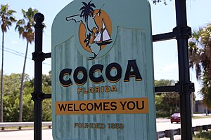
Cocoa, Florida
City in Florida, US
Distance: Approx. 2171 meters
Latitude and longitude: 28.36944444,-80.74388889
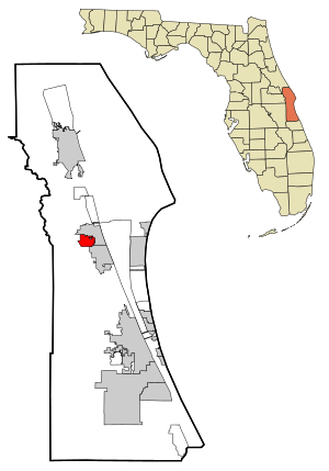
Cocoa is a city in Brevard County, Florida. The population was 19,041 at the 2020 United States Census, up from 17,140 at the 2010 census. It is part of the Palm Bay–Melbourne–Titusville Metropolitan Statistical Area.

Cocoa West, Florida
CDP in Florida, United States
Distance: Approx. 2497 meters
Latitude and longitude: 28.36166667,-80.76305556
Cocoa West is a census-designated place (CDP) in Brevard County, Florida, United States. The population was 5,939 at the 2020 census, up from 5,925 at the 2010 census. It is the closest place to Lake Poinsett and Canaveral Groves.

Cocoa High School
Public high school in Cocoa, Florida, United States
Distance: Approx. 987 meters
Latitude and longitude: 28.38257778,-80.76888056
Cocoa High School is high school located in Cocoa, Florida, and is part of the Brevard Public Schools District. The principal is Ms. C. Denise Stewart .

City Point Community Church
United States historic place
Distance: Approx. 4407 meters
Latitude and longitude: 28.42305556,-80.75305556
The City Point Community Church (also known as the Brevard County Environmental Field Station) is a historic church in Cocoa, Florida, United States. It is located at 3783 North Indian River Drive. It was originally constructed as a public hall, school, and non-denominational church for both black and white residents.
Porcher House
United States historic place
Distance: Approx. 4036 meters
Latitude and longitude: 28.3625,-80.72555556
The Porcher House is a historic home in Cocoa, Florida. It is located at 434 Delannoy Avenue. On January 6, 1986, it was added to the U.S. National Register of Historic Places.

Dr. George E. Hill House
United States historic place
Distance: Approx. 4115 meters
Latitude and longitude: 28.39583333,-80.71916667
The Dr. George E. Hill House is an historic house located at 870 Indianola Drive in Indianola on Merritt Island, Florida. On March 3, 1994, it was added to the U.S. National Register of Historic Places.

J. R. Field Homestead
United States historic place
Distance: Approx. 4430 meters
Latitude and longitude: 28.39805556,-80.71666667
Field Manor, located at 750 Field Manor Drive in Indianola on Merritt Island, Florida was added to the U.S. National Register of Historic Places on September 11, 1997, as the J.R. Field Homestead. It is one of the oldest standing structures on Merritt Island, dating to the 1880s. The property and structure now serve as a historic house museum.

Florida Solar Energy Center
Energy research institutes
Distance: Approx. 475 meters
Latitude and longitude: 28.3864,-80.75506
The Florida Solar Energy Center (FSEC) is a research institute of the University of Central Florida, located on a 20-acre (.08 km2) research complex on Florida's Space Coast at UCF's Cocoa satellite campus. FSEC is the largest and most active state-supported renewable energy and energy efficiency research, training, testing and certification institute in the United States. The director of the institute is James M. Fenton, Ph.D. FSEC's mission is to research and develop energy technologies that enhance Florida's and the nation's economy and environment, and to educate the public, students and practitioners on the results of the research.

Astronaut Memorial Planetarium and Observatory
Observatory
Distance: Approx. 326 meters
Latitude and longitude: 28.38513889,-80.76186111
The Astronaut Memorial Planetarium and Observatory, or AMPO, also known as the Eastern Florida State College Planetarium and Observatory, was an astronomical observatory and planetarium at Eastern Florida State College in Cocoa, Florida. The facility consisted of a planetarium, public observatory, large-screen movie theater, exhibit halls, multi-media classroom and an art gallery. In September 2017 Hurricane Irma caused minor damage to the building.

St. Mark's Episcopal Church (Cocoa, Florida)
Distance: Approx. 4747 meters
Latitude and longitude: 28.3535,-80.7248
St. Mark's Episcopal Church is a parish of the Episcopal Church in Cocoa, Brevard County, Florida, in the Episcopal Diocese of Central Florida. It is noted for its historic church building located at 4 Church Street, built circa 1886.

Cocoa Junior High School
United States historic place
Distance: Approx. 3860 meters
Latitude and longitude: 28.35405556,-80.73863889
Cocoa Junior High School is a historic school building in Cocoa, Florida (Brevard County). Built in 1923-24, it is one of the oldest remaining Rosenwald Schools in Florida. After the school closed in 1954, the building served as a community center and later as an African-American history museum.
Cocoa station
Planned Brightline train station
Distance: Approx. 1656 meters
Latitude and longitude: 28.39739,-80.75202
Cocoa station is a future Brightline inter-city rail infill station in Cocoa, Florida, United States. The station would be located just south of the Cocoa Curve, where Brightline's Orlando Line along State Road 528 merges with the Florida East Coast Railway main line. The station will be located on property already owned by Brightline, on the south side of the interchange between U.S. Route 1 and State Road 528.
Weather in this IP's area
broken clouds
18 Celsius
19 Celsius
16 Celsius
20 Celsius
1016 hPa
89 %
1016 hPa
1014 hPa
10000 meters
4.02 m/s
4.92 m/s
334 degree
82 %
06:46:37
17:29:28
