Country:
 Brazil
Region:
City:
Latitude and Longitude:
Time Zone:
Postal Code:
IP information under different IP Channel
ip-api
Country
Region
City
ASN
Time Zone
ISP
Blacklist
Proxy
Latitude
Longitude
Postal
Route
IPinfo
Country
Region
City
ASN
Time Zone
ISP
Blacklist
Proxy
Latitude
Longitude
Postal
Route
MaxMind
Country
Region
City
ASN
Time Zone
ISP
Blacklist
Proxy
Latitude
Longitude
Postal
Route
Luminati
Country
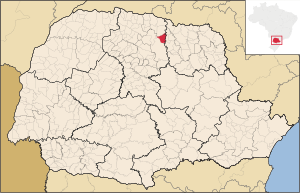
BRRegion
pr
City
ibipora
ASN
Time Zone
America/Sao_Paulo
ISP
ZAAPNET TELECOMUNICACOES LTDA
Latitude
Longitude
Postal
db-ip
Country
Region
City
ASN
Time Zone
ISP
Blacklist
Proxy
Latitude
Longitude
Postal
Route
ipdata
Country
Region
City
ASN
Time Zone
ISP
Blacklist
Proxy
Latitude
Longitude
Postal
Route
Popular places and events near this IP address
Ibiporã
Municipality in Southern, Brazil
Distance: Approx. 6522 meters
Latitude and longitude: -23.28333333,-51.05
Ibiporã is a municipality in the state of Paraná in the Southern Region of Brazil. The municipality contains the 74 hectares (180 acres) Ibiporã State Park, created in 1980.
Jataizinho
Municipality in Southern, Brazil
Distance: Approx. 6107 meters
Latitude and longitude: -23.2539,-50.98
Jataizinho is a municipality in the state of Paraná in the Southern Region of Brazil.

Ibiporã State Park
Distance: Approx. 3267 meters
Latitude and longitude: -23.256435,-51.031315
The Ibiporã State Park (Portuguese: Parque Estadual de Ibiporã) is a state park in the state of Paraná, Brazil.
Weather in this IP's area
scattered clouds
26 Celsius
26 Celsius
26 Celsius
26 Celsius
1005 hPa
69 %
1005 hPa
964 hPa
10000 meters
6.17 m/s
230 degree
40 %
05:48:18
18:29:45