Country:
Region:
City:
Latitude and Longitude:
Time Zone:
Postal Code:
IP information under different IP Channel
ip-api
Country
Region
City
ASN
Time Zone
ISP
Blacklist
Proxy
Latitude
Longitude
Postal
Route
Luminati
Country
Region
mo
City
kansascity
ASN
Time Zone
America/Chicago
ISP
Latitude.sh LTDA
Latitude
Longitude
Postal
IPinfo
Country
Region
City
ASN
Time Zone
ISP
Blacklist
Proxy
Latitude
Longitude
Postal
Route
db-ip
Country
Region
City
ASN
Time Zone
ISP
Blacklist
Proxy
Latitude
Longitude
Postal
Route
ipdata
Country
Region
City
ASN
Time Zone
ISP
Blacklist
Proxy
Latitude
Longitude
Postal
Route
Popular places and events near this IP address

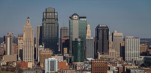
Kansas City, Missouri
City in Missouri, United States
Distance: Approx. 335 meters
Latitude and longitude: 39.09972222,-94.57833333
Kansas City, Missouri (KC or KCMO) is the largest city in the U.S. state of Missouri by population and area. Most of the city lies within Jackson County, and other portions spill into Clay, Platte, and Cass counties. It is the central city of the Kansas City metropolitan area, which straddles the Missouri–Kansas state line and has a population of 2,392,035.

Kansas City City Hall
City hall building in Kansas City, Missouri
Distance: Approx. 238 meters
Latitude and longitude: 39.100569,-94.577997
Kansas City City Hall is the official seat of government for the city of Kansas City, Missouri, United States. Located in downtown, it is a 29-story skyscraper with an observation deck. Completed in 1937, the building has a Beaux-Arts and Art-Deco style with numerous architectural features and ornamentation throughout.

925 Grand
Former headquarters of the Federal Reserve Bank of Kansas City
Distance: Approx. 242 meters
Latitude and longitude: 39.1026,-94.5806
925 Grand is the former headquarters of the Federal Reserve Bank of Kansas City (Kansas City Fed). It was the oldest Federal Reserve Bank building in active use until 2008, when the Kansas City Fed moved out. It was added to the National Register of Historic Places in 2007.

Oak Tower
Skyscraper in Kansas City, Missouri
Distance: Approx. 192 meters
Latitude and longitude: 39.1012,-94.5789
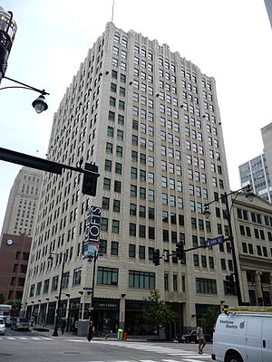
Oak Tower, also called the Bell Telephone Building, is a 28-story skyscraper in Downtown Kansas City, Missouri. Hoit, Price & Barnes, a local firm that conceived many of Kansas City's landmark structures, designed the building in association with I.R. Timlin as the headquarters of the Bell Telephone Co.'s newly consolidated Southwestern System. The ground was broken at Eleventh and Oak Streets in 1917, but due to shortages of manpower and materials during the First World War, construction was delayed and was not completed until 1920.
Central Library (Kansas City, Missouri)
United States historic place and main library of Kansas City Public library
Distance: Approx. 159 meters
Latitude and longitude: 39.10361111,-94.57638889
The Central Library is the main library of the Kansas City Public Library system, which is located in the Library District of Downtown Kansas City, Missouri, United States. It is situated at 14 West 10th Street, at the corner of West 10th Street and Baltimore Avenue, across Baltimore Avenue from the Kansas City Club and up from the New York Life Building. It contains the administration of Kansas City's library system.
East Village, Kansas City
Distance: Approx. 114 meters
Latitude and longitude: 39.10215,-94.57668
East Village is an area in Downtown Kansas City, Missouri located northeast of City Hall and east of Ilus W. Davis Park. The area which is set around 11th & Locust will be the new headquarters for J.E. Dunn Construction Group and other Village East development like residences and commercial space. The area was one of three sites under consideration for construction of the Kansas City Royals' new baseball stadium.
National Garage
United States historic place
Distance: Approx. 180 meters
Latitude and longitude: 39.10333333,-94.57972222
The National Garage in Kansas City, Missouri is a building from 1930. It was listed on the National Register of Historic Places in 2000. It was demolished in 2004.

Professional Building (Kansas City, Missouri)
United States historic place
Distance: Approx. 298 meters
Latitude and longitude: 39.10083333,-94.58027778
The Professional Building in Kansas City, Missouri is a building from 1923. It was listed on the National Register of Historic Places in 1982.

R. A. Long Building
United States historic place
Distance: Approx. 326 meters
Latitude and longitude: 39.10444444,-94.58083333
The R. A. Long building is a historic skyscraper in Kansas City, Missouri located on the northwest corner of the intersection of 10th Street and Grand Avenue. In 1906, Robert A. Long's Long-Bell Lumber Company had outgrown the office space in the Keith & Perry Building. Expanding operations and the need for a larger headquarters resulted in the construction of the R.A. Long Building, completed in 1907.

Argyle Building (Kansas City, Missouri)
United States historic place
Distance: Approx. 129 meters
Latitude and longitude: 39.10222222,-94.57916667
The Argyle Building in Kansas City, Missouri was built in 1906. It was designed as a 4-story structure by architect Louis Curtiss in Early Commercial style. In 1924–1925, the firm of Keene & Simpson expanded the building to 10 stories.
Timeline of Kansas City, Missouri
City history timeline
Distance: Approx. 335 meters
Latitude and longitude: 39.099722,-94.578333
The following is a timeline of the history of Kansas City, Missouri, United States.

Scarritt Building and Arcade
United States historic place
Distance: Approx. 195 meters
Latitude and longitude: 39.10361111,-94.57972222
The Scarritt Building and Arcade is a historic building in Kansas City, Missouri. It was built in 1906. It was designed by Root & Siemens.
Weather in this IP's area
broken clouds
16 Celsius
16 Celsius
15 Celsius
17 Celsius
1006 hPa
82 %
1006 hPa
974 hPa
10000 meters
5.14 m/s
210 degree
75 %
06:50:51
17:12:59
