Country:
 USA
USARegion:
City:
Latitude and Longitude:
Time Zone:
Postal Code:
IP information under different IP Channel
ip-api
Country
Region
City
ASN
Time Zone
ISP
Blacklist
Proxy
Latitude
Longitude
Postal
Route
IPinfo
Country
Region
City
ASN
Time Zone
ISP
Blacklist
Proxy
Latitude
Longitude
Postal
Route
MaxMind
Country
Region
City
ASN
Time Zone
ISP
Blacklist
Proxy
Latitude
Longitude
Postal
Route
Luminati
Country
USRegion
ga
City
marietta
ASN
Time Zone
America/New_York
ISP
KSU-KENNESAW-01
Latitude
Longitude
Postal
db-ip
Country
Region
City
ASN
Time Zone
ISP
Blacklist
Proxy
Latitude
Longitude
Postal
Route
ipdata
Country
Region
City
ASN
Time Zone
ISP
Blacklist
Proxy
Latitude
Longitude
Postal
Route
Popular places and events near this IP address
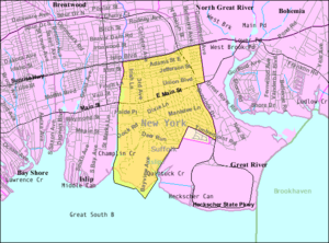
East Islip, New York
Hamlet and census-designated place in New York, United States
Distance: Approx. 2173 meters
Latitude and longitude: 40.73194444,-73.185
East Islip is a hamlet and CDP in the Town of Islip, Suffolk County, New York, United States. At the time of the 2010 census, the CDP had a population of 14,475.

Islip Terrace, New York
Hamlet and census-designated place in New York, United States
Distance: Approx. 2925 meters
Latitude and longitude: 40.74861111,-73.18638889
Islip Terrace (formerly known as Germantown) is a hamlet and census-designated place (CDP) in the Town of Islip in Suffolk County, on the South Shore of Long Island, in New York, United States. The population was 5,323 at the time of the 2020 census.

The Moorings, New York
American private gated-community
Distance: Approx. 2276 meters
Latitude and longitude: 40.711,-73.2
The Moorings is a guard-gated private community in the unincorporated East Islip hamlet of Suffolk County, New York and is not a census-designated place (CDP) within itself. It is situated on Long Island's Great South Bay.
Champlin Creek
Distance: Approx. 1125 meters
Latitude and longitude: 40.721437,-73.203106
Champlin Creek is on Long Island, located between the hamlets of Islip and East Islip, flowing southward into the Great South Bay between the Seatuck National Wildlife Refuge and The Moorings. The fish and wildlife habitat is an approximate three and one-half mile length of the stream, extending from Knapps Lake, just north of the Main Street, to near its headwaters north of the Southern State Parkway. Champlin Creek is a relatively clean, cold, free-flowing, freshwater stream, generally less than 6 feet (1.8 m) wide, partially vegetated sandy substrate.
WBWD (AM)
Radio station in Islip, New York
Distance: Approx. 2450 meters
Latitude and longitude: 40.75166667,-73.21388889
WBWD (540 AM Radio Zindagi) is a radio station licensed to Islip, New York and broadcasting an Indian and South Asian radio format.
WWWF-FM
Radio station in New York, United States
Distance: Approx. 2355 meters
Latitude and longitude: 40.75083333,-73.21361111
WWWF-FM (103.1 FM) is a country music radio station owned by Connoisseur Media and licensed to Bay Shore, New York. The station's studios are located at Airport Plaza in Farmingdale, New York, and its transmitter is located on Freeman Avenue in Islip, New York.

Islip station (LIRR)
Long Island Rail Road station in Suffolk County, New York
Distance: Approx. 703 meters
Latitude and longitude: 40.736,-73.209
Islip is a station on the Montauk Branch of the Long Island Rail Road, off NY 111 (Islip Avenue) and Nassau Avenue, north of Suffolk CR 50 (Union Boulevard), and south of Moffitt Boulevard in Islip, New York.

United States Post Office (Bay Shore, New York)
United States historic place
Distance: Approx. 2975 meters
Latitude and longitude: 40.72305556,-73.24472222
Bay Shore Post Office, the U.S. post office in Bay Shore, New York, is located at 10 Bay Shore Avenue just north of Main Street. It serves the ZIP code 11706, as well as Kismet, Saltaire, Dunewood, Fair Harbor, and Point O'Woods, on Fire Island. Bay Shore Post Office was designed by Louis A. Simon and artist Wheeler Williams.
Islip Speedway
Sports venue
Distance: Approx. 2194 meters
Latitude and longitude: 40.7495,-73.2115
Islip Speedway was a .2-mile (320-meter) oval race track in Islip, New York which was open from 1947 until 1984. It is the smallest track to host NASCAR's Grand National Series, from 1964 to 1971. The first demolition derby took place at Islip Speedway in 1958.

Seatuck National Wildlife Refuge
Wildlife refuge in New York, United States
Distance: Approx. 2174 meters
Latitude and longitude: 40.71027,-73.21111
Seatuck National Wildlife Refuge is located in the hamlet of Islip, New York, on the south shore of Long Island. It is managed by the U.S. Fish and Wildlife Service as part of the Long Island National Wildlife Refuge Complex. The refuge consists of 196 acres (0.79 km2) bordering the Great South Bay, separated from the Atlantic Ocean only by Fire Island.

Wereholme
Historic house in New York, United States
Distance: Approx. 1854 meters
Latitude and longitude: 40.71333333,-73.21388889
Wereholme, also known as the Harold H. Weekes Estate, and the Scully Estate, is a historic estate located at Islip in Suffolk County, New York. The mansion was built in 1917 in the French Provincial style for Lousine Peters and her husband Harold H. Weekes. It was designed by architect Grosvenor Atterbury (1869–1956) and is an L-shaped structure built of concrete block.

Islip High School
Public school in the United States
Distance: Approx. 821 meters
Latitude and longitude: 40.73055556,-73.22027778
Islip High School is the public high school in Islip, in Suffolk County, New York on the South Shore of Long Island. It is a part of the Islip School District. As of 2023 the principal is Lara Gonzalez.
Weather in this IP's area
clear sky
18 Celsius
17 Celsius
17 Celsius
20 Celsius
1029 hPa
36 %
1029 hPa
1029 hPa
10000 meters
4.63 m/s
9.77 m/s
10 degree
07:07:36
18:07:51