168.245.214.202 - IP Lookup: Free IP Address Lookup, Postal Code Lookup, IP Location Lookup, IP ASN, Public IP
Country:
 USA
USARegion:
City:
Location:
Time Zone:
Postal Code:
ISP:
ASN:
language:
User-Agent:
Proxy IP:
Blacklist:
IP information under different IP Channel
ip-api
Country
Region
City
ASN
Time Zone
ISP
Blacklist
Proxy
Latitude
Longitude
Postal
Route
db-ip
Country
Region
City
ASN
Time Zone
ISP
Blacklist
Proxy
Latitude
Longitude
Postal
Route
IPinfo
Country
Region
City
ASN
Time Zone
ISP
Blacklist
Proxy
Latitude
Longitude
Postal
Route
IP2Location
168.245.214.202Country
usRegion
idaho
City
coeur d'alene
Time Zone
America/Los_Angeles
ISP
Language
User-Agent
Latitude
Longitude
Postal
ipdata
Country
Region
City
ASN
Time Zone
ISP
Blacklist
Proxy
Latitude
Longitude
Postal
Route
Popular places and events near this IP address

Coeur d'Alene, Idaho
City in Idaho, United States
Distance: Approx. 890 meters
Latitude and longitude: 47.69277778,-116.78
Coeur d'Alene ( KOR də-LAYN; French: Cœur d'Alène, lit. 'Heart of Awl' French pronunciation: [kœʁ d a.lɛn]) is a city and the county seat of Kootenai County, Idaho, United States. It is the most populous city in North Idaho and the principal city of the Coeur d'Alene Metropolitan Statistical Area. The population was 54,628 at the 2020 census.

Coeur d'Alene Resort
Resort hotel in Coeur d'Alene, Idaho
Distance: Approx. 1470 meters
Latitude and longitude: 47.672,-116.784
The Coeur d'Alene Resort is a resort hotel in the northwest United States, located in Coeur d’Alene, Idaho. Seated on the north shore of Lake Coeur d'Alene by Tubbs Hill, the resort features a marina, convention facilities, spa, as well as a notable 18-hole golf course. The hotel has 338 guest rooms and suites, and its main tower has 18 floors; the resort also has 40,912 square feet (3,800 m2) of meeting room space and 23,000 square feet (2,140 m2) of exhibition space for conventions.

Brooks Seaplane Base
Airport
Distance: Approx. 1493 meters
Latitude and longitude: 47.67222222,-116.78611111
Brooks Seaplane Base (FAA LID: S76) is a city-owned, public-use seaplane base located in the city of Coeur d'Alene, Kootenai County, Idaho, United States. It is located on Lake Coeur d'Alene.

North Idaho Centennial Trail
Hiking trail in the state of Idaho
Distance: Approx. 1422 meters
Latitude and longitude: 47.67416667,-116.78972222
The North Idaho Centennial Trail is a 24 miles (39 km) paved trail in Idaho used for transportation and recreational activities. Extending from Higgens Point on the northeast side of Lake Coeur d'Alene, a popular place for bald eagle watchers in early winter, the trail follows the lake's north shoreline to the Spokane River where it follows it to the Idaho/Washington border. On the other side of the state border, the trail becomes the Spokane River Centennial Trail and extends for another 37 miles (60 km) out to Sontag Park in Nine Mile Falls, Washington.

Coeur d'Alene Masonic Temple
United States historic place
Distance: Approx. 1297 meters
Latitude and longitude: 47.673154,-116.778511
The Coeur d'Alene Masonic Temple in Coeur d'Alene, Idaho is a building constructed during 1909–1911. It was listed on the National Register of Historic Places in 1978. The building includes terra cotta and iron ornamentation.

The Roosevelt Inn
United States historic place
Distance: Approx. 956 meters
Latitude and longitude: 47.67715278,-116.785
The Roosevelt Inn is located near downtown Coeur d'Alene in North Idaho. Originally built in 1905 as the Roosevelt School, it is recognized as a historic building listed on the National Register of Historic Places. It was converted into an inn in 1994.

First United Methodist Church (Coeur d'Alene, Idaho)
Historic church in Idaho, United States
Distance: Approx. 939 meters
Latitude and longitude: 47.676493,-116.776987
First United Methodist Church is a historic Methodist church at 618 Wallace Avenue in Coeur d'Alene, Idaho. It was built in 1906 and was added to the National Register in 1979. The church was designed by Coeur d'Alene architect George Williams, and it was built mostly by volunteer labor.

Kootenai County Courthouse
United States historic place
Distance: Approx. 1012 meters
Latitude and longitude: 47.677245,-116.786713
The Kootenai County Courthouse, located at 501 Government Way in Coeur d'Alene, is the county courthouse serving Kootenai County, Idaho. The courthouse was built in 1925–26. Spokane architect Julius A. Zittle designed the Georgian Revival building.

Coeur d'Alene Federal Building
United States historic place
Distance: Approx. 1125 meters
Latitude and longitude: 47.67472222,-116.78027778
The Coeur d'Alene Federal Building is a historic building built in 1927 in Coeur d'Alene, Idaho. It was listed on the National Register of Historic Places in 1977. It is a three-story cast stone and brick Federal building, built in Adamesque style.

Coeur d'Alene City Hall
United States historic place
Distance: Approx. 1277 meters
Latitude and longitude: 47.67333333,-116.77861111
The Coeur d'Alene City Hall is a historic building in Coeur d'Alene, Idaho. It was built in 1908, and designed in the Renaissance Revival style by architect George Williams. It served as the de facto courthouse until the construction of the Kootenai County Courthouse in 1926, and it later housed the offices of city officials, police officers and firefighters.

Harvey M. Davey House
United States historic place
Distance: Approx. 883 meters
Latitude and longitude: 47.67694444,-116.78083333
The Harvey M. Davey House is a historic house in Coeur d'Alene, Idaho. It was built in 1908 for Harvey M. Davey, a general contractor who oversaw the construction of many buildings in the area. According to historian Nancy F. Renk, "The Davey house remains significant today because it has been changed so little over the years." It has been listed on the National Register of Historic Places since May 23, 1985.
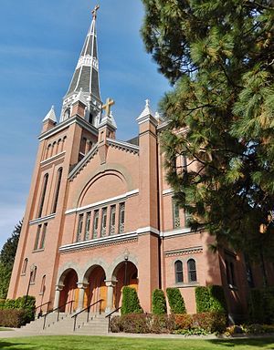
St. Thomas Catholic Church (Coeur d'Alene, Idaho)
Historic church in Idaho, United States
Distance: Approx. 1100 meters
Latitude and longitude: 47.67611111,-116.77222222
St. Thomas Catholic Church is parish of the Roman Catholic Church in Coeur d'Alene, Idaho. Founded in 1890 to serve the Catholic miners and lumber workers relocating to the area, it remains an active congregation of the Diocese of Boise.
Weather in this IP's area
overcast clouds
-7 Celsius
-14 Celsius
-7 Celsius
-6 Celsius
1014 hPa
71 %
1014 hPa
915 hPa
10000 meters
9.26 m/s
12.86 m/s
20 degree
100 %