168.245.214.136 - IP Lookup: Free IP Address Lookup, Postal Code Lookup, IP Location Lookup, IP ASN, Public IP
Country:
 USA
USARegion:
City:
Location:
Time Zone:
Postal Code:
ISP:
ASN:
language:
User-Agent:
Proxy IP:
Blacklist:
IP information under different IP Channel
ip-api
Country
Region
City
ASN
Time Zone
ISP
Blacklist
Proxy
Latitude
Longitude
Postal
Route
db-ip
Country
Region
City
ASN
Time Zone
ISP
Blacklist
Proxy
Latitude
Longitude
Postal
Route
IPinfo
Country
Region
City
ASN
Time Zone
ISP
Blacklist
Proxy
Latitude
Longitude
Postal
Route
IP2Location
168.245.214.136Country
usRegion
washington
City
spokane
Time Zone
America/Los_Angeles
ISP
Language
User-Agent
Latitude
Longitude
Postal
ipdata
Country
Region
City
ASN
Time Zone
ISP
Blacklist
Proxy
Latitude
Longitude
Postal
Route
Popular places and events near this IP address

Dishman, Washington
Locale in Washington, United States
Distance: Approx. 2718 meters
Latitude and longitude: 47.65666667,-117.27777778
Dishman is a locale and former census-designated place (CDP) in Spokane County, Washington, United States. Founded by Addison T. Dishman (II), who operated a nearby rock quarry in 1889, its population was 10,031 at the 2000 census. Dishman has been part of Spokane Valley since 2003.

Avista Stadium
Distance: Approx. 2361 meters
Latitude and longitude: 47.662,-117.345
Avista Stadium is a baseball park in the northwest United States, located in Spokane Valley, Washington. It is the home ballpark of the Spokane Indians, a minor league baseball team in the High-A Northwest League.
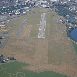
Felts Field
Airport near Spokane, Washington
Distance: Approx. 2609 meters
Latitude and longitude: 47.68305556,-117.3225
Felts Field (IATA: SFF, ICAO: KSFF, FAA LID: SFF) is a public airport in the Northwestern United States, located five miles (8 km) northeast of Downtown Spokane, in Spokane County, Washington. It is owned by Spokane City-County. The airport has two parallel runways.

Dishman Hills
Mountains in Washington (state), United States
Distance: Approx. 2516 meters
Latitude and longitude: 47.64666667,-117.28694444
Dishman Hills Natural Resources Conservation Area is a 530-acre (210 ha) area protected by a combination of public and non-profit groups (Spokane County Parks and Recreation Department, Washington Department of Natural Resources, Inland Northwest Land Conservancy, and Dishman Hills Conservancy), located in Spokane County, Washington. The granite outcroppings, forming the bulk of the area, were originally formed 70 million years ago, by volcanic magma pushing up through the Earth's crust and then cooling. The protected Dishman Hills Natural Resources Conservation Area with its rugged, potholed appearance and deep gullies is a result of the Missoula Floods and represents one of the most ecologically diverse regions in Washington state, where forests, grasslands and shrublands converge and is within two ecoregions, the Okanagan and Northern Rockies ecoregions.

Spokane Community College
Public college in Spokane, Washington, US
Distance: Approx. 3732 meters
Latitude and longitude: 47.67472222,-117.35861111
Spokane Community College is a public community college in Spokane, Washington. It is part of the Community Colleges of Spokane and was established in 1963.

West Valley High School (Spokane, Washington)
Public high school in Spokane Valley, Washington, United States
Distance: Approx. 3030 meters
Latitude and longitude: 47.68361111,-117.2925
West Valley High School is a public secondary school in Spokane Valley, Washington. It enrolls over 900 students in grades 9 through 12. The school colors are orange and black and the mascot is the eagles.

History of Felts Field
Airfield in the United States
Distance: Approx. 2613 meters
Latitude and longitude: 47.683,-117.323
Felts Field is an historic active airfield near Spokane, Washington, United States, on the south bank of the Spokane River. Aviation activities began there 112 years ago in 1913. In 1920, then called the Parkwater airstrip, was designated a municipal flying field at the instigation of the Spokane Chamber of Commerce.

Millwood Historic District
Historic district in Washington, United States
Distance: Approx. 3630 meters
Latitude and longitude: 47.6869,-117.28538
The Millwood Historic District in Millwood, Washington is a 20-acre (8.1 ha) historic district that was listed on the National Register of Historic Places in 2001. The listing included 69 contributing buildings and one other contributing site. It includes work by architect Harold Whitehouse.
West Valley School District (Spokane, Washington)
School district in Washington (state)
Distance: Approx. 3346 meters
Latitude and longitude: 47.682555,-117.283426
West Valley School District (WVSD) is located in the city of Spokane Valley, Washington, United States. The district has five elementary schools, two middle schools, and three high schools, two of which are non-traditional high schools. The grade configurations are K-5 in the elementary, 6–8 in the middle schools, and 9–12 in the high schools.
Spokane Valley High School
Public high school in Spokane Valley, Washington, United States
Distance: Approx. 2761 meters
Latitude and longitude: 47.67549,-117.284374
Spokane Valley High School (SVHS or SVH) in Spokane Valley, Washington, USA, is part of the West Valley School District.
River City Leadership Academy
Public high school in Spokane, Washington, United States
Distance: Approx. 3235 meters
Latitude and longitude: 47.68309,-117.286633
RiverCity Leadership Academy (also known as RLA) is a fully accredited high school in which students share common wilderness experiences, use applied technology, study under a group of teachers and create their own projects according to individual interests. RiverCity Leadership Academy is the first Project-based high school in Washington state to utilize this successful and revolutionary hands-on approach to learning developed by the EdVisions coop. The student projects will provide individualized HSPE preparation and T & I certifications.

Historic Flight Foundation
Aviation museum in Spokane, Washington
Distance: Approx. 2256 meters
Latitude and longitude: 47.6797,-117.3228
The Historic Flight Foundation (HFF) was an aviation museum located at Felts Field in Spokane, Washington. The museum collected, restored, and flew historic aircraft from the period between Charles Lindbergh's solo Atlantic crossing in 1927 and the first commercial flight of the Boeing 707 in 1957, a 30-year period when airplanes evolved from relatively simple wood and fabric biplanes to commercial jets. The museum was previously located at Paine Field in Mukilteo, Washington, but relocated to Spokane during the spring of 2020 due to the presence of commercial air service at Paine Field.
Weather in this IP's area
overcast clouds
-5 Celsius
-11 Celsius
-6 Celsius
-4 Celsius
1013 hPa
66 %
1013 hPa
930 hPa
10000 meters
4.63 m/s
120 degree
100 %