Country:
Region:
City:
Latitude and Longitude:
Time Zone:
Postal Code:
IP information under different IP Channel
ip-api
Country
Region
City
ASN
Time Zone
ISP
Blacklist
Proxy
Latitude
Longitude
Postal
Route
Luminati
Country
ASN
Time Zone
America/Sao_Paulo
ISP
GPS NET SERVICOS EM INTERNET
Latitude
Longitude
Postal
IPinfo
Country
Region
City
ASN
Time Zone
ISP
Blacklist
Proxy
Latitude
Longitude
Postal
Route
db-ip
Country
Region
City
ASN
Time Zone
ISP
Blacklist
Proxy
Latitude
Longitude
Postal
Route
ipdata
Country
Region
City
ASN
Time Zone
ISP
Blacklist
Proxy
Latitude
Longitude
Postal
Route
Popular places and events near this IP address
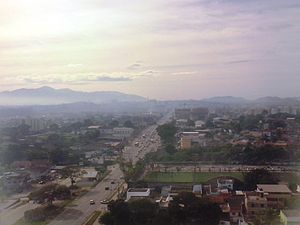
Itaboraí
Municipality in Southeast, Brazil
Distance: Approx. 372 meters
Latitude and longitude: -22.74388889,-42.85888889
Itaboraí (Portuguese pronunciation: [itɐboɾaˈi], [itɐbuɾɐˈi]) is a city in the state of Rio de Janeiro in Brazil, that belongs to the Rio de Janeiro metropolitan area. It was founded in 1672. In 2020, it had a population of 242,543.
Da Aldeia River
River in Brazil
Distance: Approx. 4255 meters
Latitude and longitude: -22.71666667,-42.88333333
The Da Aldeia River is a river of Rio de Janeiro state in southeastern Brazil.
Do Gado River
River in Rio de Janeiro, Brazil
Distance: Approx. 6892 meters
Latitude and longitude: -22.71666667,-42.8
The Do Gado River is a river of Rio de Janeiro state in southeastern Brazil.
Porto das Caixas River
River in Brazil
Distance: Approx. 9317 meters
Latitude and longitude: -22.7,-42.93333333
The Porto das Caixas River is a river of Rio de Janeiro state in southeastern Brazil.
Weather in this IP's area
broken clouds
29 Celsius
29 Celsius
28 Celsius
34 Celsius
1008 hPa
40 %
1008 hPa
1003 hPa
10000 meters
2.66 m/s
3.61 m/s
304 degree
52 %
05:02:57
18:07:22
