Country:
 Brazil
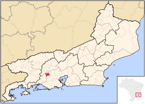
Region:
City:
Latitude and Longitude:
Time Zone:
Postal Code:
IP information under different IP Channel
ip-api
Country
Region
City
ASN
Time Zone
ISP
Blacklist
Proxy
Latitude
Longitude
Postal
Route
Luminati
Country
BRRegion
rj
City
japeri
ASN
Time Zone
America/Sao_Paulo
ISP
JAPNET NETWORK BR SERV TELECOM LTDA - ME - ME
Latitude
Longitude
Postal
IPinfo
Country
Region
City
ASN
Time Zone
ISP
Blacklist
Proxy
Latitude
Longitude
Postal
Route
db-ip
Country
Region
City
ASN
Time Zone
ISP
Blacklist
Proxy
Latitude
Longitude
Postal
Route
ipdata
Country
Region
City
ASN
Time Zone
ISP
Blacklist
Proxy
Latitude
Longitude
Postal
Route
Popular places and events near this IP address

Queimados
Municipality in Southeast, Brazil
Distance: Approx. 7432 meters
Latitude and longitude: -22.71583333,-43.555
Queimados (Portuguese pronunciation: [kejˈmadus]) is a municipality located in the Brazilian state of Rio de Janeiro. Its population was 151,335 (2020) and its area is 75 km2. The city is divided into 37 districts.
Japeri
Municipality in Southeast, Brazil
Distance: Approx. 6061 meters
Latitude and longitude: -22.64305556,-43.65333333
Japeri (Portuguese pronunciation: [ʒapeˈɾi]) is a municipality in the state of Rio de Janeiro, southeast region of Brazil. This city was founded on June 30, 1991. Is very known to be located next to the last station of the largest branch of the railroad of Brazil (Central do Brasil), whose image has been stamps in Brazil.
Santo Antônio River (Rio de Janeiro)
River in Brazil
Distance: Approx. 2361 meters
Latitude and longitude: -22.68333333,-43.6
The Santo Antônio River is a river of Rio de Janeiro state in southeastern Brazil.
São Pedro River (Guandu River tributary)
River in Brazil
Distance: Approx. 3607 meters
Latitude and longitude: -22.660264,-43.633154
The São Pedro River is a river of Rio de Janeiro state in southeastern Brazil. It is a tributary of the Guandu River. The 2,353 hectares (5,810 acres) Jaceruba Environmental Protection Area in the municipality of Nova Iguaçu was created in 2002 with objectives that included protection and preservation of the forests, springs and headwaters of the São Pedro River basin.
Jaceruba Environmental Protection Area
Distance: Approx. 5887 meters
Latitude and longitude: -22.627016,-43.555324
The Jaceruba Environmental Protection Area (Portuguese: Área de Proteção Ambiental Jaceruba, formerly the Rio São Pedro de Jaceruba Environmental Protection Area) is a municipal environmental protection area in the state of Rio de Janeiro, Brazil.
Weather in this IP's area
overcast clouds
24 Celsius
25 Celsius
24 Celsius
24 Celsius
1011 hPa
92 %
1011 hPa
1006 hPa
10000 meters
1.18 m/s
3.22 m/s
251 degree
95 %
05:03:58
18:13:23