Country:
 Peru
PeruRegion:
City:
Latitude and Longitude:
Time Zone:
Postal Code:
IP information under different IP Channel
ip-api
Country
Region
City
ASN
Time Zone
ISP
Blacklist
Proxy
Latitude
Longitude
Postal
Route
IPinfo
Country
Region
City
ASN
Time Zone
ISP
Blacklist
Proxy
Latitude
Longitude
Postal
Route
MaxMind
Country
Region
City
ASN
Time Zone
ISP
Blacklist
Proxy
Latitude
Longitude
Postal
Route
Luminati
Country
PERegion
lma
City
lima
ASN
Time Zone
America/Lima
ISP
M & B Soluciones Peru S.A.C. FASTNET
Latitude
Longitude
Postal
db-ip
Country
Region
City
ASN
Time Zone
ISP
Blacklist
Proxy
Latitude
Longitude
Postal
Route
ipdata
Country
Region
City
ASN
Time Zone
ISP
Blacklist
Proxy
Latitude
Longitude
Postal
Route
Popular places and events near this IP address

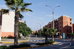
Surquillo
District in Lima, Peru
Distance: Approx. 1106 meters
Latitude and longitude: -12.11722222,-77.02055556
Surquillo District is a district located in Lima, Peru. The district is bordered by the districts of San Isidro and San Borja on the north; by Miraflores on the south and west; and by Santiago de Surco on the east.
San Borja District
District in Lima, Peru
Distance: Approx. 1035 meters
Latitude and longitude: -12.1,-77.01666667
San Borja is a district of the Lima Province in Peru, and one of the upscale districts that comprise the city of Lima. Originally part of the district of Surquillo and San Isidro, it became officially established as a separate district on June 1, 1983. The new district took its name from a former hacienda (estate) which dominated the area.

Coliseo Eduardo Dibós
Indoor arena in Lima, Peru
Distance: Approx. 1504 meters
Latitude and longitude: -12.111088,-77.001028
The Coliseo Eduardo Dibos is a multi-purpose indoor arena located at the intersection of Angamos and Aviación avenuss in San Borja, Lima, Peru. It is named after politician Eduardo Dibós Dammert, who served two times as mayor of Lima, from 1938 to 1940 and from 1950 to 1952.

Chocavento Tower
Office in Lima, Peru
Distance: Approx. 1437 meters
Latitude and longitude: -12.0976,-77.0207
The Chocavento Tower (Edificio Chocavento) is a high-rise office building located in the San Isidro district of Lima, Peru, built in 2001. At a height of 107 meters, is the third highest building in Peru, surpassed by the "Centro Civico de Lima" (Civic center of Lima) at 109 meters, the "Westin Libertador Hotel" at 120 meters and the "Banco Continental (BBVA) Building" at 132 meters. The Chocavento building has 25 storeys above ground and five below ground.

Huaca Pucllana
Archaeological site in Peru
Distance: Approx. 2101 meters
Latitude and longitude: -12.11111111,-77.03388889
Huaca Pucllana or Huaca Juliana (possibly from Quechua wak'a a local shrine to a protector deity, a sacred place, sacred, pukllana game) is a great adobe and clay pyramid located in the Miraflores district of central Lima, Peru, built from seven staggered platforms. It served as an important ceremonial and administrative center for the advancement of the Lima Culture, a society which developed in the Peruvian Central Coast between the years of 200 AD and 700 AD. With the intended purpose of having the elite clergymen (who politically governed several valleys in the area) express their complete religious power and ability to control the use of all the natural water resources (saltwater and freshwater) of the zone, a Great Pyramid was constructed in the Huaca. As a whole, the structure is surrounded by a plaza, or central square, that borders the outer limits, and by a large structured wall dividing it into two separate sections.
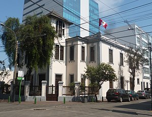
Raúl Porras Barrenechea Institute
Distance: Approx. 1659 meters
Latitude and longitude: -12.11833333,-77.02666667
The Raúl Porras Barrenechea Institute of the National University of San Marcos (IRPB-UNMSM) was founded in 1964 by the University of San Marcos in honor of the distinguished alum, Peruvian historian and diplomat Raúl Porras Barrenechea. The institute acts as a Center for Higher Studies and Peruvian Research, developing and promoting research mainly related to the areas of humanities, arts and social sciences. To this end, the institute offers researchers and the general public a library specialized in the mentioned fields.

Angamos metro station
Lima metro station
Distance: Approx. 1328 meters
Latitude and longitude: -12.11352778,-77.02602778
Angamos is a Lima and Callao Metro station on Line 1. The station is located between Cabitos and San Borja Sur. It was opened on 11 July 2011 as part of the extension of the line from Atocongo to Miguel Grau.

San Borja Sur metro station
Lima metro station
Distance: Approx. 1704 meters
Latitude and longitude: -12.1005,-77.00175
San Borja Sur is a Lima and Callao Metro station on Line 1. The station is located between Angamos and La Cultura. It was opened on 11 July 2011 as part of the extension of the line from Atocongo to Miguel Grau.

Casa Suárez
Cultural heritage site in Lima, Peru
Distance: Approx. 1727 meters
Latitude and longitude: -12.10837,-77.03055
The Casa Suárez is a house located in the city of Lima, Peru. It was declared Cultural heritage of the Nation in May 2007.
Parque Reducto No. 2
Park in Lima, Peru
Distance: Approx. 2104 meters
Latitude and longitude: -12.12638889,-77.0225
The Parque Reducto No. 2 is a 20,000 m2 public park located at the intersections of Benavides and Luis Bedoya Reyes avenues, in Miraflores District, Lima, Peru. Located in a former redoubt built by the Peruvian Army during the War of the Pacific, it was declared a National Monument in 1944, and a Patriotic Sanctuary in 1965.

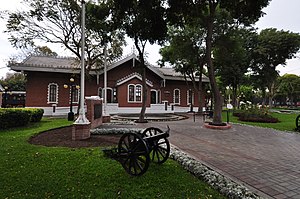
Andrés Avelino Cáceres Museum
Museum in Lima, Peru
Distance: Approx. 2106 meters
Latitude and longitude: -12.12665,-77.02192
Andrés Avelino Cáceres Museum (Spanish: Museo de Sitio Andrés Avelino Cáceres) is a war museum located at a building formerly used as a train station at the Parque Reducto № 2 in Miraflores District, Lima, Peru. It is named after Marshal Andrés Avelino Cáceres, who participated at the park's defense during the War of the Pacific, then used as a redoubt.
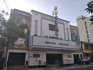
Teatro Canout
Theatre in Lima, Peru
Distance: Approx. 1658 meters
Latitude and longitude: -12.10807,-77.0299
Canout Theatre (Spanish: Teatro Canout) is a theatre located at Petit Thouars Avenue in Miraflores District, Lima, Peru. It was inaugurated on March 24, 1954, as a cinema-theatre, and since then it has been the scene of a wide variety of shows, from film screenings to plays, concerts and cultural events. Once set to be closed and demolished in 2021 due to the economic effects of the then-ongoing COVID-19 pandemic in Peru, two local comedians saved the theatre by first renting and then and purchasing the building.
Weather in this IP's area
mist
16 Celsius
16 Celsius
14 Celsius
16 Celsius
1014 hPa
88 %
1014 hPa
999 hPa
5000 meters
3.6 m/s
300 degree
100 %
05:58:41
18:04:02