Country:
 Kuwait
Region:
City:
Latitude and Longitude:
Time Zone:
Postal Code:
IP information under different IP Channel
ip-api
Country
Region
City
ASN
Time Zone
ISP
Blacklist
Proxy
Latitude
Longitude
Postal
Route
IPinfo
Country
Region
City
ASN
Time Zone
ISP
Blacklist
Proxy
Latitude
Longitude
Postal
Route
MaxMind
Country
Region
City
ASN
Time Zone
ISP
Blacklist
Proxy
Latitude
Longitude
Postal
Route
Luminati
Country
KWASN
Time Zone
Asia/Kuwait
ISP
KW KEMS Block-A, Floor 7, Souq Al-Kabeer Kuwait City, State of Kuwait P O Box 3623, Safat 130
Latitude
Longitude
Postal
db-ip
Country
Region
City
ASN
Time Zone
ISP
Blacklist
Proxy
Latitude
Longitude
Postal
Route
ipdata
Country
Region
City
ASN
Time Zone
ISP
Blacklist
Proxy
Latitude
Longitude
Postal
Route
Popular places and events near this IP address

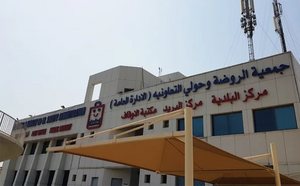
Hawalli Governorate
Governorate of Kuwait
Distance: Approx. 3041 meters
Latitude and longitude: 29.30555556,48.03083333
Hawalli Governorate (Arabic: محافظة حولي Muḥāfaẓat Ḥawalli) is one of the six governorates of Kuwait, consisting of the following areas: Hawalli Bayan Mishref Maidan Hawalli Jabriya Rumaithiya Salmiya Salwa Sha'ab Al-Salam Hattin Al-Zahra Mubarak Al-Abdullah Al-Jaber Al-Shuhada Al-Badae Al-Siddiq Nawaf Al-Ahmad Al-Jaber Al-Sabah became governor in 1962. A more recent governor of the Hawalli governorate is Ahmad Nawaf Al-Ahmad Al-Sabah, who later became prime minister. A 2005 estimate reported the population of Hawalli to be 393,861.
Bayan, Kuwait
Distance: Approx. 1854 meters
Latitude and longitude: 29.31666667,48.03333333
Bayan (Arabic: بيان) is a residential area and district in the Hawalli Governorate of Kuwait, consisting of 13 blocks, and situated approximately 15 kilometres away from the core areas of Kuwait City. Its naming was inspired by the fact that it is in an area of higher altitude in comparison to its surrounding Mishref, Salwa, and Rumaithiya. The Kuwaiti Government headquarters are located in Bayan Palace which houses its own mosque and gardens within its walls.
Jabriya
City in Hawalli Governorate, Kuwait
Distance: Approx. 1854 meters
Latitude and longitude: 29.31666667,48.03333333
Jabriya (Arabic: الجابرية) is in an area in Hawalli Governorate in Kuwait. It is a large, mainly residential area that borders Surra, Hawalli, Salmiya and Bayan. On 31 December 2007, Jabriya's population was estimated to be 66,056.
Mubarak Al-Kabeer Hospital
Hospital in Jabriya, Kuwait
Distance: Approx. 959 meters
Latitude and longitude: 29.326223,48.034989
Mubarak Al-Kabeer Hospital (Arabic: مستشفى مبارك الكبير) is a general hospital built in Jabriya, Kuwait in 1982. The hospital was named after Shiekh Mubarak Al-Kabeer Al-Sabah. It serves the Hawalli Governorate and covers about 700,000 people in the area.
American School of Kuwait
Private school in Kuwait
Distance: Approx. 532 meters
Latitude and longitude: 29.332047,48.034014
The American School of Kuwait (ASK) is a K-12 private school institution which also includes a pre-school (referred to as the Child Development Center). It is located in Hawalli, Kuwait.
Kuwait Central Blood Bank
Blood bank - Affiliated with the Kuwaiti Ministry of Health
Distance: Approx. 672 meters
Latitude and longitude: 29.32694444,48.03027778
Kuwait Central Blood Bank is the only blood bank in Kuwait being operated by the government. It is located in Jabriya behind Mubarak Al-Kabeer Hospital.
Mohammed Al-Hamad Stadium
Distance: Approx. 818 meters
Latitude and longitude: 29.34,48.03027778
Mohammed al-Hamad Stadium is a multi-purpose stadium in Hawally, Kuwait. It is currently used mostly for football matches. The stadium holds 22,000.
Maidan Hawalli
Neighbourhood/Block in Salmiya, Hawalli Governorate, Kuwait
Distance: Approx. 1696 meters
Latitude and longitude: 29.33805556,48.045
Maidan Hawally Is one of the blocks of Salmiya in Hawalli Governorate, Kuwait. The population of this block is 200,000. The district is also close to Hawally.
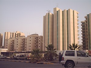
Hawally, Kuwait
Place in Hawalli Governorate, Kuwait
Distance: Approx. 463 meters
Latitude and longitude: 29.33333333,48.03333333
Hawally (Arabic: حولي) is an area in, and the namesake of, the Hawalli Governorate, located in the State of Kuwait. Hawally is a large settlement and the commercial center for most computer-related goods in Kuwait. Prior to the first Gulf War, it housed many Palestinians, but many left during and after the War.
Qadsiya (Kuwait)
District in Capital Governorate, Kuwait
Distance: Approx. 3095 meters
Latitude and longitude: 29.34944444,48.00305556
Qadsiya (Arabic: القادسية) is an area in Capital Governorate in Kuwait City, Kuwait. It was named after Al-Qadisiyyah in Iraq, the site of the Battle of al-Qādisiyyah. According to the 2011 census, about 14,389 people live there.
Sheikh Abdullah Al-Salem Cultural Centre
Cultural complex in Kuwait
Distance: Approx. 1745 meters
Latitude and longitude: 29.343917,48.041278
The Sheikh Abdullah Al-Salem Cultural Centre (Arabic: مركز الشيخ عبدالله السالم الثقافي) is a cultural complex located in Kuwait City Kuwait, owned by the Amiri Diwan. It consists of six main components; The Natural History Museum, Science Museum, Space Museum, Arabic Islamic Science Museum, Fine Arts Centre and the external spaces known as the Public Realm. The Sheikh Abdullah Al-Salem Cultural Centre is a 18-hectare site making it the world's largest museum complex.
Rawda, Kuwait
Area in Capital Governorate, Kuwait
Distance: Approx. 2930 meters
Latitude and longitude: 29.32972222,47.99861111
Rawda (Arabic: الروضة Gulf Arabic pronunciation: /ɪrːoːðˤə/) is an area located within the Capital Governorate of Kuwait and is considered a suburb of Kuwait's capital city, Kuwait City. It comprises five residential blocks. The area is served by the Rawda and Hawally Cooperative Society.
Weather in this IP's area
clear sky
32 Celsius
36 Celsius
32 Celsius
35 Celsius
1006 hPa
59 %
1006 hPa
1004 hPa
10000 meters
0.95 m/s
1.35 m/s
356 degree
05:35:18
17:47:19