168.181.223.150 - IP Lookup: Free IP Address Lookup, Postal Code Lookup, IP Location Lookup, IP ASN, Public IP
Country:
Region:
City:
Location:
Time Zone:
Postal Code:
IP information under different IP Channel
ip-api
Country
Region
City
ASN
Time Zone
ISP
Blacklist
Proxy
Latitude
Longitude
Postal
Route
Luminati
Country
Region
sc
City
saojoaobatista
ASN
Time Zone
America/Sao_Paulo
ISP
WS TELECOMUNICACOES LTDA EPP
Latitude
Longitude
Postal
IPinfo
Country
Region
City
ASN
Time Zone
ISP
Blacklist
Proxy
Latitude
Longitude
Postal
Route
IP2Location
168.181.223.150Country
Region
santa catarina
City
sao joao batista
Time Zone
America/Sao_Paulo
ISP
Language
User-Agent
Latitude
Longitude
Postal
db-ip
Country
Region
City
ASN
Time Zone
ISP
Blacklist
Proxy
Latitude
Longitude
Postal
Route
ipdata
Country
Region
City
ASN
Time Zone
ISP
Blacklist
Proxy
Latitude
Longitude
Postal
Route
Popular places and events near this IP address
Do Braço River (Santa Catarina)
River in Brazil
Distance: Approx. 1052 meters
Latitude and longitude: -27.26666667,-48.85
The Do Braço River is a river of Santa Catarina state in southeastern Brazil, a tributary of the Tijucas River. Some sources treat it as part of the Alto Braço River.

Canelinha
Municipality in South, Brazil
Distance: Approx. 6586 meters
Latitude and longitude: -27.28333333,-48.78333333
Canelinha is a municipality in the state of Santa Catarina in the South region of Brazil. Canelinha is a small town, located 15.2 kilometres (9.4 mi) west of Tijucas and 9.9 kilometres (6.2 mi) by road east of São João Batista. It has an altitude of 17 metres and its population according to the 2020 estimate is 12,398 inhabitants.

Nova Trento
Municipality in South, Brazil
Distance: Approx. 8088 meters
Latitude and longitude: -27.28666667,-48.93027778
Nova Trento is a municipality in the state of Santa Catarina in the South region of Brazil. The municipality contains part of the 1,899 hectares (4,690 acres) Canela Preta Biological Reserve, a full protected area.
São João Batista, Santa Catarina
Municipality in South, Brazil
Distance: Approx. 59 meters
Latitude and longitude: -27.27583333,-48.84888889
São João Batista, Santa Catarina is a municipality in the state of Santa Catarina in the South region of Brazil.

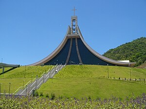
Shrine of St. Paulina
Church complex in Nova Trento, Santa Catarina, Brazil
Distance: Approx. 9668 meters
Latitude and longitude: -27.25222222,-48.94333333
The Shrine of St. Paulina, also known as the Sanctuary of St. Paulina, is a church complex located in Nova Trento, Santa Catarina, Brazil.
Weather in this IP's area
broken clouds
28 Celsius
28 Celsius
26 Celsius
28 Celsius
1011 hPa
50 %
1011 hPa
1009 hPa
10000 meters
2.28 m/s
4.14 m/s
53 degree
53 %