168.181.221.81 - IP Lookup: Free IP Address Lookup, Postal Code Lookup, IP Location Lookup, IP ASN, Public IP
Country:
Region:
City:
Location:
Time Zone:
Postal Code:
ISP:
ASN:
language:
User-Agent:
Proxy IP:
Blacklist:
IP information under different IP Channel
ip-api
Country
Region
City
ASN
Time Zone
ISP
Blacklist
Proxy
Latitude
Longitude
Postal
Route
db-ip
Country
Region
City
ASN
Time Zone
ISP
Blacklist
Proxy
Latitude
Longitude
Postal
Route
IPinfo
Country
Region
City
ASN
Time Zone
ISP
Blacklist
Proxy
Latitude
Longitude
Postal
Route
IP2Location
168.181.221.81Country
Region
santa catarina
City
ingleses do rio vermelho
Time Zone
America/Sao_Paulo
ISP
Language
User-Agent
Latitude
Longitude
Postal
ipdata
Country
Region
City
ASN
Time Zone
ISP
Blacklist
Proxy
Latitude
Longitude
Postal
Route
Popular places and events near this IP address

Canasvieiras
Distance: Approx. 6433 meters
Latitude and longitude: -27.44004,-48.464813
Canasvieiras is a neighbourhood and beach located in southern Brazil, approximately 27 kilometres (17 mi) north-east of the city of Florianópolis on the northern part of Santa Catarina Island. Nearby beaches include Jurerê and Cachoeira do Bom Jesus. The population is 10,129, and the area is 29.0 km² (11.1 square miles) The area has accommodation, bathhouses and shops (many of which have bilingual attendants), a police station and a health clinic.

Transbrasil Flight 303
1980 passenger plane crash in Florianópolis, Brazil
Distance: Approx. 7529 meters
Latitude and longitude: -27.49305556,-48.44611111
Transbrasil Flight 303 was a flight from Congonhas-São Paulo Airport in São Paulo, Brazil, to Hercílio Luz International Airport in Florianópolis, Brazil, on 12 April 1980. It crashed on approach to Hercílio Luz International Airport. Only 3 of the 58 people on board survived.

Praia dos Ingleses
Distance: Approx. 941 meters
Latitude and longitude: -27.43527778,-48.39138889
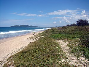
Praia dos Ingleses (English: Beach of the Englishmen) is a beach located in the neighborhood of Ingleses do Rio Vermelho, in the north of the Santa Catarina Island 31 km from the Centro downtown district of Florianópolis the capital of the state of Santa Catarina, Brazil. The beach is 4.83 km long, open ocean, blue warm water, the right side of the beach has calm water ideal for taking children and the elderly and on the other side, the waves are strong and conducive to surfing, bodyboarding and Standup paddleboarding. And a lot of sand where sandboarding is practiced by people of all ages on the beach's dunes.
Ingleses do Rio Vermelho
Distance: Approx. 3470 meters
Latitude and longitude: -27.45,-48.36666667
Ingleses do Rio Vermelho is a district of Florianópolis located in the northeast of the island of Santa Catarina, between the districts of Cachoeira do Bom Jesus and São João do Rio Vermelho, created by a decree in 1831 . The origin of its name is attributed to the sinking of an English ship, occurring in the mid-eighteenth century, when some crew members opted to reside in the region. It has an area of 20.47 square kilometers (7.90 sq mi) and its population in 2000 was 16,514 inhabitants.
Jurerê
Beach-side neighbourhood in Florianópolis, Santa Catarina, Brazil
Distance: Approx. 9784 meters
Latitude and longitude: -27.4371,-48.4987
Jurerê is a beach-side neighbourhood on the northern shore of the island of Florianópolis in Santa Catarina, Brazil. The Jurerê Internacional resort is located in Jurerê.

Mozambique Beach
Beach in Brazil
Distance: Approx. 6883 meters
Latitude and longitude: -27.5012,-48.4019
Mozambique Beach (Portuguese: Praia de Moçambique) is the longest beach on Santa Catarina Island in Brazil at 13.5 km in length. The beach is located to the north of Barra da Lagoa in the east of the island.
Praia Brava
Distance: Approx. 4685 meters
Latitude and longitude: -27.399,-48.413
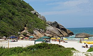
Praia Brava is a beach located at the northern end of the island of Santa Catarina Island, between Praia da Lagoinha and Praia dos Ingleses, 38 kilometres (24 mi) from the center of Florianópolis, capital of the State of Santa Catarina, and is one of the most beautiful beaches in this city. The beach is 1.5 kilometres (4,900 ft) long, open ocean, facing northwest-southeast direction and is surrounded by cliffs on the sides. It is exposed to the action of the ocean swells, especially from the east that creates strong and wild waves, resulting in a perfect environment to practice surfing, bodyboarding and Standup paddleboarding.
Weather in this IP's area
overcast clouds
29 Celsius
36 Celsius
28 Celsius
29 Celsius
1010 hPa
90 %
1010 hPa
1008 hPa
10000 meters
2.66 m/s
3.01 m/s
52 degree
95 %

