168.140.182.64 - IP Lookup: Free IP Address Lookup, Postal Code Lookup, IP Location Lookup, IP ASN, Public IP
Country:
Region:
City:
Location:
Time Zone:
Postal Code:
IP information under different IP Channel
ip-api
Country
Region
City
ASN
Time Zone
ISP
Blacklist
Proxy
Latitude
Longitude
Postal
Route
Luminati
Country
ASN
Time Zone
Australia/Sydney
ISP
Optus Customer Network
Latitude
Longitude
Postal
IPinfo
Country
Region
City
ASN
Time Zone
ISP
Blacklist
Proxy
Latitude
Longitude
Postal
Route
IP2Location
168.140.182.64Country
Region
victoria
City
burwood east
Time Zone
Australia/Melbourne
ISP
Language
User-Agent
Latitude
Longitude
Postal
db-ip
Country
Region
City
ASN
Time Zone
ISP
Blacklist
Proxy
Latitude
Longitude
Postal
Route
ipdata
Country
Region
City
ASN
Time Zone
ISP
Blacklist
Proxy
Latitude
Longitude
Postal
Route
Popular places and events near this IP address

Mount Waverley Secondary College
School in Australia
Distance: Approx. 2319 meters
Latitude and longitude: -37.86777778,145.13277778
Mount Waverley Secondary College is a public secondary school located in the Melbourne suburb of Mount Waverley. The school consists of roughly 1900 students and is one of the largest in the state. The school consists of two campuses (junior and senior) both situated on Stephensons Road in Mount Waverley.

City of Whitehorse
Local government area in Victoria, Australia
Distance: Approx. 2078 meters
Latitude and longitude: -37.83333333,145.15
The City of Whitehorse is a local government area in Victoria, Australia in the eastern suburbs of Melbourne. It has an area of 64.3 km2 (25 sq mi) and an estimated residential population of 171,167 as of June 2021.
Forest Hill, Victoria
Suburb of Melbourne, Victoria, Australia
Distance: Approx. 2231 meters
Latitude and longitude: -37.842,145.172
Forest Hill is a suburb of Melbourne, Victoria, Australia, 18 km east of Melbourne's Central Business District, located within the City of Whitehorse local government area. Forest Hill recorded a population of 10,780 at the 2021 census. Forest Hill was recently ranked 93rd on Melbourne's most liveable suburb list, which was higher than other nearby popular suburbs such as Bentleigh, Mount Waverley and Glen Waverley.
Blackburn South, Victoria
Suburb of Melbourne, Victoria, Australia
Distance: Approx. 1645 meters
Latitude and longitude: -37.838,145.144
Blackburn South is a suburb of Melbourne, Victoria, Australia, 16 km east of Melbourne's Central Business District, located within the City of Whitehorse local government area. Blackburn South recorded a population of 10,939 at the 2021 census. Blackburn South is bordered by Canterbury Road, Middleborough Road, Eley Road, and by an irregular line to the east of Blackburn Road.

Burwood East, Victoria
Suburb of Melbourne, Victoria, Australia
Distance: Approx. 0 meters
Latitude and longitude: -37.852,145.15
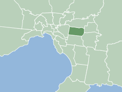
Burwood East is a suburb of Melbourne, Victoria, Australia, located 17 km (11 mi) east of Melbourne's Central Business District, located within the City of Whitehorse local government area. Burwood East recorded a population of 10,675 at the 2021 census. Burwood East is bounded by Springvale Road to the east, Middleborough Road to the west, Eley Road and Hawthorn Road to the north and Highbury Road to the south.
Syndal, Victoria
Neighbourhood in Melbourne
Distance: Approx. 2233 meters
Latitude and longitude: -37.872,145.148
Syndal is a Locality in the Melbourne suburbs of Glen Waverley and Mount Waverley in Victoria, Australia around the intersection of High Street Road and Blackburn Road. It is in the local government area of the City of Monash. From the intersection down to Syndal railway station on Coleman Parade, is the Syndal Shopping Centre.

Forest Hill Chase
Shopping center in Forest Hill, Melbourne, Australia
Distance: Approx. 2150 meters
Latitude and longitude: -37.8354,145.1625
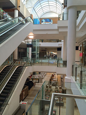
Forest Hill Chase is a major regional shopping centre located in the eastern suburb of Forest Hill in Melbourne, Australia. Owned by JY Group (50%) and Haben Property Fund (50%), the centre is among the oldest in Victoria, opening in 1964 as an outdoor strip shopping centre, before being developed over the years into its current three level indoor form. Currently, Forest Hill Chase contains 200 stores and over 3500 free car parking spaces.
Forest Hill College
Public school in Burwood East, Victoria, Australia
Distance: Approx. 1124 meters
Latitude and longitude: -37.8485,145.162
Forest Hill College is a co-educational state secondary college in Burwood East, Victoria, Australia.

Wobbies World
Distance: Approx. 2234 meters
Latitude and longitude: -37.845824,145.174176
Wobbies World was an amusement park which operated from about 1980 to the late 1990s in the Melbourne suburb of Nunawading, Australia. The park consisted of many custom-built attractions, most slow moving and aimed at very young children. The park had some characteristic modes of transport including a helicopter "Whirliebird" monorail circuit, mower motor driven 6 wheeler ATVs, a real Bell helicopter refurbished as a ground-mounted simulator, a "Splashdown" mini log ride, a mini-golf course, trampolines, a ball pit, several food and drink kiosks, a miniature train circuit, a miniature car circuit, four Melbourne W2 class trams and a large Vickers Viscount propeller plane fitted out as a movie-projector simulator.

Crossway Baptist Church
Church in Australia
Distance: Approx. 1712 meters
Latitude and longitude: -37.859083,145.1672922
Crossway Baptist Church is a Baptist evangelical multi-site megachurch based in Burwood East, in the eastern suburbs of Melbourne, Victoria, Australia. The church is affiliated with the Australian Baptist Ministries.
Electoral district of Syndal
Former state electoral district of Victoria
Distance: Approx. 1633 meters
Latitude and longitude: -37.86666667,145.15
Electoral district of Syndal was an electoral district of the Legislative Assembly in the Australian state of Victoria.
Syndal High School
Defunct secondary school in Victoria, Australia
Distance: Approx. 1868 meters
Latitude and longitude: -37.86701389,145.1595
Syndal High School (also known as Syndal Secondary School) was a public secondary school located in Glen Waverley, Victoria, Australia.
Weather in this IP's area
overcast clouds
20 Celsius
20 Celsius
19 Celsius
22 Celsius
1011 hPa
54 %
1011 hPa
997 hPa
10000 meters
1.86 m/s
3.45 m/s
32 degree
92 %
