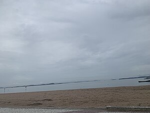
Country:
Region:
City:
Latitude and Longitude:
Time Zone:
Postal Code:
IP information under different IP Channel
ip-api
Country
Region
City
ASN
Time Zone
ISP
Blacklist
Proxy
Latitude
Longitude
Postal
Route
Luminati
Country
Region
rj
City
mage
ASN
Time Zone
America/Sao_Paulo
ISP
BINDNET RJ
Latitude
Longitude
Postal
IPinfo
Country
Region
City
ASN
Time Zone
ISP
Blacklist
Proxy
Latitude
Longitude
Postal
Route
db-ip
Country
Region
City
ASN
Time Zone
ISP
Blacklist
Proxy
Latitude
Longitude
Postal
Route
ipdata
Country
Region
City
ASN
Time Zone
ISP
Blacklist
Proxy
Latitude
Longitude
Postal
Route
Popular places and events near this IP address

Magé
Place in Southeast, Brazil
Distance: Approx. 8741 meters
Latitude and longitude: -22.65277778,-43.04083333
Magé (Portuguese pronunciation: [maˈʒɛ]) is a municipality located in the Brazilian state of Rio de Janeiro. Magepe-Mirim (pronounced [maˈʒɛpi miˈɾĩ]) was established in 1566 by Portuguese colonists. It is considered to be a calm place, especially compared to nearby Rio.
Iriri River (Rio de Janeiro)
River of Rio de Janeiro state in southeastern Brazil
Distance: Approx. 7055 meters
Latitude and longitude: -22.68333333,-43.08333333
The Iriri River is a river of Rio de Janeiro state in southeastern Brazil.
Suruí River
River in Brazil
Distance: Approx. 6994 meters
Latitude and longitude: -22.693387,-43.111574
The Suruí River (Portuguese: Rio Suruí) is a river of Rio de Janeiro state in southeastern Brazil.
Pau Grande
Place in Southeast, Brazil
Distance: Approx. 7118 meters
Latitude and longitude: -22.58444444,-43.16972222
Pau Grande is a village from the Vila Inhomirim of the municipality of Magé, in Rio de Janeiro. The name "Pau Grande" means "big log" or "big stick" in Portuguese. Pau Grande is located by the Range of the Organs.

Parque das Ruínas
Distance: Approx. 9099 meters
Latitude and longitude: -22.5503,-43.1117
The Centro Cultural Municipal Parque das Ruínas, or simply Parque das Ruínas (Ruins Park), is a public park with an art gallery built around the ruins of a mansion, located in the Santa Teresa neighborhood in Rio de Janeiro, Brazil. It is a venue for live outdoor concerts and houses a bar. The site was the residence of Belle Époque art mecenas Laurinda Santos Lobo, who invited intellectuals and artists to her mansion in the early 20th century.
Six Days of Rio de Janeiro
Distance: Approx. 9099 meters
Latitude and longitude: -22.5503,-43.1117
The Six Days of Rio de Janeiro was a six-day cycling event, held in Rio de Janeiro. The event was only held once, in August 1956, won by Italian-Argentine team Severino Rigoni and Bruno Sivilotti.
Suruí Environmental Protection Area
Distance: Approx. 3580 meters
Latitude and longitude: -22.656557,-43.144406
The Suruí Environmental Protection Area (Portuguese: Área de Proteção Ambiental Municipal de Suruí) is a municipal Environmental protection area in the state of Rio de Janeiro, Brazil.
Weather in this IP's area
overcast clouds
31 Celsius
37 Celsius
26 Celsius
31 Celsius
1008 hPa
72 %
1008 hPa
1003 hPa
10000 meters
2.38 m/s
6.25 m/s
356 degree
100 %
05:04:10
18:08:16