168.114.32.16 - IP Lookup: Free IP Address Lookup, Postal Code Lookup, IP Location Lookup, IP ASN, Public IP
Country:
Region:
City:
Location:
Time Zone:
Postal Code:
IP information under different IP Channel
ip-api
Country
Region
City
ASN
Time Zone
ISP
Blacklist
Proxy
Latitude
Longitude
Postal
Route
Luminati
Country
ASN
Time Zone
America/Chicago
ISP
UNITAS
Latitude
Longitude
Postal
IPinfo
Country
Region
City
ASN
Time Zone
ISP
Blacklist
Proxy
Latitude
Longitude
Postal
Route
IP2Location
168.114.32.16Country
Region
new york
City
new york city
Time Zone
America/New_York
ISP
Language
User-Agent
Latitude
Longitude
Postal
db-ip
Country
Region
City
ASN
Time Zone
ISP
Blacklist
Proxy
Latitude
Longitude
Postal
Route
ipdata
Country
Region
City
ASN
Time Zone
ISP
Blacklist
Proxy
Latitude
Longitude
Postal
Route
Popular places and events near this IP address

Museum of Modern Art
Art museum in Manhattan, New York City, U.S.
Distance: Approx. 106 meters
Latitude and longitude: 40.76166667,-73.9775
The Museum of Modern Art (MoMA) is an art museum located in Midtown Manhattan, New York City, on 53rd Street between Fifth and Sixth Avenues. The institution was conceived in 1929 by Abby Aldrich Rockefeller, Lillie P. Bliss, and Mary Quinn Sullivan. Initially located in the Heckscher Building on Fifth Avenue, it opened just days after the Wall Street Crash.

Ziegfeld Theatre (1969)
Former movie theater in Manhattan, New York
Distance: Approx. 63 meters
Latitude and longitude: 40.7627,-73.9788
The Ziegfeld Theatre was a single-screen movie theater located at 141 West 54th Street in midtown Manhattan in New York City. It opened in 1969 and closed in 2016. The theater was named in honor of the original Ziegfeld Theatre (1927–1966), which was built by the impresario Florenz Ziegfeld Jr.
Adelphi Theatre (New York City)
Former theatre in Manhattan, New York
Distance: Approx. 113 meters
Latitude and longitude: 40.7625,-73.97944444
The Adelphi Theatre (1934–1940 and 1944–1958), originally named the Craig Theatre, opened on December 24, 1928. The Adelphi was located at 152 West 54th Street in Manhattan, with 1,434 seats. The theater was taken over by the Federal Theater Project in 1934 and renamed the Adelphi.

Warwick New York Hotel
Hotel in Manhattan, New York
Distance: Approx. 25 meters
Latitude and longitude: 40.7623,-73.97824
The Warwick New York is a luxury hotel at 65 West 54th Street, on the northeastern corner with Sixth Avenue, in Midtown Manhattan, New York City. Constructed between 1925 and 1927, it is owned by Warwick Hotels and Resorts.
La Côte Basque
Former restaurant in New York City
Distance: Approx. 97 meters
Latitude and longitude: 40.7625,-73.97694444
La Côte Basque was a New York City restaurant. It opened in the late 1950s and operated until it closed on March 7, 2004.

53W53
Skyscraper in Manhattan, New York
Distance: Approx. 95 meters
Latitude and longitude: 40.76166667,-73.97833333
53 West 53 (also known as 53W53 and formerly known as Tower Verre) is a supertall skyscraper at 53 West 53rd Street in the Midtown Manhattan neighborhood of New York City, adjacent to the Museum of Modern Art (MoMA). It was developed by the real estate companies Pontiac Land Group and Hines. With a height of 1,050 ft (320 m), 53 West 53 is the tenth-tallest completed building in the city as of November 2019.

1345 Avenue of the Americas
Office skyscraper in Manhattan, New York
Distance: Approx. 84 meters
Latitude and longitude: 40.763074,-73.978752
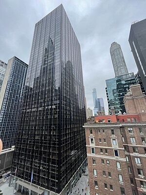
1345 Avenue of the Americas (also known as the AllianceBernstein Building and formerly the Burlington House) is a 625-foot (191 m)-tall, 50-story skyscraper in Midtown Manhattan, New York City. Located on Sixth Avenue between 54th and 55th Streets, the building was built by Fisher Brothers and designed by Emery Roth & Sons. When completed in 1969, the building was originally named after Burlington Industries and today it is named after AllianceBernstein.

New York Hilton Midtown
Hotel in Manhattan, New York
Distance: Approx. 61 meters
Latitude and longitude: 40.76225,-73.97874
The New York Hilton Midtown is the largest hotel in New York City. The hotel is owned by Park Hotels & Resorts and managed by Hilton Worldwide. It is the largest Hilton hotel in the U.S., with 2,052 rooms total (1,878 hotel rooms and an additional 174 rooms belonging to Hilton Grand Vacations) and over 150,000 sq ft of meeting space.

The Halal Guys
Fast food carts in Manhattan, New York
Distance: Approx. 126 meters
Latitude and longitude: 40.7618,-73.97928
The Halal Guys is a halal fast casual restaurant franchise that began as halal carts on the southeast and southwest corners of 53rd Street and Sixth Avenue in Manhattan, New York City. New locations, both food cart and storefront, are being added throughout New York (including a storefront on 14th Street and Second Avenue) and around the world. The franchise is most recognized by its primary dish which is a platter of chicken or gyro meat with rice, though it also serves a chicken or gyro wrap sandwich.

Ziegfeld Theatre (1927)
Former Broadway theater in Manhattan, New York
Distance: Approx. 54 meters
Latitude and longitude: 40.76256,-73.97873
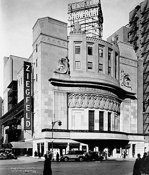
The Ziegfeld Theatre was a Broadway theatre located at 1341 Sixth Avenue, corner of 54th Street in Manhattan, New York City. It was built in 1927 and despite public protests, it was razed in 1966.

46 West 55th Street
Building in Manhattan, New York
Distance: Approx. 100 meters
Latitude and longitude: 40.76229,-73.97695
46 West 55th Street (also the Joseph B. and Josephine H. Bissell House) is a commercial building in the Midtown Manhattan neighborhood of New York City. It is along the south side of 55th Street between Fifth Avenue and Sixth Avenue. The five-story building was designed by Thomas Thomas in the Italianate style and was constructed in 1869.

Killing of Brian Thompson
2024 shooting of an American CEO
Distance: Approx. 144 meters
Latitude and longitude: 40.76283333,-73.97975
Brian Thompson, the 50-year-old CEO of the American health insurance company UnitedHealthcare, was shot and killed in Midtown Manhattan, New York City, on December 4, 2024. The shooting occurred early in the morning outside an entrance to the New York Hilton Midtown. Thompson was in the city to attend an annual investors' meeting for UnitedHealth Group, the parent company of UnitedHealthcare.
Weather in this IP's area
clear sky
3 Celsius
-2 Celsius
1 Celsius
3 Celsius
1025 hPa
60 %
1025 hPa
1023 hPa
10000 meters
4.63 m/s
10 degree