Country:
 Canada
Region:
City:
Latitude and Longitude:
Time Zone:
Postal Code:
IP information under different IP Channel
ip-api
Country
Region
City
ASN
Time Zone
ISP
Blacklist
Proxy
Latitude
Longitude
Postal
Route
IPinfo
Country
Region
City
ASN
Time Zone
ISP
Blacklist
Proxy
Latitude
Longitude
Postal
Route
MaxMind
Country
Region
City
ASN
Time Zone
ISP
Blacklist
Proxy
Latitude
Longitude
Postal
Route
Luminati
Country
CARegion
on
City
toronto
ASN
Time Zone
America/Toronto
ISP
TEKSAVVY
Latitude
Longitude
Postal
db-ip
Country
Region
City
ASN
Time Zone
ISP
Blacklist
Proxy
Latitude
Longitude
Postal
Route
ipdata
Country
Region
City
ASN
Time Zone
ISP
Blacklist
Proxy
Latitude
Longitude
Postal
Route
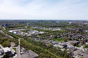
Popular places and events near this IP address

Union Pearson Express
Airport rail link in Ontario, Canada
Distance: Approx. 1210 meters
Latitude and longitude: 43.677,-79.47
The Union Pearson Express (UP Express or UPX) is an airport rail link connecting Union Station in Downtown Toronto to Toronto Pearson International Airport. The UP Express began operation on 6 June 2015, in time for the 2015 Pan American Games. The UP Express travels between Union and Pearson in 25 minutes departing every 15 minutes, seven days a week.

CPKC Lambton Yard
Freight marshalling yard located in Toronto
Distance: Approx. 1117 meters
Latitude and longitude: 43.66666667,-79.48888889
CPKC Lambton Yard is a freight marshalling yard for the Canadian Pacific Railway in Toronto, Ontario, Canada, and is located to the west of and contiguous with the West Toronto Yard on the Galt Subdivision. The two were the main freight marshalling yard complex for the CPR in Toronto until replaced by the modern CPR Toronto Yard in Agincourt in April 1964. Built from 1912 to 1913, Lambton served as mechanical and freight facilities.
Rockcliffe–Smythe
Neighbourhood in Toronto, Ontario, Canada
Distance: Approx. 312 meters
Latitude and longitude: 43.67527778,-79.48861111
Rockcliffe–Smythe is a neighbourhood in Toronto, Ontario, Canada. It was developed after World War II as part of the urbanization of the former suburb of York Township. It is in Ward 5 (York-South Weston) in the City of Toronto.

CPKC West Toronto Yard
Rail yard in Canada
Distance: Approx. 1213 meters
Latitude and longitude: 43.6675,-79.47611111
CPKC West Toronto Yard is a small marshalling yard for the Canadian Pacific Kansas City on the Galt Subdivision in Toronto, Ontario, Canada. The yard was built in 1882 to relieve stress at the Parkdale Yard and is located near Keele Street and Dundas Street West in The Junction. It was once the main yards for Toronto, but was replaced in that role in April 1964 by the CPR Toronto Yard in Agincourt.
St. Oscar Romero Catholic Secondary School
Bill 30 catholic high school in Toronto, Ontario, Canada
Distance: Approx. 568 meters
Latitude and longitude: 43.680416,-79.480838
St. Oscar Romero Catholic Secondary School (acronym as SORCSS, St. Oscar Romero, St.
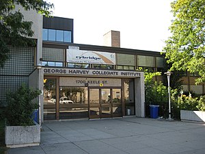
George Harvey Collegiate Institute
Public high school in Toronto, Ontario, Canada
Distance: Approx. 1307 meters
Latitude and longitude: 43.684459,-79.473327
George Harvey Collegiate Institute (George Harvey CI, GHCI, also known simply as Harvey) was a high school in Toronto, Ontario, Canada. It was formerly known as George Harvey Vocational School and George Harvey Secondary School. It was located in the former suburb of York and was part of the Toronto District School Board.

Runnymede Park
Park in The Junction neighborhood of Toronto
Distance: Approx. 1011 meters
Latitude and longitude: 43.668238,-79.479228
Runnymede Park is a medium-sized public park located in The Junction neighbourhood of Toronto, Canada, one block east of Runnymede Road. Its southern boundary is the West Toronto Yard used by the Canadian Pacific Railway, its northern boundary is Ryding Avenue, while a laneway and parking lot make up the western and eastern boundaries respectively. It is relatively flat, and features many soaring mature oak trees.

Gunns Loop
Distance: Approx. 1198 meters
Latitude and longitude: 43.67194444,-79.47138889
Gunns Loop is a station and turning loop at the western terminus of the 512 St. Clair streetcar line of the Toronto Transit Commission (TTC). It is located at the northwest corner of St.

Congregation Knesseth Israel (Toronto)
Orthodox Jewish congregation in Toronto, Ontario, Canada
Distance: Approx. 1344 meters
Latitude and longitude: 43.666354,-79.475527
Congregation Knesseth Israel, also known as the Junction Shul, is an Orthodox Jewish congregation in Toronto, Ontario, Canada. Its synagogue building is the oldest surviving in Toronto that is still in use, and was designated an Ontario Heritage site in 1984 under the Ontario Heritage Act. Located at 56 Maria Street, in Toronto's Junction neighbourhood, the congregation was established in 1909 by Jewish immigrants, largely from Russia and Poland.

Mount Dennis station
Future transit terminal in Toronto, Canada
Distance: Approx. 1260 meters
Latitude and longitude: 43.6875,-79.48722222
Mount Dennis is an intermodal transit terminal under construction in Toronto, Ontario, Canada. Located east of the intersection of Eglinton Avenue and Weston Road in the Mount Dennis neighbourhood in the district of York, the station will be the western terminus of the future Line 5 Eglinton as well as an intermediate station on the GO Transit Kitchener line and Union Pearson Express. The station has been designated as one of many "mobility hubs" in Greater Toronto.

Kodak Building 9
Former industrial building in Toronto, Ontario
Distance: Approx. 1311 meters
Latitude and longitude: 43.688,-79.4869
Kodak Building 9 was a recreation centre for employees at the Kodak Mount Dennis Campus in Toronto, Ontario, Canada.

Stock Yards Village
Shopping centre in The Junction, Toronto, Ontario, Canada
Distance: Approx. 1193 meters
Latitude and longitude: 43.6728,-79.471
Stock Yards Village (commonly misspelled as Stockyards Village) is a shopping centre in Toronto, Ontario, Canada. It is located at Weston Road and St. Clair Avenue West in The Junction neighbourhood.
Weather in this IP's area
few clouds
26 Celsius
26 Celsius
24 Celsius
27 Celsius
1023 hPa
54 %
1023 hPa
1009 hPa
10000 meters
2.57 m/s
130 degree
20 %
06:58:58
19:26:27