167.86.35.63 - IP Lookup: Free IP Address Lookup, Postal Code Lookup, IP Location Lookup, IP ASN, Public IP
Country:
Region:
City:
Location:
Time Zone:
Postal Code:
ISP:
ASN:
language:
User-Agent:
Proxy IP:
Blacklist:
IP information under different IP Channel
ip-api
Country
Region
City
ASN
Time Zone
ISP
Blacklist
Proxy
Latitude
Longitude
Postal
Route
db-ip
Country
Region
City
ASN
Time Zone
ISP
Blacklist
Proxy
Latitude
Longitude
Postal
Route
IPinfo
Country
Region
City
ASN
Time Zone
ISP
Blacklist
Proxy
Latitude
Longitude
Postal
Route
IP2Location
167.86.35.63Country
Region
georgia
City
raoul
Time Zone
America/New_York
ISP
Language
User-Agent
Latitude
Longitude
Postal
ipdata
Country
Region
City
ASN
Time Zone
ISP
Blacklist
Proxy
Latitude
Longitude
Postal
Route
Popular places and events near this IP address

Alto, Georgia
Town in Georgia, United States
Distance: Approx. 2623 meters
Latitude and longitude: 34.465,-83.57277778
Alto is a town in Banks and Habersham counties in the U.S. state of Georgia. As of the 2010 census, the town had a population of 1,172, up from 876 at the 2000 census.
Cornelia, Georgia
City in Georgia, United States
Distance: Approx. 9486 meters
Latitude and longitude: 34.51694444,-83.53111111
Cornelia is a city in Habersham County, Georgia, United States. The population was 4,160 at the 2010 census, up from 3,674 at the 2000 census. It is home to one of the world's largest apple sculptures, which is displayed on top of an obelisk-shaped monument.

Raoul, Georgia
Place in Georgia, United States
Distance: Approx. 749 meters
Latitude and longitude: 34.45472222,-83.59944444
Raoul is an unincorporated community and census-designated place (CDP) in Habersham County, Georgia, United States. As of the 2010 census, the CDP had a population of 2,558, up from 1,816 at the 2000 census.
Arrendale State Prison
Women's prison in Georgia, United States
Distance: Approx. 177 meters
Latitude and longitude: 34.45094,-83.59347
Lee Arrendale State Prison of the Georgia Department of Corrections is a women's prison located in Raoul, unincorporated Habersham County, Georgia, near Alto, and in proximity to Gainesville. It houses the state death row for women. It became exclusively a women's prison in early 2005.
Fort Hollingsworth–White House
Historic house in Georgia, United States
Distance: Approx. 6117 meters
Latitude and longitude: 34.42643333,-83.53382222
The Fort Hollingsworth–White House is a well-preserved example of an early frontier fort built near Alto, Georgia in the late 18th century. The fort was built around 1793 by Jacob Hollingsworth on newly opened lands resulting from treaties with the Cherokee Nation, and was meant to protect the settlers in the area. The fort was adapted as a farm residence, principally by the White family, and has passed through generations of owners.

Chenocetah Mountain
Mountain in Georgia, United States
Distance: Approx. 9956 meters
Latitude and longitude: 34.50222222,-83.50666667
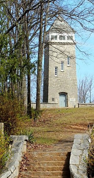
Chenocetah Mountain, known to locals as "Tower Mountain," is located near the towns of Mount Airy and Cornelia, Georgia. The mountain has an elevation of 1,830 feet (560 m). Atop the mountain, the WPA built an observation tower in 1937 for the Forest Service; it is used as a fire tower for observation by rangers.

Habersham County Airport
County-owned public-use airport in Georgia, US
Distance: Approx. 6571 meters
Latitude and longitude: 34.49972222,-83.55666667
Habersham County Airport (ICAO: KAJR, FAA LID: AJR) is a county-owned public-use airport located two nautical miles (3.7 km) southwest of the central business district of Cornelia, in Habersham County, Georgia, United States.

Chenocetah Fire Tower
United States historic place
Distance: Approx. 9935 meters
Latitude and longitude: 34.50222222,-83.50694444
Chenocetah Fire Tower is a historic fire tower in the Chenocetah Mountains, Cornelia, Habersham County, Georgia, United States. It was added to the National Register of Historic Places on June 11, 1984. The tower was built in 1937 as part of a public works program by the Farm Security Administration's Resettlement Administration in effort to move and employ impoverished farmers.
White Creek (Chattahoochee River tributary)
Stream in White County, Georgia, U.S.
Distance: Approx. 9272 meters
Latitude and longitude: 34.51944444,-83.64916667
White Creek is a stream in White County, Georgia, and is a tributary of the Chattahoochee River. The creek is approximately 8.07 miles (12.99 km) long.
Mossy Creek (Chattahoochee River tributary)
Stream in White and Hall counties in Georgia
Distance: Approx. 8799 meters
Latitude and longitude: 34.49555556,-83.67222222
Mossy Creek is a stream in White and Hall counties in Georgia, and is a tributary of the Chattahoochee River. The creek rises in White County and passes into Hall County approximately one mile south of the White-Hall county line.
Mud Creek (Chattahoochee River tributary)
Stream in Habersham and Hall County, Georgia, U.S.
Distance: Approx. 7391 meters
Latitude and longitude: 34.44638889,-83.67472222
Mud Creek is a stream in Habersham and Hall counties in Georgia, USA, and is a tributary of the Chattahoochee River. The creek is approximately 12.39 miles (19.94 km) long.
Hollingsworth, Georgia
Unincorporated community in Georgia, United States
Distance: Approx. 7985 meters
Latitude and longitude: 34.43861111,-83.50833333
Hollingsworth is an unincorporated community in Banks County, Georgia, United States.
Weather in this IP's area
clear sky
6 Celsius
4 Celsius
4 Celsius
6 Celsius
1020 hPa
49 %
1020 hPa
976 hPa
10000 meters
2.57 m/s
290 degree


