167.253.154.154 - IP Lookup: Free IP Address Lookup, Postal Code Lookup, IP Location Lookup, IP ASN, Public IP
Country:
Region:
City:
Location:
Time Zone:
Postal Code:
ISP:
ASN:
language:
User-Agent:
Proxy IP:
Blacklist:
IP information under different IP Channel
ip-api
Country
Region
City
ASN
Time Zone
ISP
Blacklist
Proxy
Latitude
Longitude
Postal
Route
db-ip
Country
Region
City
ASN
Time Zone
ISP
Blacklist
Proxy
Latitude
Longitude
Postal
Route
IPinfo
Country
Region
City
ASN
Time Zone
ISP
Blacklist
Proxy
Latitude
Longitude
Postal
Route
IP2Location
167.253.154.154Country
Region
england
City
coventry
Time Zone
Europe/London
ISP
Language
User-Agent
Latitude
Longitude
Postal
ipdata
Country
Region
City
ASN
Time Zone
ISP
Blacklist
Proxy
Latitude
Longitude
Postal
Route
Popular places and events near this IP address

Coventry
Cathedral city in the West Midlands, England
Distance: Approx. 197 meters
Latitude and longitude: 52.40805556,-1.51055556
Coventry ( KOV-ən-tree or rarely KUV-) is a cathedral city and metropolitan borough in the West Midlands county, in England, on the River Sherbourne. Coventry had been a large settlement for centuries. Founded in the early Middle Ages, its city status was formally recognised in a charter of 1345.

Bond's Hospital
Hospital in England
Distance: Approx. 261 meters
Latitude and longitude: 52.40861111,-1.51416667
Bond's Hospital is an almshouse in Coventry, England, established for old bedesmen. It is a Grade II* listed building. It was built in 1506 on Hill Street, around the same courtyard as the old disused buildings of Bablake School.
Coventry Castle
Former castle in England
Distance: Approx. 305 meters
Latitude and longitude: 52.407442,-1.507933
Coventry Castle (grid reference SP336788) was a motte and bailey castle in the city of Coventry, England. It was demolished in the late 12th century and St Mary's Guildhall was built on part of the site.

Golden Cross, Coventry
Building in Coventry, West Midlands
Distance: Approx. 279 meters
Latitude and longitude: 52.4078,-1.5086
The Golden Cross is one of the oldest pubs in Coventry, West Midlands, and one of the longest-established alcohol-serving venues in England.

Greyfriars, Coventry
Medieval spire in Coventry, England
Distance: Approx. 106 meters
Latitude and longitude: 52.40574,-1.51153
Greyfriars was a medieval Franciscan priory in Coventry, England. The original monastic buildings were lost in the Reformation; the spire standing on the site today was most recently part of a 19th-century church that was destroyed in an air raid in the Second World War. The spire, also called Christchurch Steeple, is a Grade II* listed building.

Ford's Hospital
Hospital in England
Distance: Approx. 118 meters
Latitude and longitude: 52.4064,-1.5105
Ford's Hospital, Coventry, traditionally known as Grey Friars Hospital, is a grade I listed 16th century half-timbered almshouse in Greyfriars Lane, Coventry. It was founded by the merchant William Ford (or perhaps 'Fourd') in 1509 to provide accommodation for six elderly people: five men and one woman. Despite the earlier name of "Grey Friars", it bears no relationship to the Franciscan Order but was so named because of its location on Greyfriars Lane.

County Hall, Coventry
County building in Coventry, England
Distance: Approx. 290 meters
Latitude and longitude: 52.408,-1.5086
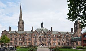
County Hall is a historic former courthouse in Cuckoo Lane in Coventry's Cathedral Quarter. It is a Grade II* listed building.

Kirby House, Coventry
Distance: Approx. 236 meters
Latitude and longitude: 52.40615,-1.5088
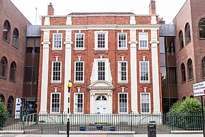
16 Little Park Street (also known as Kirby House) is a Georgian townhouse (Grade II* listed) in central Coventry, West Midlands, England. It is one of two remaining Georgian buildings on the street and three in the city centre (the other two being 7 Little Park Street and 11 Priory Row). The name Kirby House comes from Thomas Hulston Kirby, a solicitor and clerk to the county's magistrates, who bought it in 1874.

Council House, Coventry
Municipal building in Coventry, West Midlands, England
Distance: Approx. 300 meters
Latitude and longitude: 52.4072,-1.5079
The Council House, Coventry in Coventry, England, is a Tudor Revival style city hall building which is the home of Coventry City Council and the seat of local government. It was built in the early 20th century. It is a Grade II-listed building.

The Wave, Coventry
English indoor waterpark
Distance: Approx. 134 meters
Latitude and longitude: 52.40566667,-1.51094444
The Wave is an indoor waterpark situated in Coventry in the West Midlands, England. The waterpark currently holds the record for the largest wave pool in the UK, at a capacity of 20 million litres. The Wave caters for visitors of all ages with six slides of varying intensity and speed, along with a lazy river, wave pool and splash zone - The Reef - which hosts mini slides, jets, climbing area and giant tipping bucket.

Self Sacrifice (statue)
Monument in Coventry, , United Kingdom
Distance: Approx. 199 meters
Latitude and longitude: 52.40801,-1.51041
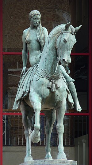
Self Sacrifice, better known as the Lady Godiva statue is an equestrian statue of Lady Godiva in Broadgate, Coventry. The statue is bronze, on a plinth of Portland stone.

Owen Owen Building, Coventry
Retail in Coventry, England
Distance: Approx. 268 meters
Latitude and longitude: 52.40873,-1.51036
The Owen Owen Building is a large retail building in Coventry's Broadgate shopping precinct. It is named for the company that originally owned it, Owen Owen Ltd, it is currently occupied by Primark.
Weather in this IP's area
clear sky
1 Celsius
-2 Celsius
0 Celsius
2 Celsius
1007 hPa
92 %
1007 hPa
995 hPa
10000 meters
2.57 m/s
150 degree
