167.251.12.134 - IP Lookup: Free IP Address Lookup, Postal Code Lookup, IP Location Lookup, IP ASN, Public IP
Country:
Region:
City:
Location:
Time Zone:
Postal Code:
IP information under different IP Channel
ip-api
Country
Region
City
ASN
Time Zone
ISP
Blacklist
Proxy
Latitude
Longitude
Postal
Route
Luminati
Country
Region
tn
City
germantown
ASN
Time Zone
America/Chicago
ISP
BMHCC
Latitude
Longitude
Postal
IPinfo
Country
Region
City
ASN
Time Zone
ISP
Blacklist
Proxy
Latitude
Longitude
Postal
Route
IP2Location
167.251.12.134Country
Region
tennessee
City
memphis
Time Zone
America/Chicago
ISP
Language
User-Agent
Latitude
Longitude
Postal
db-ip
Country
Region
City
ASN
Time Zone
ISP
Blacklist
Proxy
Latitude
Longitude
Postal
Route
ipdata
Country
Region
City
ASN
Time Zone
ISP
Blacklist
Proxy
Latitude
Longitude
Postal
Route
Popular places and events near this IP address

Memorial Park Cemetery (Memphis, Tennessee)
Historic cemetery in Tennessee, United States
Distance: Approx. 1762 meters
Latitude and longitude: 35.10846667,-89.873625
Memorial Park Cemetery was founded in 1924 by E. Clovis Hinds on initial 54 acres (.22 km2). It is located at 5668 Poplar Avenue in Memphis, Tennessee. Different species of trees of different ages, as well as bushes, can be found throughout the cemetery, enhancing the atmosphere of a park-like setting.
Christian Brothers High School (Memphis, Tennessee)
School in Memphis, Tennessee, United States
Distance: Approx. 1123 meters
Latitude and longitude: 35.13088,-89.86429
Christian Brothers High School (CBHS) is located in Memphis, Tennessee, at 5900 Walnut Grove Road. It is a Catholic, all-boys college preparatory school which has a Lasallian tradition.
Baptist Memorial Hospital-Memphis
Hospital in Tennessee, United States
Distance: Approx. 1058 meters
Latitude and longitude: 35.1305,-89.861437
Baptist Memorial Hospital-Memphis (formerly known as Baptist East) is a 706-bed general hospital in Memphis, Tennessee.
Baron Hirsch Synagogue
Modern Orthodox Jewish congregation and synagogue in Memphis, Tennessee
Distance: Approx. 1121 meters
Latitude and longitude: 35.1205,-89.8741
The Baron Hirsch Synagogue (also Baron Hirsch Congregation), is a Modern Orthodox Jewish congregation and synagogue located at 400 South Yates Road, Memphis, Tennessee, in the United States. Founded in c. 1862 – c. 1864, the congregation underwent tremendous growth in the first half of the 20th century, emerging, in the 1950s, as the largest Orthodox congregation in North America, a position it still holds. Its former building, located at 1740 Vollintine Avenue, is an impressive International Style structure built in the 1950s.
St. Joseph's Hospital (Memphis)
Death site of Martin Luther King Jr.
Distance: Approx. 962 meters
Latitude and longitude: 35.129628,-89.862339
Saint Joseph Hospital was a Catholic operated hospital located at 220 Overton Avenue in Memphis, Tennessee. It is most well known for being the hospital where Martin Luther King Jr. died at 7:05 p.m.

Temple Israel (Memphis, Tennessee)
Reform Jewish congregation in Memphis, Tennessee, US
Distance: Approx. 1784 meters
Latitude and longitude: 35.11111111,-89.84638889
Temple Israel is a Reform Jewish congregation and synagogue located at 1376 East Massey Road, in Memphis, Tennessee, in the United States. It is the only Reform synagogue in Memphis, the oldest and largest Jewish congregation in Tennessee, and one of the largest Reform congregations in the U.S. It was founded in 1853 by mostly German Jews as Congregation B'nai Israel (Hebrew for "Children of Israel"). Led initially by cantors, in 1858 it hired its first rabbi, Jacob Peres, and leased its first building, which it renovated and eventually purchased.

White Station, Memphis
Neighborhood in Tennessee, United States
Distance: Approx. 2130 meters
Latitude and longitude: 35.10194444,-89.85972222
White Station is a neighborhood in the east section of Memphis, Tennessee, United States, and is known for White Station High School.

Wilks Brooks House
Historic house in Tennessee, United States
Distance: Approx. 2345 meters
Latitude and longitude: 35.10333333,-89.84777778
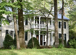
The Wilks Brooks House is a home in Memphis, Tennessee, listed on the National Register of Historic Places. The house was built by Wilks Brooks and his fifteen-year-old son Joseph Brooks; construction started in October 1834 and ended in 1835. The Wilks Brooks house is the oldest example of Greek Revival architecture in the Shelby County, Tennessee area.

Hilton Memphis
Hilton skyscraper hotel in Memphis, Tennessee
Distance: Approx. 1841 meters
Latitude and longitude: 35.10527778,-89.86805556
The Hilton Memphis is the tallest hotel in Memphis, Tennessee, United States. Located off Interstate 240 in East Memphis. the 27-story hotel was designed by Hawaiian-born Memphis architect Francis Mah and was built by Boyle Investment.

Anshei Sphard Beth El Emeth Congregation
Distance: Approx. 1979 meters
Latitude and longitude: 35.1351879,-89.8749041
Anshei Sphard Beth El Emeth Congregation, abbreviated as ASBEE, was a Modern Orthodox synagogue located at 120 North East Yates Road, in East Memphis, Tennessee, in the United States. Established in 1966, with a history dating from 1861, the congregation operated for over 160 years prior to its 2023 merger with the Baron Hirsch Congregation. As of 2023, ASBEE is a charity fund the supports maintenance of its cemetery and other charitable causes.
Margolin Hebrew Academy
School in Memphis, Tennessee, United States
Distance: Approx. 2240 meters
Latitude and longitude: 35.12027778,-89.88638889
The Margolin Hebrew Academy is a co-educational school located in East Memphis, Tennessee. It is the only Orthodox Jewish day school in Memphis. The MHA/FYOS comprises the Margolin Hebrew Academy, a pre-kindergarten through 8th grade section, with the Feinstone Yeshiva of the South, including Cooper Yeshiva High School for Boys, and the Goldie Margolin High School for Girls.

Mosby-Bennett House
Historic house in Tennessee, United States
Distance: Approx. 2276 meters
Latitude and longitude: 35.10138889,-89.85472222
The Mosby-Bennett House is a historic house in Memphis, Tennessee. It was built in the Antebellum era. It is listed on the National Register of Historic Places.
Weather in this IP's area
scattered clouds
5 Celsius
1 Celsius
3 Celsius
5 Celsius
1027 hPa
63 %
1027 hPa
1016 hPa
10000 meters
4.12 m/s
320 degree
40 %
