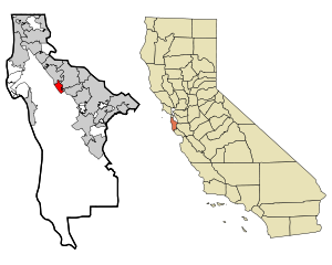
Country:
 USA
USARegion:
City:
Latitude and Longitude:
Time Zone:
Postal Code:
IP information under different IP Channel
ip-api
Country
Region
City
ASN
Time Zone
ISP
Blacklist
Proxy
Latitude
Longitude
Postal
Route
IPinfo
Country
Region
City
ASN
Time Zone
ISP
Blacklist
Proxy
Latitude
Longitude
Postal
Route
MaxMind
Country
Region
City
ASN
Time Zone
ISP
Blacklist
Proxy
Latitude
Longitude
Postal
Route
Luminati
Country
USASN
Time Zone
America/Chicago
ISP
CENTURYLINK-LEGACY-SAVVIS
Latitude
Longitude
Postal
db-ip
Country
Region
City
ASN
Time Zone
ISP
Blacklist
Proxy
Latitude
Longitude
Postal
Route
ipdata
Country
Region
City
ASN
Time Zone
ISP
Blacklist
Proxy
Latitude
Longitude
Postal
Route
Popular places and events near this IP address
Highlands-Baywood Park, California
Unincorporated community in California, United States
Distance: Approx. 1936 meters
Latitude and longitude: 37.525,-122.34333333
Highlands-Baywood Park is an unincorporated community and former census designated place (CDP) in San Mateo County, California, United States. The population was 4,027 at the 2010 census.

College of San Mateo
Community college in San Mateo, California, US
Distance: Approx. 806 meters
Latitude and longitude: 37.53611111,-122.33611111
College of San Mateo (CSM) is a public community college in San Mateo, California. It is part of the San Mateo County Community College District. College of San Mateo is located at the northern corridor of Silicon Valley and situated on a 153-acre site in the San Mateo hills.

Junípero Serra High School (San Mateo, California)
Private school in the United States
Distance: Approx. 1351 meters
Latitude and longitude: 37.54611111,-122.3175
Junípero Serra High School (commonly Serra or JSHS) is a Catholic college preparatory high school in San Mateo, California, United States, serving students in grades 9–12. A part of the Roman Catholic Archdiocese of San Francisco, this school provides education for young men. The school has an academic focus with a college preparatory curriculum.

Aragon High School
Public secondary school in San Mateo, California, United States
Distance: Approx. 1559 meters
Latitude and longitude: 37.550481,-122.32933
Aragon High School is a public co-educational high school in San Mateo, California. It is part of the San Mateo Union High School District (SMUHSD). It is located in San Mateo County, a large suburb just outside San Francisco.
San Mateo County Community College District
School district in California
Distance: Approx. 1113 meters
Latitude and longitude: 37.531243,-122.337648
The San Mateo County Community College District is a community college system in California with three institutions: College of San Mateo in San Mateo, Cañada College in Redwood City, and Skyline College in San Bruno. The district serves more than 25,000 students each day with both day and evening classes.

Hillsdale High School (San Mateo, California)
Public secondary school in San Mateo, California, United States
Distance: Approx. 1349 meters
Latitude and longitude: 37.532403,-122.312669
Hillsdale High School is a public co-educational high school in San Mateo, California, serving grades 9–12 as part of the San Mateo Union High School District. Hillsdale generally serves the residents of San Mateo and Foster City. The main feeder schools to Hillsdale are Abbott, Bayside, Borel, and Bowditch Middle Schools of the San Mateo-Foster City School District.
Baywood Park, San Mateo County, California
Unincorporated community Census-designated place in California, United States
Distance: Approx. 1535 meters
Latitude and longitude: 37.52916389,-122.34163889
Baywood Park is an unincorporated community and census designated place (CDP) in San Mateo County. As of the 2020 U.S. Census, the population was 1,693.
Odyssey School
Private, coeducational school in San Mateo, California, United States
Distance: Approx. 1987 meters
Latitude and longitude: 37.534211,-122.349311
Odyssey School is a private middle school in San Mateo, California, a town about 15 miles (24 km) south of San Francisco. Founded in 1998, Odyssey caters to students in grades 6 through 8. Its five academic core subjects consist of mathematics, science, history/ social studies, language arts, and Japanese.

Peninsula Library System
Distance: Approx. 1970 meters
Latitude and longitude: 37.544342,-122.306928
The Peninsula Library System (PLS) is a consortium of public and community college libraries in San Mateo County, California, United States, which serves the part of the San Francisco Bay Area known as "The Peninsula". The system has dozens of branches in local communities and at various area community colleges, a bookmobile, and automated book kiosks called Library-a-Go-Go.
Gurnick Academy
Private medical school in California
Distance: Approx. 2050 meters
Latitude and longitude: 37.54722,-122.30802
Gurnick Academy (also known as Gurnick Academy of Medical Arts) is a private for-profit higher-education institution in California providing nursing, imaging and allied health programs. The school’s corporate office is located in San Jose, California, and it operates six campuses, in San Jose, Concord, Modesto, Fresno, Sacramento and Los Angeles, as well as offering distance education online. The academy is operated and owned by the Gurnick Academy of Medical Arts, with Konstantin Gourji as the chief executive officer.
Pacific Recorders
Independent recording studio in San Mateo
Distance: Approx. 2071 meters
Latitude and longitude: 37.55154,-122.31302
Pacific Recorders (also referred to as Pacific Recording) was an independent recording studio in San Mateo, California. Founded in 1968, the studio was the location for recordings by such notable artists as Santana, the Grateful Dead, The Doobie Brothers, Moby Grape, and Taj Majal.
Wakuriya
Japanese restaurant in San Mateo, California, U.S.
Distance: Approx. 1904 meters
Latitude and longitude: 37.521355,-122.336785
Wakuriya is a Japanese restaurant in San Mateo, California. The restaurant is owned by Katsuhiro and Mayumi Yamasaki. It has received a Michelin star award.
Weather in this IP's area
clear sky
15 Celsius
13 Celsius
12 Celsius
17 Celsius
1017 hPa
38 %
1017 hPa
1007 hPa
10000 meters
0.45 m/s
0.89 m/s
280 degree
07:22:38
18:25:01