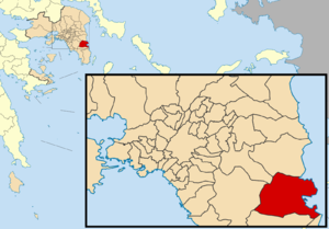
Country:
 Greece
Region:
City:
Latitude and Longitude:
Time Zone:
Postal Code:
IP information under different IP Channel
ip-api
Country
Region
City
ASN
Time Zone
ISP
Blacklist
Proxy
Latitude
Longitude
Postal
Route
IPinfo
Country
Region
City
ASN
Time Zone
ISP
Blacklist
Proxy
Latitude
Longitude
Postal
Route
MaxMind
Country
Region
City
ASN
Time Zone
ISP
Blacklist
Proxy
Latitude
Longitude
Postal
Route
Luminati
Country
GRRegion
i
City
attica
ASN
Time Zone
Europe/Athens
ISP
ASN-UNIVERSAL-MUSIC-GROUP-INC
Latitude
Longitude
Postal
db-ip
Country
Region
City
ASN
Time Zone
ISP
Blacklist
Proxy
Latitude
Longitude
Postal
Route
ipdata
Country
Region
City
ASN
Time Zone
ISP
Blacklist
Proxy
Latitude
Longitude
Postal
Route
Popular places and events near this IP address

Athens International Airport
International airport serving Athens, Greece
Distance: Approx. 3810 meters
Latitude and longitude: 37.93638889,23.94722222
Athens International Airport Eleftherios Venizelos (IATA: ATH, ICAO: LGAV), commonly initialised as AIA, is the largest international airport in Greece, serving the city of Athens and region of Attica. It began operation on 28 March 2001 (in time for the 2004 Summer Olympics) and is the main base of Aegean Airlines, as well as other smaller Greek airlines. It replaced the old Ellinikon International Airport.

Koropi
Town in East Attica, Greece
Distance: Approx. 3873 meters
Latitude and longitude: 37.9,23.87333333
Koropi (Greek: Κορωπί, Greek pronunciation: [ko.ro.ˈpi]) is a suburban town in East Attica, Greece. It is the seat of the municipality Kropia. It has been home to the new training facilities of Panathinaikos football club since the summer of 2013.

Kropia
Municipality in Greece
Distance: Approx. 4353 meters
Latitude and longitude: 37.9,23.86666667
Kropia (Greek: Κρωπία) is a municipality in East Attica, Greece and has a land area of 102.0 km2. The soil is very fertile (something common in the Mediterranean) and many crops are grown on it, most importantly vineyards, olives, figs, pistachios, honey and vegetables. Its population was 30,817 at the 2021 census.

Spata
Municipal unit in Greece
Distance: Approx. 5124 meters
Latitude and longitude: 37.96666667,23.91666667
Spata (Greek: Σπάτα) is a town 20 kilometres (12 mi) east of downtown Athens, Greece. Since the 2011 local government reform it is part of the municipality Spata-Artemida, of which it is the seat and a municipal unit. The municipal unit (officially named Spata-Loutsa) has an area of 55.042 km2.
Markopoulo Mesogaias
Municipality in Greece
Distance: Approx. 4740 meters
Latitude and longitude: 37.88333333,23.93333333
Markopoulo Mesogaias (Greek: Μαρκόπουλο Μεσογαίας) is a town and a municipality in East Attica, Greece. The municipality has an area of 81.844 km2 (31.600 sq mi).

Athens International Airport Archaeological Collection
Distance: Approx. 3793 meters
Latitude and longitude: 37.9364,23.947
The Athens International Airport Archaeological Collection is a museum on level 2 outside security in the main terminal building of Athens International Airport in Spata, Attica, Greece. The collection was established in 2003 and houses 177 ancient artefacts which were uncovered during construction work at the site, once a flourishing agricultural area in ancient times.
Paiania (training ground)
Distance: Approx. 4743 meters
Latitude and longitude: 37.93472222,23.85722222
The Paiania training ground is a training ground and academy base, previously used by the Greek football club Panathinaikos FC. It was officially opened on June 19, 1981. Located in Paiania and covering 70 acres it is used since 1981.

Koropi station
Athens Suburban Railway and Athens Metro station
Distance: Approx. 1441 meters
Latitude and longitude: 37.91277778,23.89583333
Koropi (Greek: Κορωπί) is an Athens Metro and Suburban Railway station situated at east of the town of Koropi, East Attica in Athens metropolitan area. located in the median strip of the Attiki Odos motorway. It opened to Athens Suburban Railway trains on 30 July 2004, with Athens Metro services calling at this station from 10 July 2006.

Athens Airport–Patras railway
Railway line in Greece
Distance: Approx. 3648 meters
Latitude and longitude: 37.9369,23.9448
The railway from Athens Airport to Patras is a double-track, standard-gauge railway line in Greece that, when completed, will connect Athens International Airport with Patras, the country's third-largest city. One of the largest railway projects of the last 30 years in Greece, its completion is of major significance for the infrastructure of the entire region of the northern Peloponnese. As of 2020, the line is completed until the city of Aigio.

Athens Airport station
Athens Suburban Railway and Athens Metro station
Distance: Approx. 3640 meters
Latitude and longitude: 37.93689,23.9447
Athens Airport (Greek: Αεροδρόμιο, Aerodromio), also known as Athens International Airport (Διεθνής Αερολιμένας Αθηνών, Diethnis Aerolimenas Athinon) on signage, is a railway station and metro station that serves the international airport of Athens, Greece. It operates on both the Athens Suburban Railway as well as Line 3 of the Athens Metro. It is the first and only train station in Greece that is not managed by Gaiose.
Conthyle
Deme of ancient Attica
Distance: Approx. 4579 meters
Latitude and longitude: 37.958783,23.929311
Conthyle or Konthyle (Ancient Greek: Κονθύλη) was a deme of ancient Attica, originally of the phyle of Pandionis, but after 224/3 BCE of the phyle of Ptolemais, sending one delegate to the Athenian Boule. There was an association among Conthyle, Cytherus, and Erchia. Its site is located southeast of modern Spata.

Spata Training Centre
Distance: Approx. 4303 meters
Latitude and longitude: 37.956634,23.9277037
The Spata Training Centre (Greek: Προπονητικό Κέντρο Σπάτων) is the name given to AEK Athens' training complex, located in Spata near Spata International Airport. Also hosting the club's youth academy. The facility replaced the old Thrakomakedones Training Centre, which was in use until 2010.
Weather in this IP's area
few clouds
16 Celsius
16 Celsius
16 Celsius
17 Celsius
1022 hPa
60 %
1022 hPa
1012 hPa
10000 meters
4.63 m/s
30 degree
20 %
07:35:46
18:42:51