167.160.6.98 - IP Lookup: Free IP Address Lookup, Postal Code Lookup, IP Location Lookup, IP ASN, Public IP
Country:
 Spain
SpainRegion:
City:
Location:
Time Zone:
Postal Code:
ISP:
ASN:
language:
User-Agent:
Proxy IP:
Blacklist:
IP information under different IP Channel
ip-api
Country
Region
City
ASN
Time Zone
ISP
Blacklist
Proxy
Latitude
Longitude
Postal
Route
db-ip
Country
Region
City
ASN
Time Zone
ISP
Blacklist
Proxy
Latitude
Longitude
Postal
Route
IPinfo
Country
Region
City
ASN
Time Zone
ISP
Blacklist
Proxy
Latitude
Longitude
Postal
Route
IP2Location
167.160.6.98Country
esRegion
valenciana, comunidad
City
redovan
Time Zone
Europe/Madrid
ISP
Language
User-Agent
Latitude
Longitude
Postal
ipdata
Country
Region
City
ASN
Time Zone
ISP
Blacklist
Proxy
Latitude
Longitude
Postal
Route
Popular places and events near this IP address

Vega Baja del Segura
Comarca in Valencian Community, Spain
Distance: Approx. 4714 meters
Latitude and longitude: 38.08416667,-0.945
Vega Baja del Segura (Spanish: [ˈbeɣa ˈβaxa ðel seˈɣuɾa]; Valencian: Baix Segura [ˈbajʃ seˈɣuɾa]), simply known locally and regionally as Vega Baja (in Spanish), is a comarca in the province of Alicante, Valencian Community, Spain. The region is only Spanish-speaking, except Guardamar del Segura where Valencian is the traditional local language. To the north its neighbouring comarcas are the Baix Vinalopó and Vinalopó Mitjà.

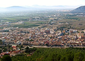
Cox, Spain
Municipality in Valencian Community, Spain
Distance: Approx. 3394 meters
Latitude and longitude: 38.13944444,-0.88472222
Cox (Spanish: [koks]) is a municipality in the comarca of Vega Baja del Segura in the Valencian Community, Spain. This town is located at the feet of the Sierra de Callosa mountain range.

Roman Catholic Diocese of Orihuela-Alicante
Diocese of the Catholic Church in Spain
Distance: Approx. 4682 meters
Latitude and longitude: 38.0857,-0.9466
The Diocese of Orihuela-Alicante (Latin: Dioecesis Oriolensis-Lucentinus) is a Latin Church diocese of the Catholic Church located in the cities of Orihuela and Alicante in the ecclesiastical province of Valencia in Spain. It was established as Diocese of Orihuela from the Diocese of Cartagena in 1564, obtaining its current denomination in 1959.
La Campaneta
Place in Alicante, Spain
Distance: Approx. 4331 meters
Latitude and longitude: 38.08333333,-0.88333333
La Campaneta is a parish belonging to the municipality of Orihuela, Alicante, Spain, with a population of around 1225. It has a large shoe industry, as well as various agricultural companies.

San Martin, Callosa de Segura
Distance: Approx. 2781 meters
Latitude and longitude: 38.12277778,-0.87916667
San Martín, Obispo de Tours is a Renaissance-style, Roman Catholic archpresbyteral church (iglesia arciprestal) located in the town of in Callosa de Segura, Alicante, Spain. It has been declared a historic monument.

Sierra de Callosa
Mountain range in Spain
Distance: Approx. 1473 meters
Latitude and longitude: 38.12388889,-0.89611111
Sierra de Callosa (Valencian: Serra de Callosa) is a 4.6 km (3 mi) long mountain range in the Vega Baja del Segura (Valencian: Baix Segura) comarca, Valencian Community, Spain. Its highest point is Águila (572 m). This range is named after the town of Callosa de Segura located at the feet of the mountains.
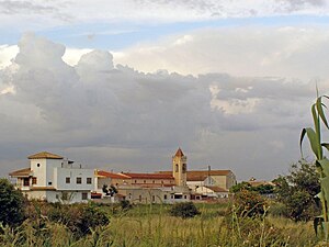
Redován
Municipality in Valencian Community, Spain
Distance: Approx. 452 meters
Latitude and longitude: 38.11388889,-0.90555556
Redován is a municipality in the comarca of Vega Baja del Segura in the Valencian Community, Spain. This town is located at the feet of the Sierra de Callosa mountain range. Redovan is one of the Vega Baja (low fertile valley) villages of the southern Costa Blanca, Spain.

Orihuela Cathedral
Distance: Approx. 4625 meters
Latitude and longitude: 38.08583333,-0.94583333
Orihuela Cathedral (Catedral de Orihuela) is the main Roman Catholic church of Orihuela, Valencian Community, southern Spain.

Granja de Rocamora
Village in Spain
Distance: Approx. 4419 meters
Latitude and longitude: 38.15,-0.88333333
Granja de Rocamora is a village in the province of Alicante and autonomous community of Valencia, Spain. The municipality covers an area of 7.2 square kilometres (2.8 sq mi) and as of 2011 had a population of 2,463 people.

University of Orihuela
Historic site in Alicante, Spain
Distance: Approx. 4052 meters
Latitude and longitude: 38.0894,-0.9411
The University of Orihuela was located at the Convent of Santo Domingo, in Orihuela. It was the second university in the ancient Kingdom of Valencia, founded 40 years after the University of Valencia. The official name of the institution was Pontificia y Real Universidad de Orihuela (Pontifical and Royal University of Orihuela).
Correntías Medias
Place in Alicante, Spain
Distance: Approx. 4709 meters
Latitude and longitude: 38.077,-0.93
Correntías Medias is a village in Alicante, Spain.

El Escorratel
Place in Alicante, Spain
Distance: Approx. 2448 meters
Latitude and longitude: 38.101,-0.93
El Escorratel is a village in Alicante, Spain. It is part of the municipality of Orihuela.
Weather in this IP's area
broken clouds
11 Celsius
10 Celsius
10 Celsius
12 Celsius
1020 hPa
81 %
1020 hPa
1002 hPa
10000 meters
0.89 m/s
1.79 m/s
41 degree
83 %