Country:
Region:
City:
Latitude and Longitude:
Time Zone:
Postal Code:
IP information under different IP Channel
ip-api
Country
Region
City
ASN
Time Zone
ISP
Blacklist
Proxy
Latitude
Longitude
Postal
Route
Luminati
Country
Region
md
City
stevensville
ASN
Time Zone
America/New_York
ISP
NETWORKMARYLAND
Latitude
Longitude
Postal
IPinfo
Country
Region
City
ASN
Time Zone
ISP
Blacklist
Proxy
Latitude
Longitude
Postal
Route
db-ip
Country
Region
City
ASN
Time Zone
ISP
Blacklist
Proxy
Latitude
Longitude
Postal
Route
ipdata
Country
Region
City
ASN
Time Zone
ISP
Blacklist
Proxy
Latitude
Longitude
Postal
Route
Popular places and events near this IP address

Chester, Maryland
CDP in Maryland, United States
Distance: Approx. 2479 meters
Latitude and longitude: 38.97194444,-76.28805556
Chester is a census-designated place on Kent Island in Queen Anne's County, Maryland, United States. The population was 3,723 at the 2000 census.

Stevensville, Maryland
CDP in Maryland, United States
Distance: Approx. 391 meters
Latitude and longitude: 38.98111111,-76.31888889
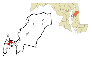
Stevensville is a census-designated place (CDP) in Queen Anne's County, Maryland, United States, and is the county's most populous place among both CDPs and municipalities. The community is the eastern terminus of the Chesapeake Bay Bridge. The Stevensville Historic District is one of two registered historic districts in the county, the other being the Centreville Historic District.

Kent Island High School
Public school in Stevensville, Maryland, United States
Distance: Approx. 1215 meters
Latitude and longitude: 38.9909,-76.3094
Kent Island High School (KIHS) is a public high school in Stevensville, Maryland, United States that first opened in 1998 to accommodate the growing population of Queen Anne's County. The school takes its name from Kent Island, the location of the school (and the entire census-designated place of Stevensville). The school is often seen as the successor to Stevensville High School, which closed in 1966, and was renovated and reopened as Stevensville Middle School.
Broad Creek, Maryland
Distance: Approx. 1470 meters
Latitude and longitude: 38.97416667,-76.32916667
Broad Creek was a town on western Kent Island, Maryland that existed from the 17th century to the 19th century. The town once served as the eastern terminus of a trans-Chesapeake Bay ferry line that was part of an early route between Annapolis and Philadelphia. In the mid 19th century, with the rise of steamboat travel, much of Kent Island's activity shifted to the towns of Stevensville, Chester, and Dominion, and in 1880, Christ Church, the main congregation on the island, moved to Stevensville, cementing the new town's position as Kent Island's main center of activity.

Episcopal Diocese of Easton
Diocese of the Episcopal Church in the United States
Distance: Approx. 17 meters
Latitude and longitude: 38.98055556,-76.31444444
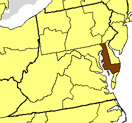
The Episcopal Diocese of Easton is a diocese of the Episcopal Church in the United States of America that comprises the nine counties that make up the Eastern Shore of Maryland. It is in Province III (the Middle Atlantic region) and was created as a split from the Diocese of Maryland in 1868. The diocese consists of the Eastern Shore of Maryland (the nine counties of Caroline, Cecil, Dorchester, Kent, Queen Anne's, Somerset, Talbot, Wicomico, and Worcester), and has a total membership of about 9,750 people, out of a total population of 420,792, according to a 2004 census estimate.

Cross Island Trail
Distance: Approx. 1795 meters
Latitude and longitude: 38.98106389,-76.29366667
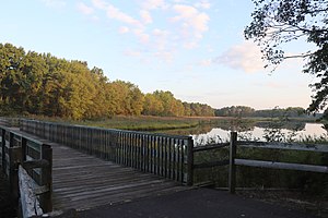
The Cross Island Trail is a rail trail in Queen Anne's County, Maryland occupying a section of the abandoned Queen Anne's Railroad corridor that traverses the width of Kent Island. It was completed in 2001 and is part of the American Discovery Trail.
Matapeake, Maryland
Unincorporated community in Maryland, U.S.
Distance: Approx. 3300 meters
Latitude and longitude: 38.96138889,-76.34333333
Matapeake is an unincorporated community located south of Stevensville on Kent Island, Maryland, United States. It is named for the historic Matapeake tribe, who lived there at the time of English colonization in 1631. Their chief village was on the southeast side of the island.

Christ Church (Stevensville, Maryland)
Historic church in Maryland, United States
Distance: Approx. 17 meters
Latitude and longitude: 38.98055556,-76.31444444
Christ Church refers to both an Episcopal parish currently located in Matapeake, Maryland and the historic church building located in the Stevensville Historic District in Stevensville, Maryland, which the parish occupied from 1880 to 1995, and that is now a Lutheran church. Christ Church Parish was one of the original 30 Anglican parishes in the Province of Maryland.

Cray House (Stevensville, Maryland)
Historic house in Maryland, United States
Distance: Approx. 141 meters
Latitude and longitude: 38.98150833,-76.31566111
The Cray House is a two-room house in Stevensville, Maryland. Built around 1809, it is a rare surviving example of post-and-plank construction, and of a build of small house which once dominated the local landscape. For these reasons it was listed on the National Register of Historic Places in 1983.

Stevensville Historic District
Historic district in Maryland, United States
Distance: Approx. 103 meters
Latitude and longitude: 38.98138889,-76.31361111
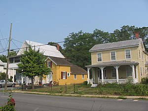
The Stevensville Historic District, also known as Historic Stevensville, is a national historic district in downtown Stevensville, Queen Anne's County, Maryland. It contains roughly 100 historic structures, and is listed on the National Register of Historic Places. It is located primarily along East Main Street, a portion of Love Point Road, and a former section of Cockey Lane.

Stevensville Bank
United States historic place
Distance: Approx. 141 meters
Latitude and longitude: 38.98194444,-76.31472222
The Stevensville Bank is a historic bank building located near the center of Stevensville, Maryland, United States, and is in the Stevensville Historic District. The building's name is a reference to Stevensville Savings Bank which once occupied the building. The classically detailed bank is now used as a law office.
Kent Island Research Facility
Distance: Approx. 3082 meters
Latitude and longitude: 38.964,-76.286
The Kent Island Research Facility is a U.S. National Security Agency facility located on Kent Island, Maryland, near the town of Chester. The facility was established in 1961 to conduct research on very high frequency and microwave antenna systems—specifically, on problems associated with anomalous propagation in communications interception. According to James Bamford in 1983, the location consists of the NSA Propagation Research Laboratory, a single-story, white, windowless building that houses automatically operating, unattended equipment, as well as a small, white cinder-block "control" building surrounded in a barbed-wire fence.
Weather in this IP's area
clear sky
10 Celsius
8 Celsius
8 Celsius
11 Celsius
1012 hPa
87 %
1012 hPa
1012 hPa
10000 meters
4.12 m/s
310 degree
06:49:53
16:50:38