Country:
Region:
City:
Latitude and Longitude:
Time Zone:
Postal Code:
IP information under different IP Channel
ip-api
Country
Region
City
ASN
Time Zone
ISP
Blacklist
Proxy
Latitude
Longitude
Postal
Route
Luminati
Country
Region
md
City
baltimore
ASN
Time Zone
America/New_York
ISP
NETWORKMARYLAND
Latitude
Longitude
Postal
IPinfo
Country
Region
City
ASN
Time Zone
ISP
Blacklist
Proxy
Latitude
Longitude
Postal
Route
db-ip
Country
Region
City
ASN
Time Zone
ISP
Blacklist
Proxy
Latitude
Longitude
Postal
Route
ipdata
Country
Region
City
ASN
Time Zone
ISP
Blacklist
Proxy
Latitude
Longitude
Postal
Route
Popular places and events near this IP address
WERQ-FM
Urban radio station in Baltimore
Distance: Approx. 739 meters
Latitude and longitude: 39.339,-76.667
WERQ-FM (92.3 MHz) is a commercial radio station in Baltimore, Maryland. It features an urban contemporary radio format and is owned by Urban One of Silver Spring, Maryland, the largest broadcasting company serving African American audiences in the United States. The studios are located in Woodlawn (they were previously located at Cathy Hughes Plaza in downtown Baltimore).

Park Heights, Baltimore
Neighborhood of Baltimore in Maryland, United States
Distance: Approx. 1046 meters
Latitude and longitude: 39.336944,-76.664167
Park Heights is an area of Baltimore, Maryland, that lies approximately 5 miles northwest of downtown Baltimore and within two miles of the Baltimore County line. A 1,500-acre community, Park Heights comprises 12 smaller neighborhoods that together contain approximately 30,000 residents. It is bounded on the south by Druid Park Drive, on the west by Wabash Avenue, on the east by Greenspring Avenue, and on the north by Northern Parkway.

Arlington, Baltimore
Neighborhood statistical area in Baltimore, Maryland, United States
Distance: Approx. 1023 meters
Latitude and longitude: 39.34817222,-76.68221111
Arlington is a neighborhood in Northwest Baltimore, Maryland. Major streets running through the area include Wabash Avenue, Rogers Avenue, Dolfield Avenue, and West Belvedere Avenue. Two Baltimore Metro Subway stations, Rogers Avenue and West Coldspring are located in the area.

Rogers Avenue station
Metro SubwayLink station in Baltimore, Maryland, US
Distance: Approx. 1247 meters
Latitude and longitude: 39.3429,-76.6895
Rogers Avenue station is a Metro SubwayLink station in Baltimore, Maryland. It is located in the Woodmere area, and is the fifth most northern and western station on the line, with approximately 900 parking spaces.

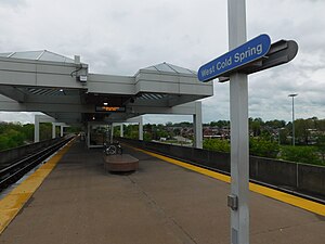
West Cold Spring station
Metro SubwayLink station
Distance: Approx. 543 meters
Latitude and longitude: 39.33633,-76.6725
West Cold Spring station is a Metro SubwayLink station in Baltimore, Maryland. It is located at the intersection of Wabash Avenue and Cold Spring Lane in the Arlington neighborhood, adjacent to the Towanda-Grantley neighborhood. It is the sixth most northern and western station on the line, with approximately 300 parking spaces.
Edgecomb, Baltimore
Neighborhood statistical area in Baltimore, Maryland, United States
Distance: Approx. 1068 meters
Latitude and longitude: 39.342662,-76.663156
Edgecomb, also known as Parklane, is a neighborhood in the North District of Baltimore, located between the neighborhoods of Cylburn (north) and Greenspring (south). Its boundaries are marked by Dupont Avenue (north), Coldspring Lane (south), Pimlico Road (west) and Greenspring Avenue (east). Central Park Heights, is located on the opposite side of Pimlico Road in the Northwest District.
Cylburn, Baltimore
Neighborhood statistical area in Baltimore, Maryland, United States
Distance: Approx. 1288 meters
Latitude and longitude: 39.348104,-76.663799
Cylburn is a neighborhood in the North District of Baltimore, located between the neighborhoods of Levindale (north) and Edgecomb (south). Its boundaries are marked by Cylburn Avenue (north), Dupont Avenue (south), Pimlico Road (west) and Greenspring Avenue (east). Central Park Heights, is located on the opposite side of Pimlico Road in the Northwest area of Baltimore City.
Greenspring, Baltimore
Neighborhood statistical area in Baltimore, Maryland, United States
Distance: Approx. 1081 meters
Latitude and longitude: 39.33673,-76.66384
Greenspring is a neighborhood in the North District of Baltimore, located between the neighborhoods of Woodberry (east) and Central Park Heights (west). Its boundaries are marked by West Cold Spring Lane (north), Greenspring Avenue (east), and Springhill Avenue (south). The western edge of the neighborhood runs along Pimlico Road from West Cold Spring Lane to Park Heights Avenue, then along Park Heights Avenue to Springhill Avenue.
Callaway-Garrison, Baltimore
Neighborhood statistical area in Baltimore, Maryland, United States
Distance: Approx. 980 meters
Latitude and longitude: 39.3325,-76.67944444
Callaway-Garrison is a neighborhood in the Northwest district of Baltimore, located between the neighborhoods of Dorchester (west) and Ashburton (east). Its boundaries are marked by West Cold Spring Lane (north), Liberty Heights Avenue (south), Callaway Avenue (east) and Garrison Boulevard (west).
Langston Hughes, Baltimore
Neighborhood statistical area in Baltimore, Maryland, United States
Distance: Approx. 601 meters
Latitude and longitude: 39.34333333,-76.68138889
Langston Hughes is a neighborhood in the Northwest District of Baltimore, located between the neighborhoods of Central Park Heights (east) and Woodmere. Its roughly pentagonal boundaries are marked by West Belvedere Avenue (northwest), Litchfield Avenue (northeast), Reisterstown Road (south) and Oakmont Avenue (east). A predominantly black community, the neighborhood of Langston Hughes is named for the black poet and novelist, Langston Hughes.

Towanda-Grantley, Baltimore
Neighborhood in Baltimore
Distance: Approx. 620 meters
Latitude and longitude: 39.338,-76.669
Towanda-Grantley is a neighborhood in northwest Baltimore which predominantly consists of attached residential properties which were built in the 1950s. The neighborhood is often described as part of the greater Park Heights area, and includes the West Cold Spring Metro Subway station at its northwestern edge at the intersection of West Cold Spring Lane and Wabash Avenue.
Woodmere, Baltimore
Neighborhood in Baltimore
Distance: Approx. 1184 meters
Latitude and longitude: 39.3453,-76.6877
Woodmere is a neighborhood in northwest Baltimore, Maryland.
Weather in this IP's area
broken clouds
11 Celsius
10 Celsius
8 Celsius
12 Celsius
1014 hPa
78 %
1014 hPa
999 hPa
10000 meters
4.12 m/s
310 degree
75 %
06:52:10
16:51:15
